

In February 2026, at the Meissa Smart Construction Forum × Korea Build Week, Ha Chang-seong, Team Lead of Meissa's Domestic Business Team, presented on the tangible value that drone solutions can deliver on construction sites.
At the outset of his talk, Team Lead Ha defined the essence of construction site management as follows.
"Construction site management is an operation run on spatial data."
Design is created with space-based drawings, construction changes on top of that space every day, and quantities are likewise calculated on a spatial basis. Everything that happens on site takes place within space — so why is it still managed under the labels of text and know-how? He opened the presentation by raising exactly this question.


Team Lead Ha summarized the structural limitations of conventional site management in four points.
First, sites are managed with a focus on paperwork and experience.
Second, reporting on site conditions relies on text, photos, and memory — and even photos are often taken only when an issue arises.
Third, on-site judgment depends on the individual manager's experience and intuition.
Fourth, if there is no problem it is passed over, and by the time one occurs it is already too late to respond.
The reason this structure is dangerous can be explained in numbers.
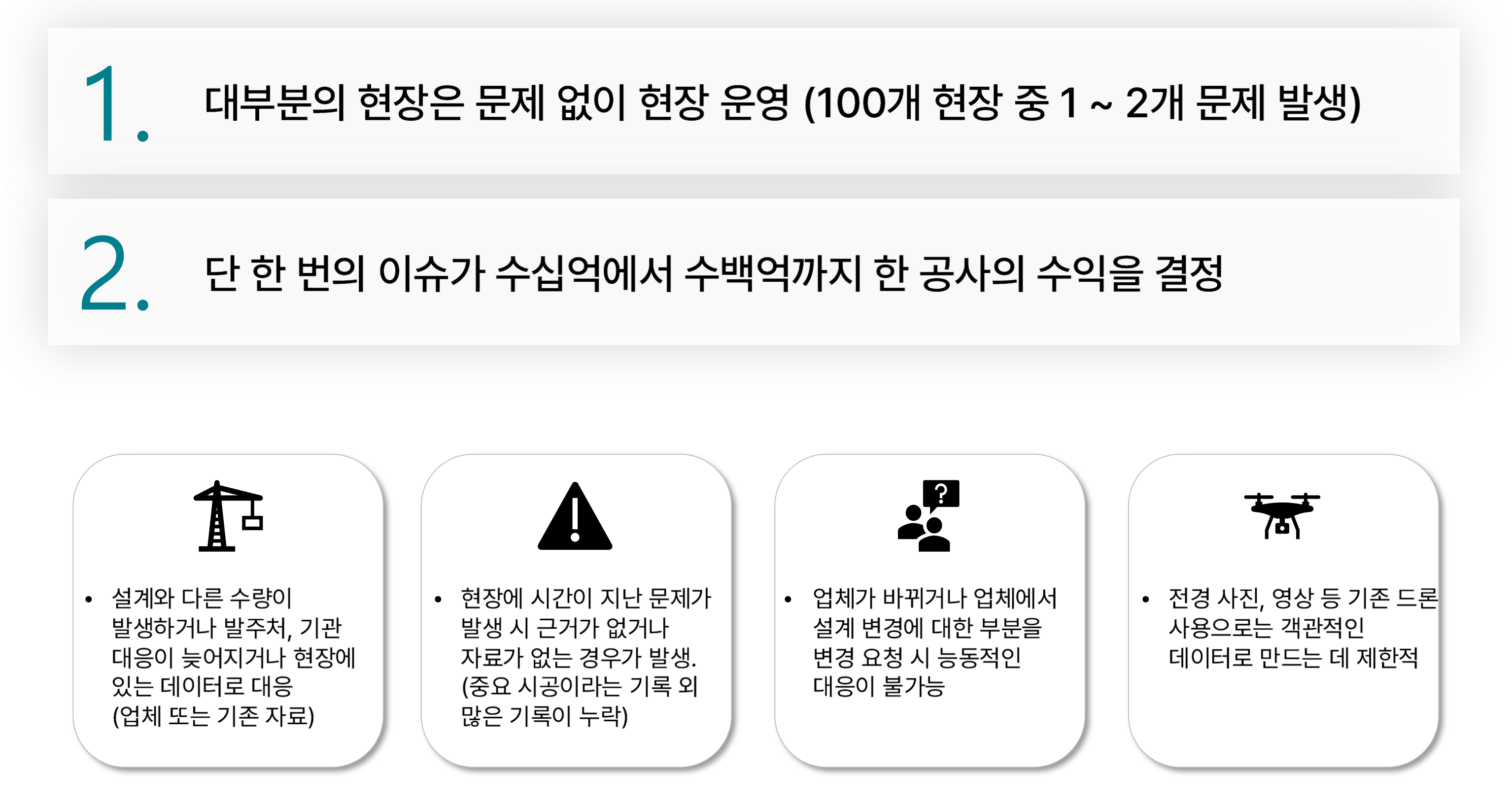
"Most sites operate without problems. Out of 100 sites, only one or two run into issues. But a single incident can determine the profit of an entire project — anywhere from billions to hundreds of billions of won."
Even when quantities differ from the design, there is no supporting evidence, and once time passes no records remain. If the contractor changes, a response becomes impossible, and simply using a drone on its own leaves only panoramic photos or video — far from enough to turn into objective data, he explained.
The value the Meissa platform provides to construction sites can be organized around three perspectives: cost, time, and trust.

On building sites, the most direct cost benefit is earthwork volume management. Based on zoning, the Meissa platform compares current elevation with planned elevation to calculate daily work volume, total work volume, and remaining quantity by stratum.
"In normal times it serves as a reference, but when a problem occurs it becomes the basis for decision-making. This should be approached not as cost reduction at the individual site level, but from the perspective of company-wide risk management at headquarters."
The same holds true on civil engineering sites. Previously, surveying itself was a cost. Both the prime contractor and subcontractors had to repeatedly commit surveying personnel and time, and any survey points that went unrecorded all disappeared over time. Drone-based surveying changes this structure, dramatically reducing the time needed to verify quantities and enabling more efficient work with the same headcount.

Situations where different people interpret the same issue in different ways happen frequently on site. The result is a repeating cycle of visiting the site in person, holding another meeting back at the office, taking action, and then writing up a report.
With spatial-data-based site management, everyone looks at the same screen to plan and make decisions. Decisions are made accurately and quickly, the number of site visits drops, and communication costs fall along with it.
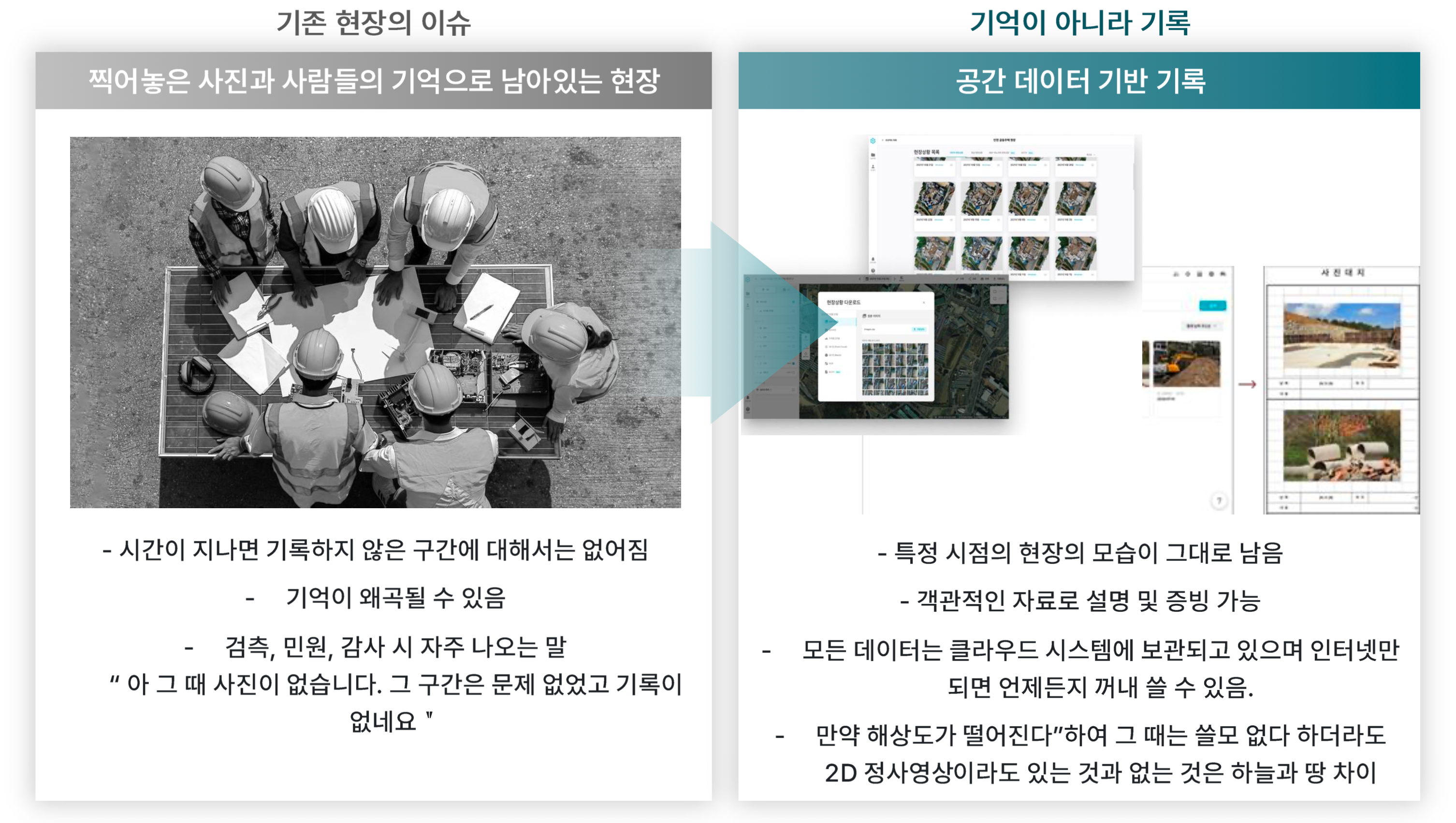
There is a phrase you often hear at inspection, complaint, and audit sites.
"Ah, there are no photos from back then. That section had no problems, but there is no record."
The Meissa platform preserves the site exactly as it looked at a specific point in time in the cloud. You can explain and provide evidence with objective materials, and as long as you have an internet connection you can pull it up anytime.
"Even if the resolution is low and it seems useless at the time, having even a 2D orthophoto versus not having one is a difference of night and day."
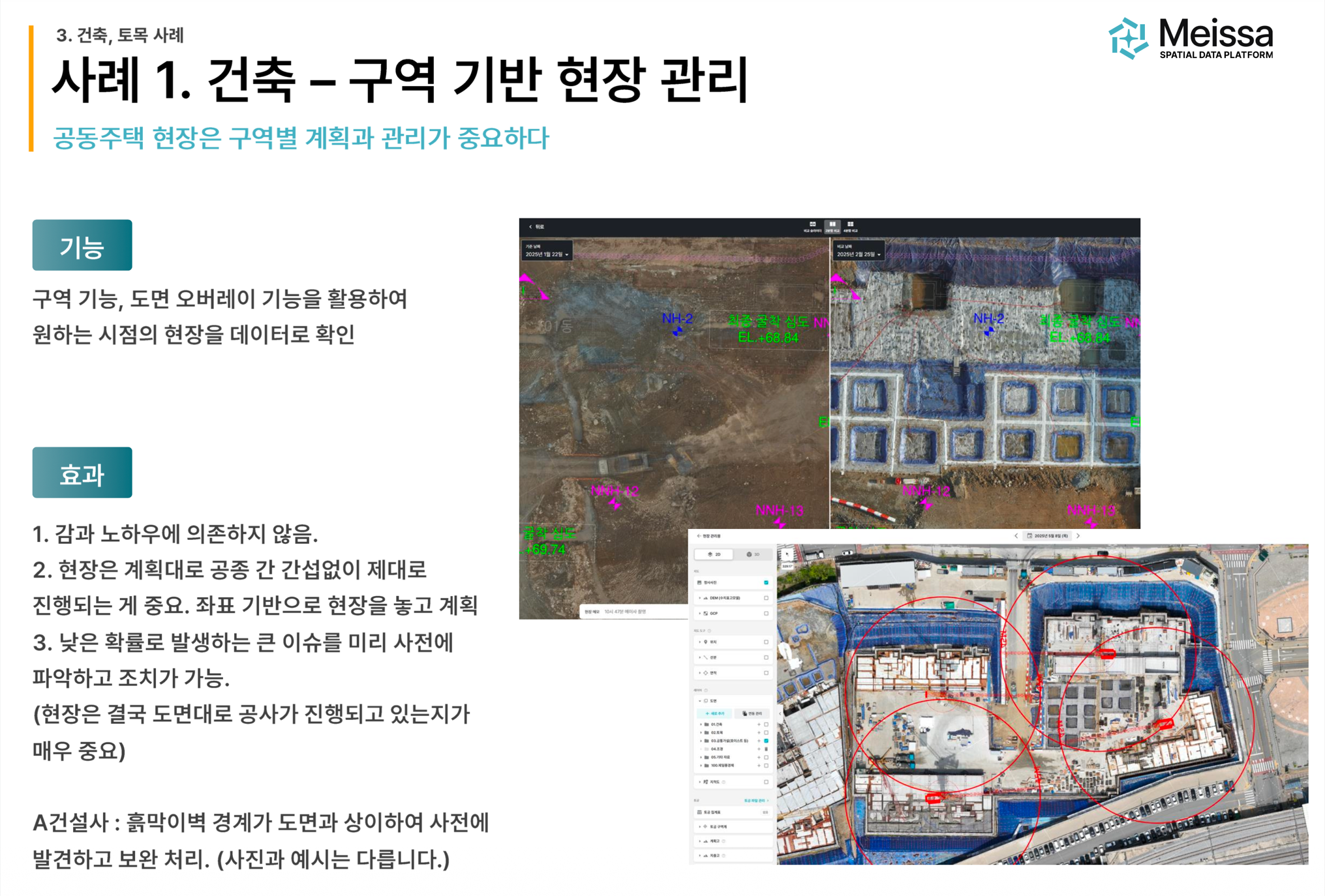
On apartment complex sites, planning and management by zone are key. Using the Meissa platform's zone feature and drawing overlay feature, you can review the site as data at any point in time you want.
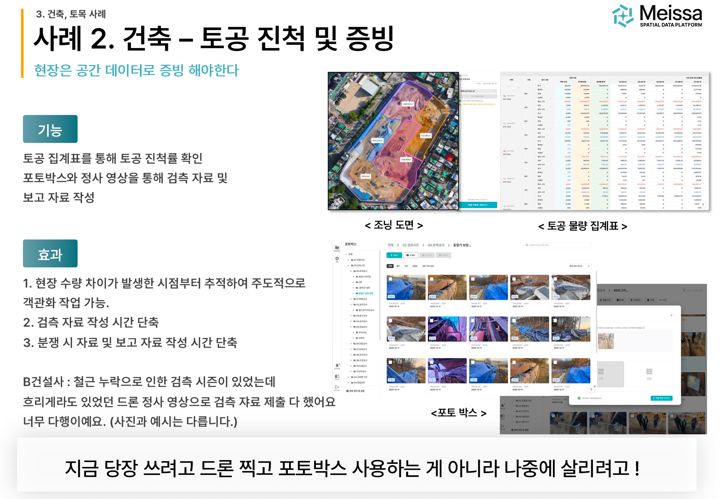
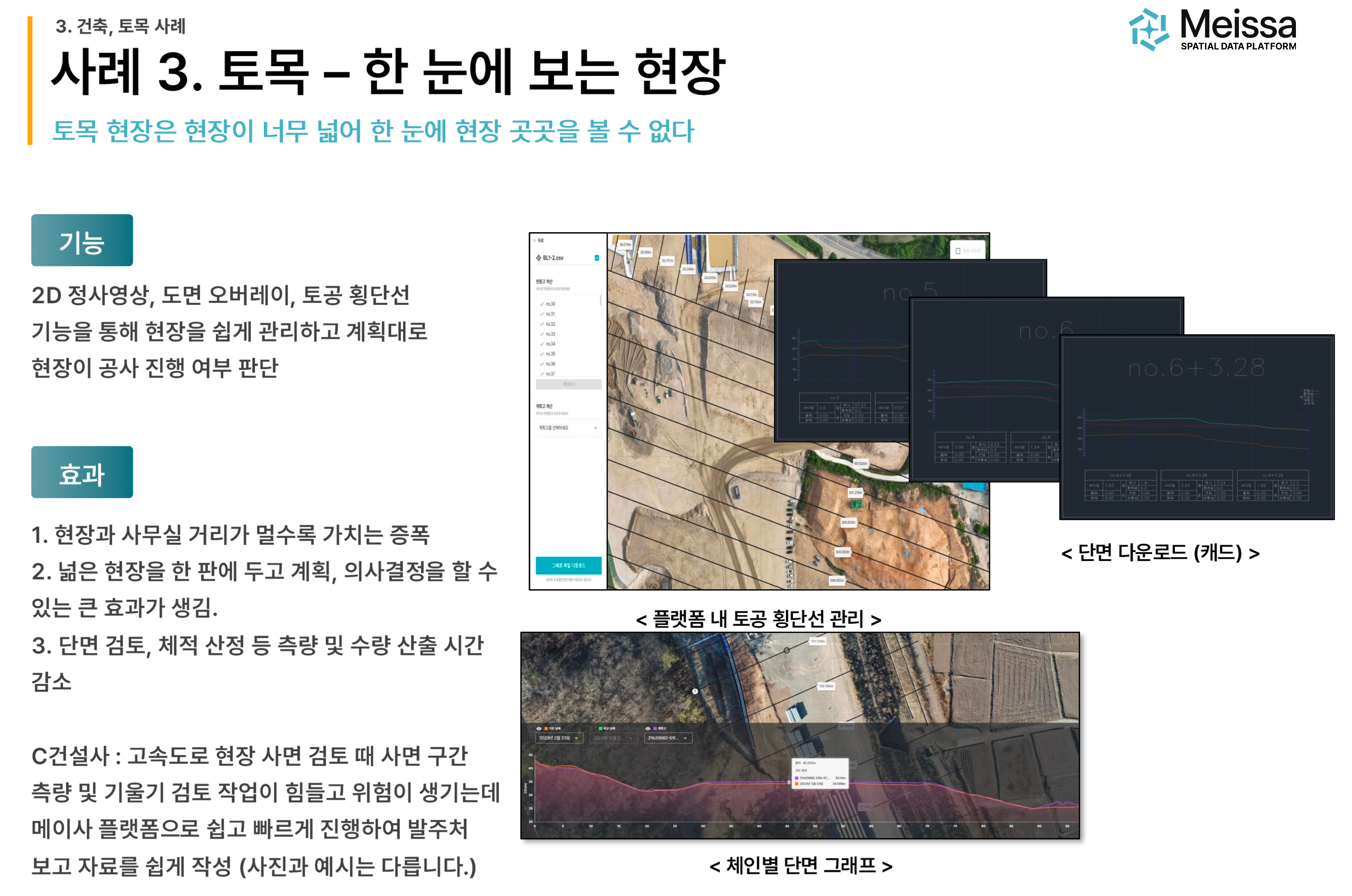
Civil engineering sites are so vast that it is hard to check every corner at a glance. Through 2D orthophotos, drawing overlays, and the earthwork cross-section line feature, you can place the entire site on one board and make plans and decisions.
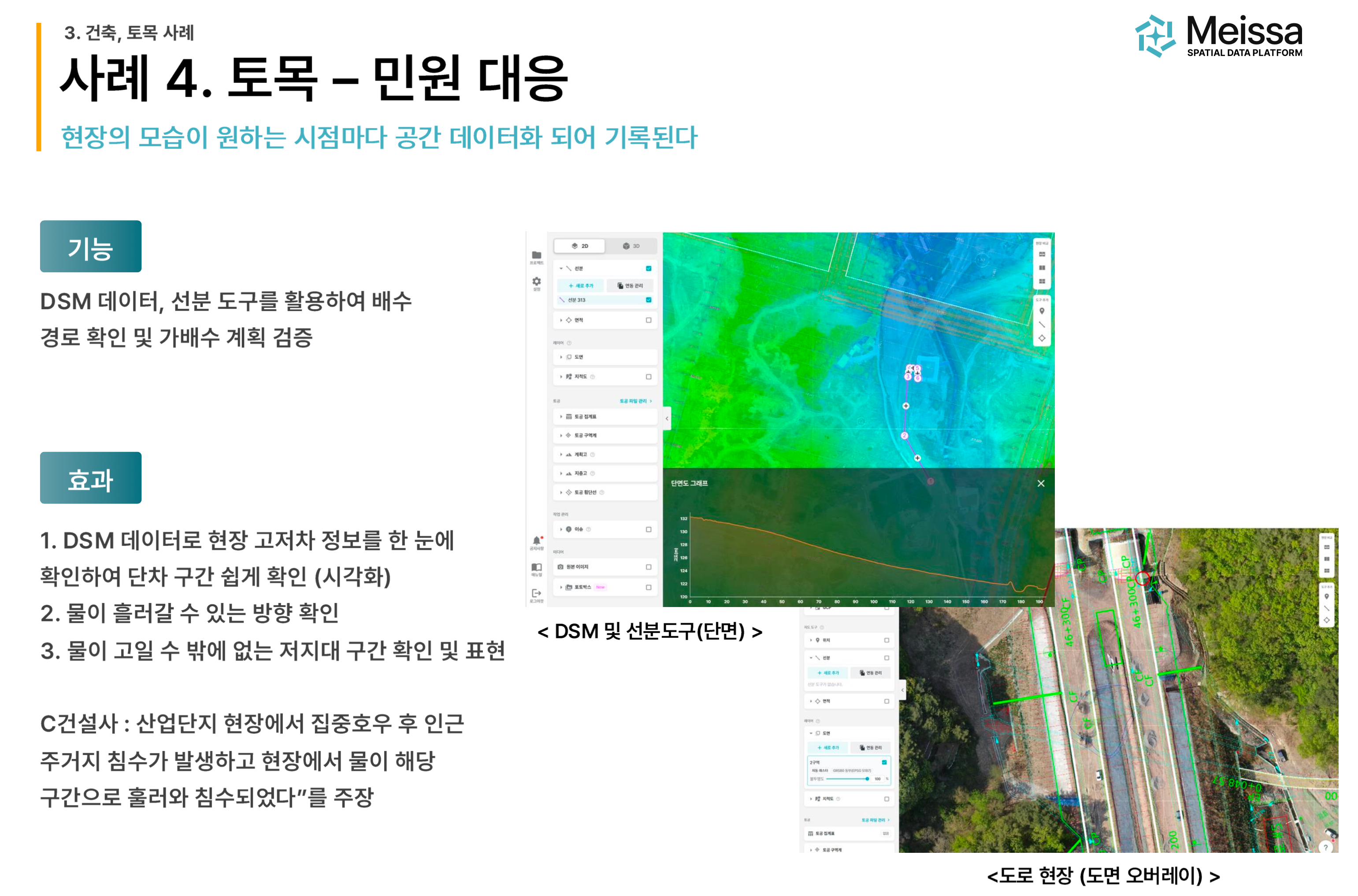
With such clear benefits, why have so many smart construction technologies failed to take root on site? Team Lead Ha spoke decisively on this point.
"The reason is not the technology — it is structure and trust."
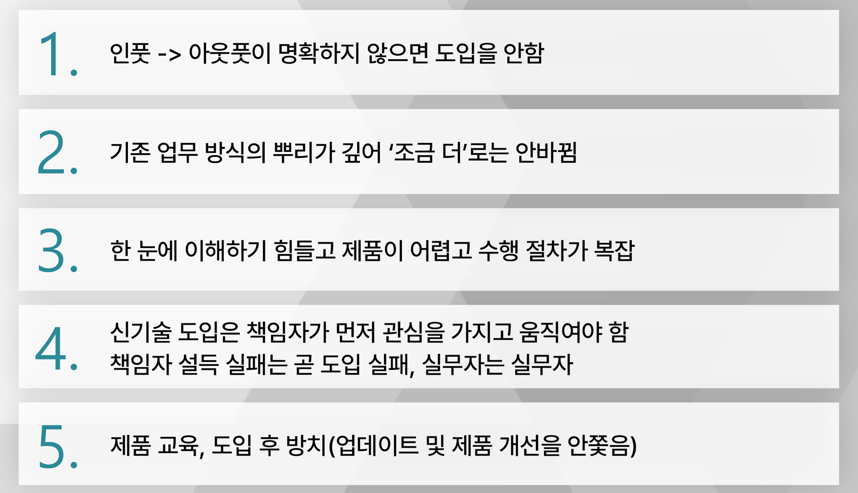
There are five structural problems that have kept technology from being used on site.

Meissa's answer to this comes down to three principles of adoption.
Minimize collection: Maximize the value gained from data relative to the time spent collecting it. Actively use unmanned drone stations and RTK sensors to automate the collection stage.
Diffusion: Build a platform that decision-makers have no choice but to use. By having decision-makers use the platform directly, create an environment in which the product stays continuously in use.
Care: Manage the service through AM (account management) activities. Sustain site care and activation with headquarters-statistics-based reporting on site usage.
"The key is not selling a tool (technology), but making it become part of operations."
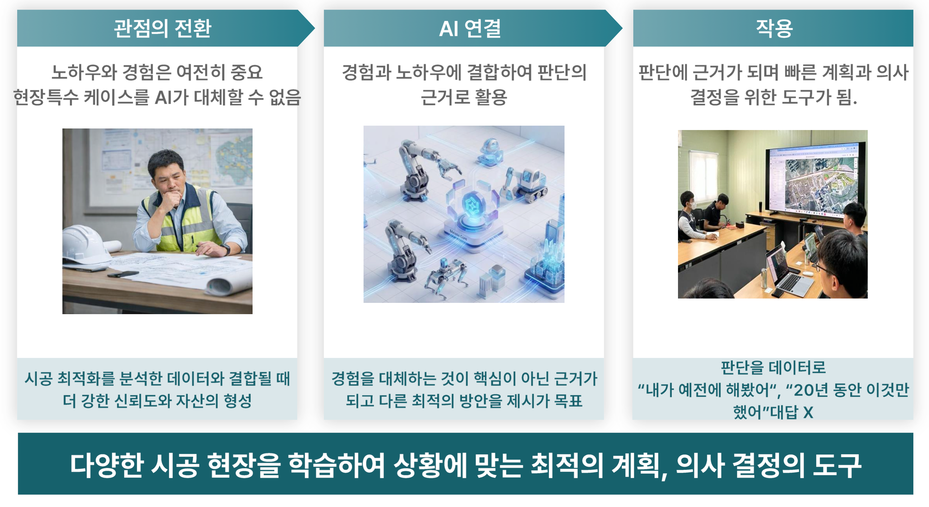
The next stage Meissa envisions is the combination of spatial data and AI. Know-how and experience remain important, and AI cannot replace special cases unique to a site. But when AI is combined with experience and know-how, it becomes the basis for judgment and a tool for fast planning and decision-making.
Team Lead Ha closed his presentation as follows.
"You feel the most painful value of spatial data not at the moment you use it, but when you do not have it."
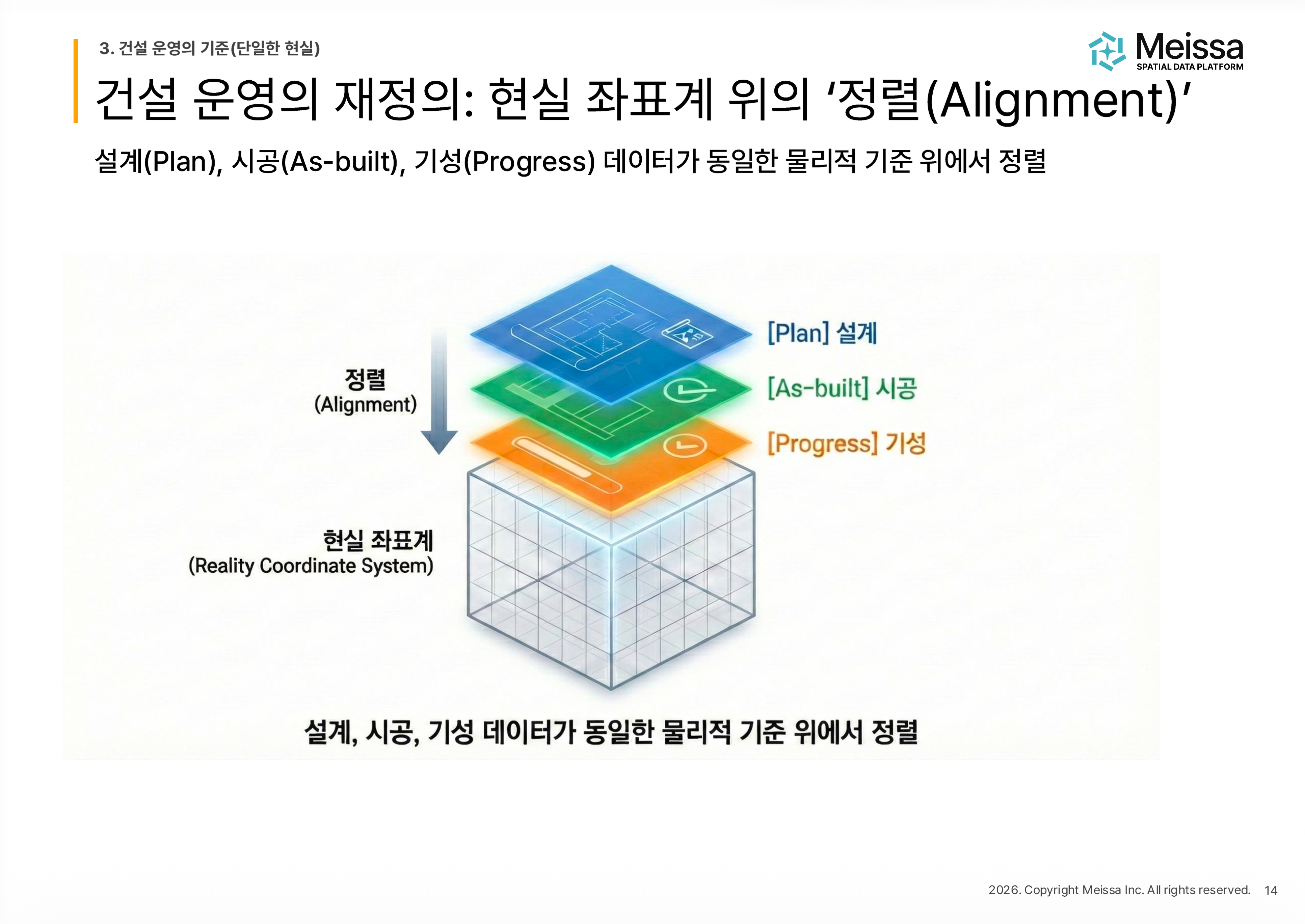
Records are assets, and alignment among design, construction, and progress payment makes immediate judgment possible. Spatial data is not merely a visualization tool but a single source of truth connecting past, present, and future.
This content was presented in person by Ha Chang-seong, Team Lead of Meissa's Domestic Business Team, in the second session of the 2026 Meissa Smart Construction Forum.
If you would like to see the on-site cases and context on video, you can check the link below.
▶ Watch the presentation video → https://youtu.be/CEQs7c0SxTU?si=J6kZB87LzdyJRhZj

