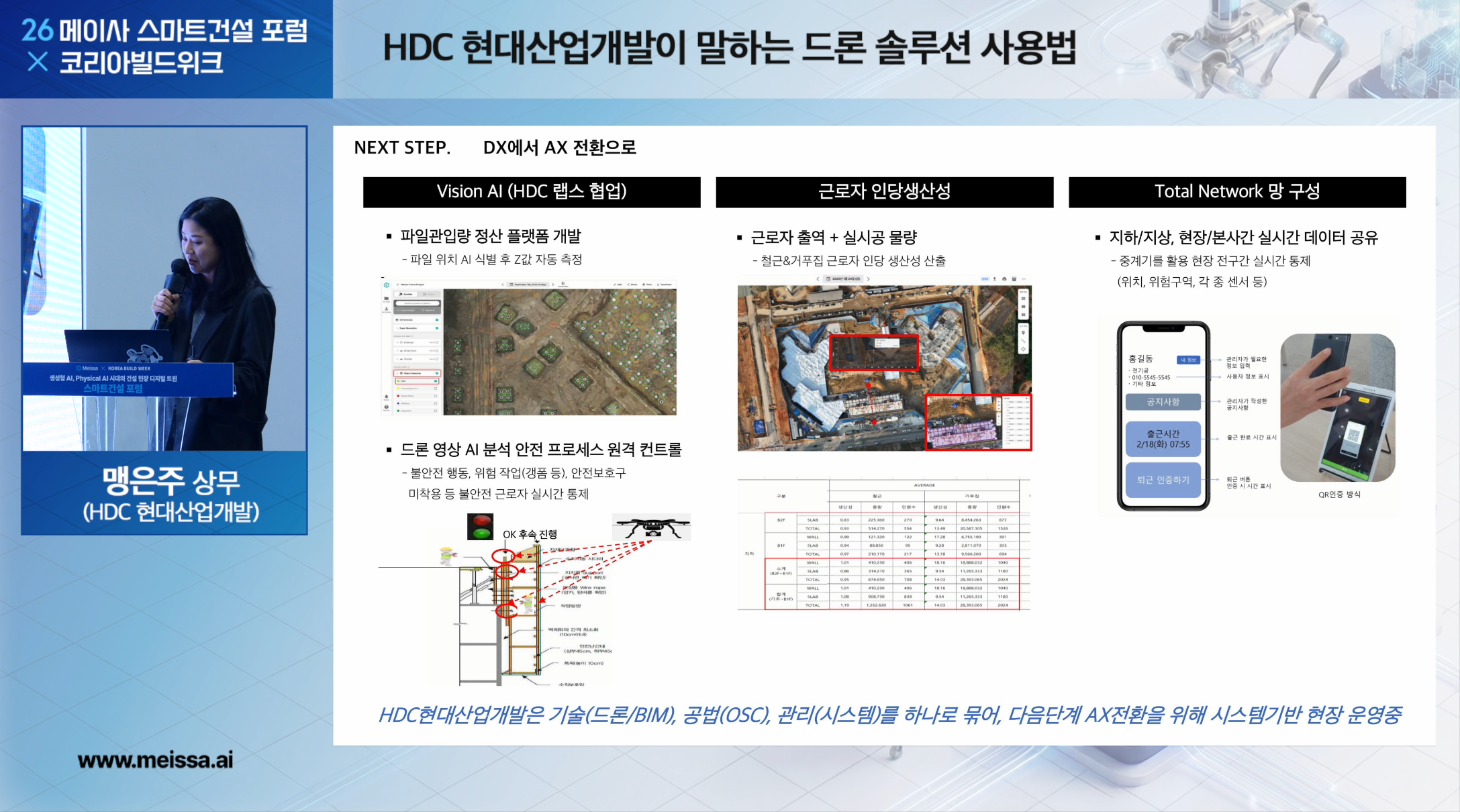
In February 2026, at the Meissa Smart Construction Forum × Korea Build Week, Executive Director Eun-ju Maeng of HDC Hyundai Development gave a case-focused presentation on how drone solutions are actually being used on construction sites. At the start of her talk, Director Maeng referred to the content Meissa had introduced earlier and remarked that “it is critically important that construction management now be run on the basis of space and data, rather than paperwork or experience.”
She also explained that while technologies such as BIM and drones have already been adopted for several years, what matters is not the existence of the technology but what it is actually changing on the ground. HDC Hyundai Development had wrestled with the same question, and over the past several years it has pursued digital transformation in a direction that changes how sites are operated, centered on BIM, drones, OSC (Off-Site Construction) methods, and quality-management platforms. Because the presentation materials contain many actual site photos and project details, the full slide deck and video are not being released; instead, we are sharing a summary of the key points.

Amid these questions, HDC Hyundai Development has driven the digital transformation of its sites around BIM, drones, OSC methods, and quality-management platforms.
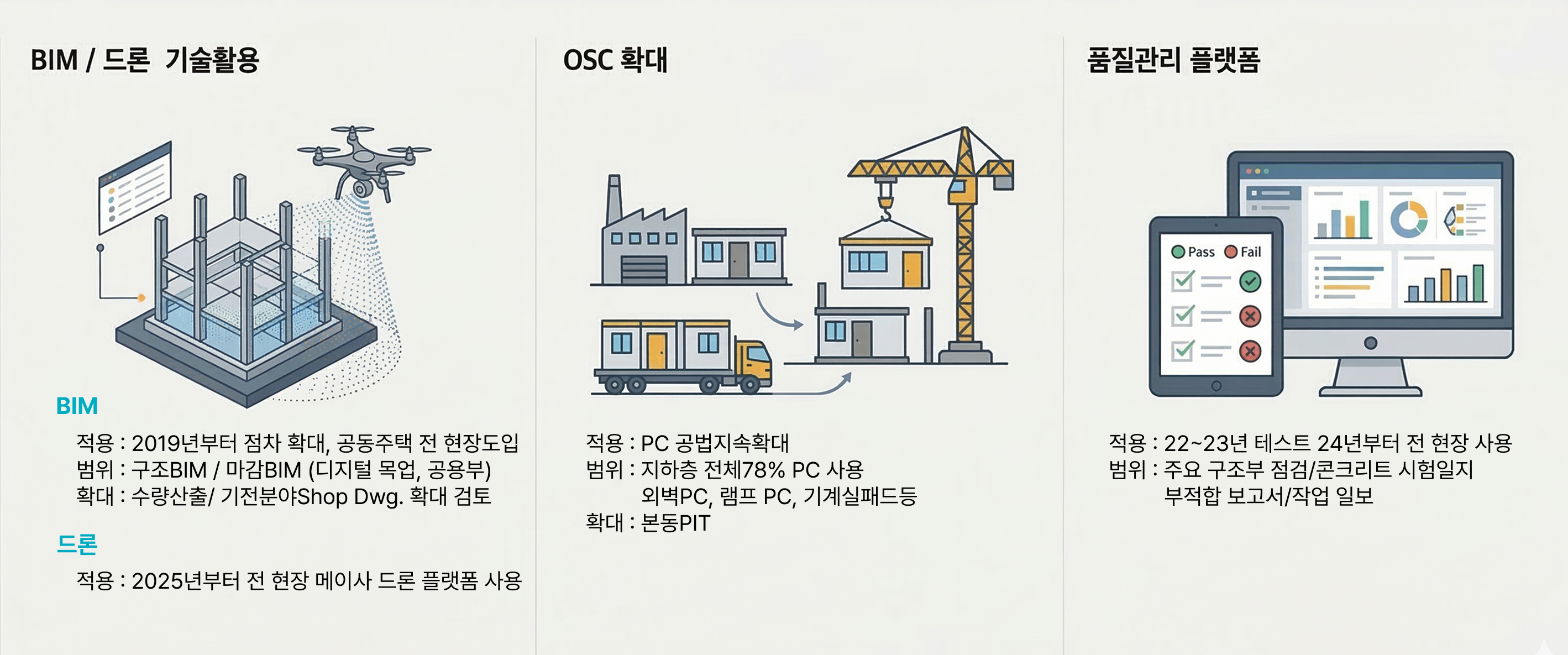
Over the past several years, HDC Hyundai Development has driven the digital transformation of its sites around three pillars.
The first is building site data using BIM and drones; the second is changing construction methods by expanding OSC methods; and the third is a site-management system built on a quality-management platform.
Based on these three pillars, HDC’s DX strategy is to accumulate site data and combine it with a digital twin to enable data-driven decision-making.
The first case is the Gonjiam Station apartment complex site. At this site, spatial data captured by drones is used across site management as a whole, including drawing verification, quantity take-off, and information sharing with partner companies.
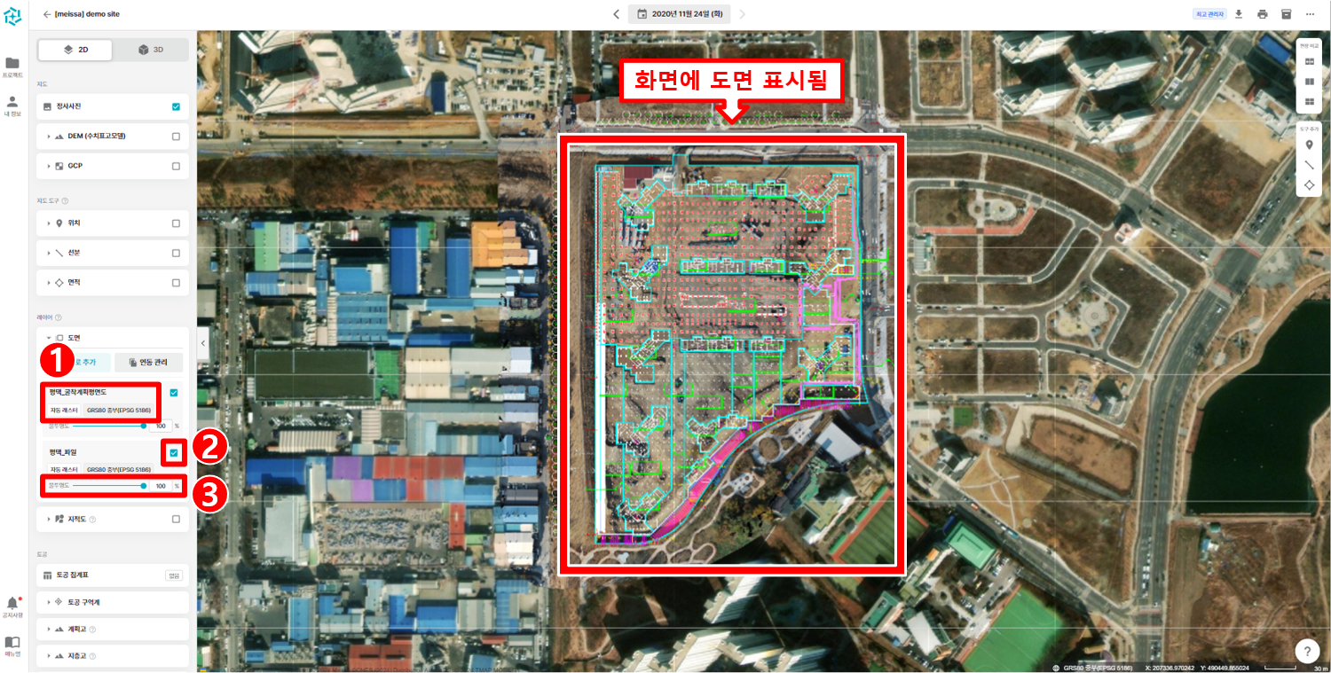
Once the site data captured by drones is georeferenced, it can be overlaid and reviewed against the design drawings on the same coordinate basis. This makes it possible to check earth-retaining wall positions,
the excavation positions of isolated footings and sumps, structural coordinates, and more—comparing the drawings with the actual construction state right on site.
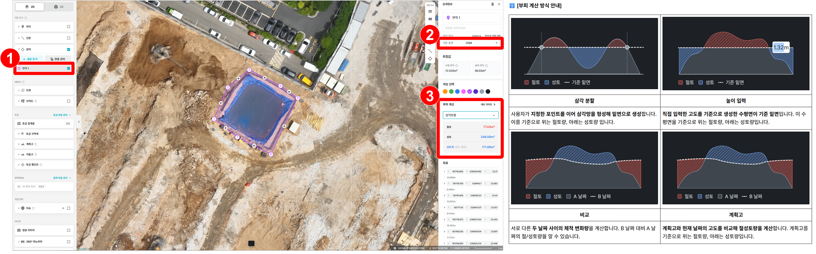
By verifying terrain height differences based on site data captured by drones, quantity take-off that reflects the site’s actual conditions becomes possible. This allows quantities for a variety of trades—earthwork volume, building quantities, backfill volume, and more—to be calculated quickly on a site basis. In particular, even for work where verifying on-site quantities is critical, such as waste disposal or civil works, quantities can be calculated based on actual data, so it is being used for construction management and settlement tasks.
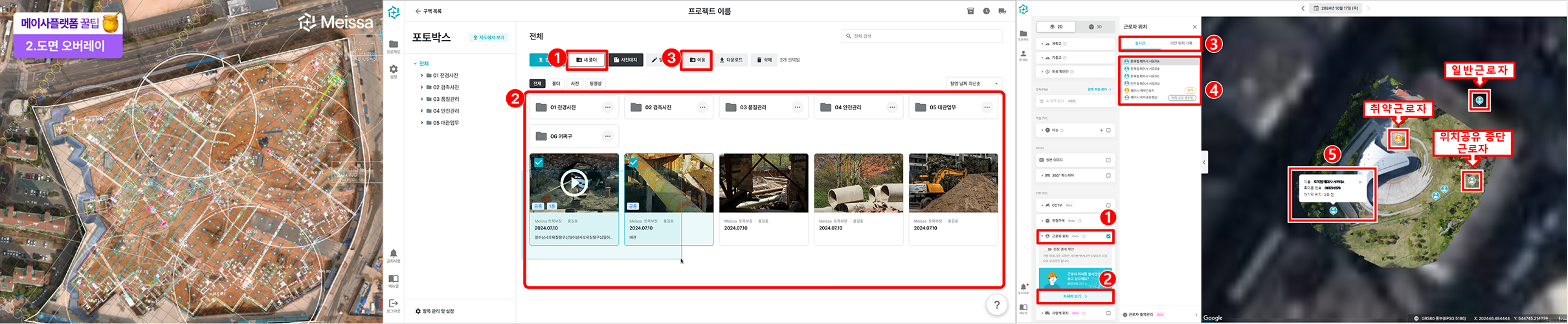
Based on site data built with drones, a variety of information such as temporary-works plans and safety management can be shared on a single screen. This lets site staff and partner companies discuss construction plans while viewing the same screen, so it is being used for a variety of tasks such as meeting materials and drawing up temporary-works plans.
In addition, bird’s-eye-view data captured repeatedly from the same location makes it possible to record and manage the history of changes at the site, and to continuously monitor site conditions on that basis. It is also being used to check key management points on site, such as worker management and safety management.
The second case is the Iksan Busong apartment complex site. At this site, drone data is used to verify pile penetration in piling work, and for process management based on quantities through soil haul-out volume calculation and BIM integration.
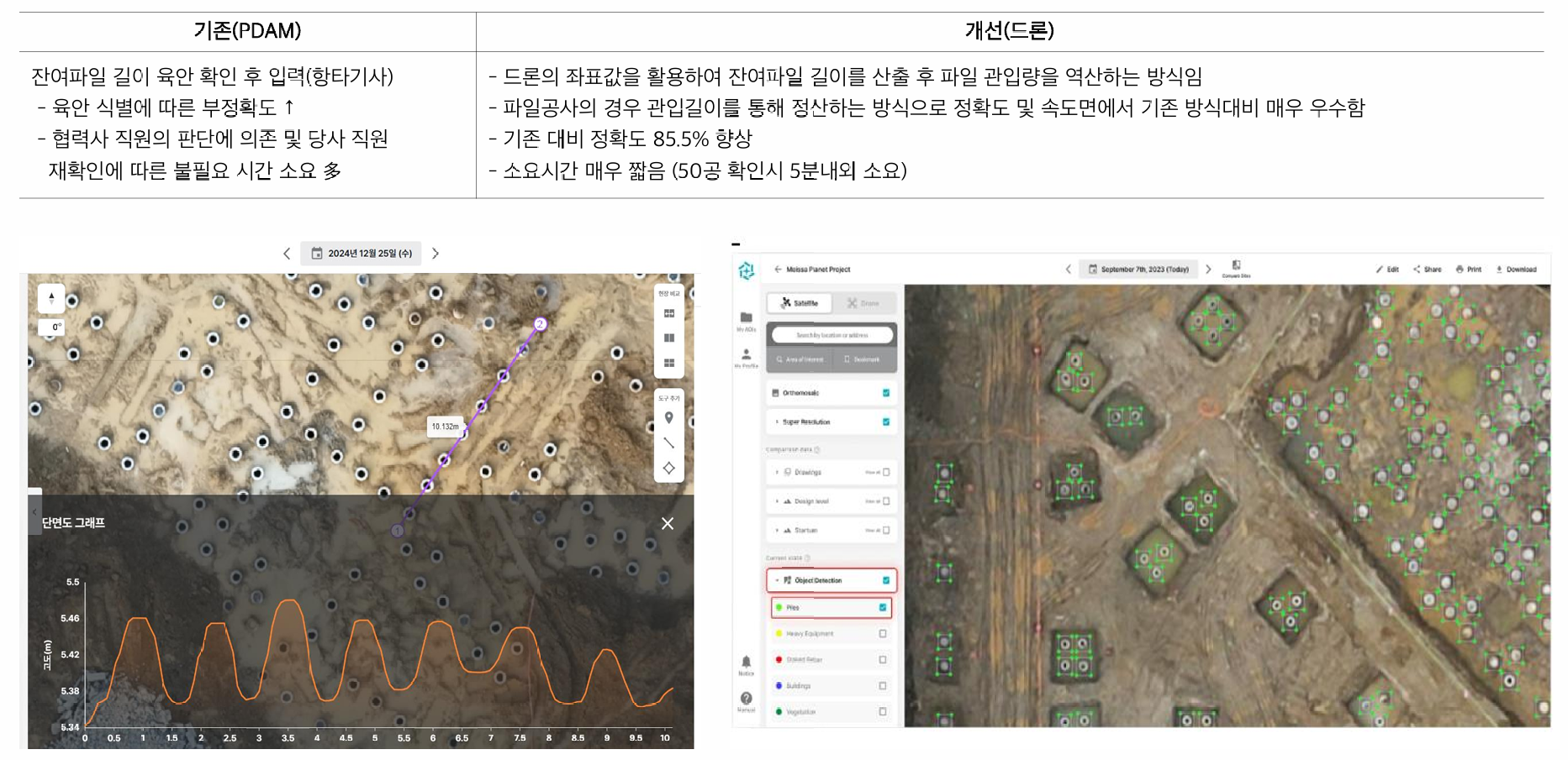
Based on drone capture data, verifying pile position coordinates and remaining pile length makes it possible to calculate pile penetration. Previously, the pile-driver operator would visually check the remaining pile length and enter it, but using drone data, pile penetration can be verified quickly on a coordinate basis.
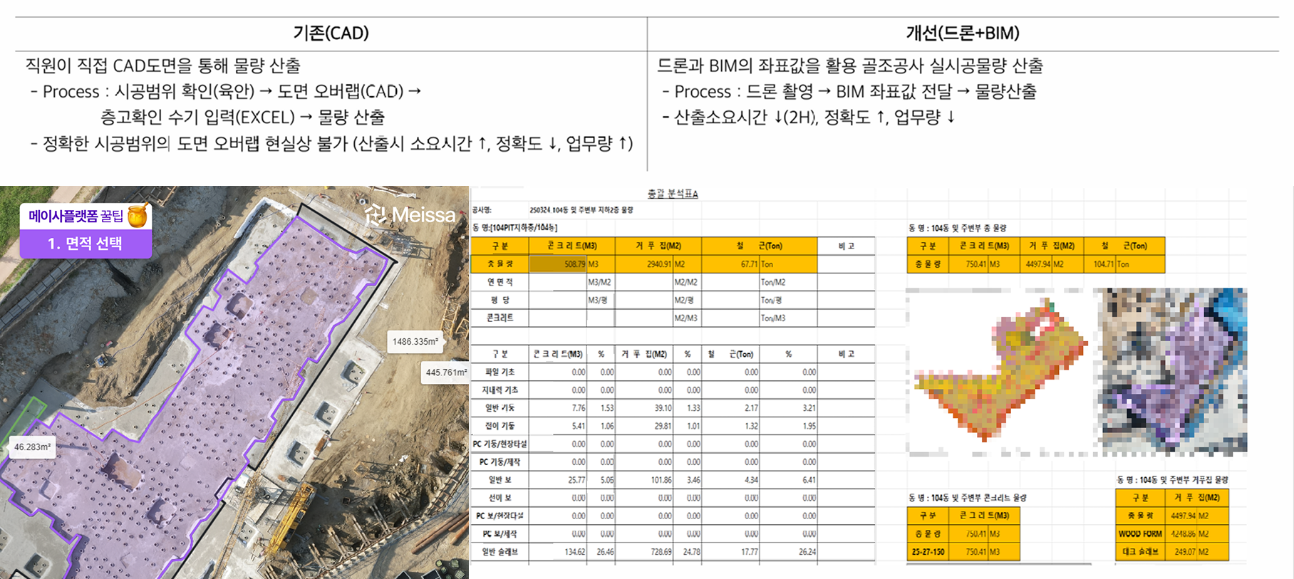
Integrating drone capture data with BIM coordinates makes it possible to calculate the actual construction quantities of frame work. Previously, quantities were calculated based on CAD drawings and manual entry, but using drone and BIM data, quantities based on the actual construction state can be calculated quickly.
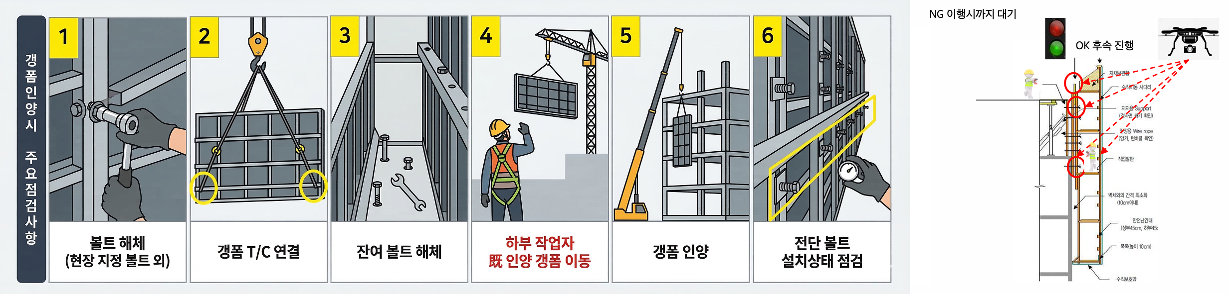
Using drone footage and Vision AI technology, key inspection items can be verified before gang-form lifting work. Gang-form work is often carried out on the exterior of a building, making it hard for managers to directly check the work state; drone footage allows the work state and hazards to be verified in advance.
On-site management points
Key risks that occur on site
The adoption of digital technologies such as drones and BIM on construction sites is now gradually becoming commonplace. But more important than the technology itself is how much it is actually used on site.
As the Gonjiam apartment complex case shows, once frontline practitioners began using drone data and systems directly, the way work itself is done began to change—going beyond simple data collection.
Amid this trend, HDC Hyundai Development aims to move beyond its existing DX (Digital Transformation) to the AX (AI Transformation) stage.
The goal is to combine AI analysis technology with existing digital technologies such as drones and BIM to build a data-driven operating system that connects all the way through to on-site decision-making.