Golf Course Data Collection Made Easy with Meissa

Meissa's drone 3D mapping allows for quick and easy course management and turf health monitoring.

파란 하늘과 녹색 들판 위로 각각 비행 중인 흰색과 회색 드론 두 대.
Golf Course Data Collection Process

4 Simple Steps to Start:

Automated system from Meissa's drone flight path setting to data collection! We reduce the difficulties of initial introduction.

01

Set Drone Path

Define the flight path for the drone.

02

Drone Flight

Autonomous flight function captures course photos (30 min).

03

Upload Photos

Generate 2D orthophotos, vegetation indices, and 3D models (4 hours).

04

Use the Data

Access Meissa Green’s features on up-to-date 2D and 3D course maps.

Drone Outdoor Field Data Collection

Gain a fresh perspective on your course.

Let Meissa handle the data collection, so you can focus on more important tasks with an updated view of your golf course.

Automatic drone flight

Flight paths for 3D modeling are auto-generated via tablet, no need for professional equipment. Data is uploaded directly to the platform.

남성이 노란색 안전 조끼를 입고 들판에서 드론을 조종하고 있습니다.

Recording and archiving of foreground photos

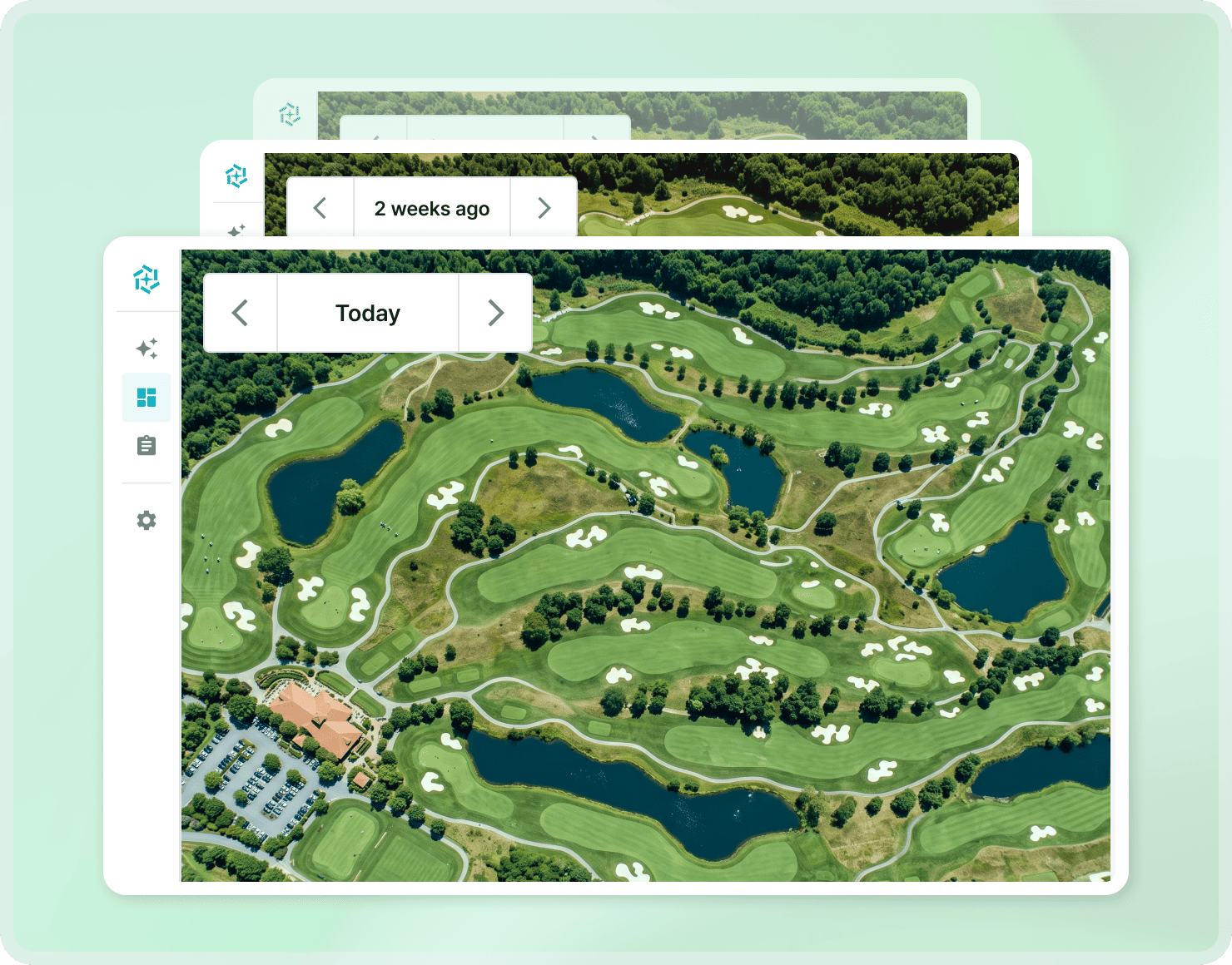
View panoramic images of the course from all angles. Easily compare course changes over time, from monthly to annual updates.

여러 날짜별 항공 촬영 이미지가 있는 건설 현장 현장상황 목록 인터페이스 화면.

Golf course 2D monitoring

Remotely monitor and share course status anytime, anywhere with drone-captured orthophotos.

산과 숲으로 둘러싸인 골프장 항공사진, 여러 개의 페어웨이와 벙커가 보임.
Q&A

Frequently Asked Questions

Meissa Green, an easy and fast golf course management solution starting with drones. Ask Meissa any time.

Isn't it difficult to use a drone?

Meissa's automatic drone route setting function allows anyone to easily set up a flight plan and collect data. We provide support with on-site training services related to the purchase and use of drones, so get started with the Meissa platform without worry.

Icon - Elements Webflow Library - BRIX Templates

How fast is the data processing speed?

The collected data is processed quickly in about half a day or 4 hours on average. This provides close to real-time analysis results. Thanks to the fast data processing speed, you can compare course conditions by date and understand the latest golf course status.

Icon - Elements Webflow Library - BRIX Templates

What is the shooting cycle?

After drone flight settings are completed, shooting and analysis are required. You can freely proceed with filming whenever you want. Since data is accumulated by shooting date, the shooting cycle can be flexibly adjusted according to the severity of golf course management work.

Icon - Elements Webflow Library - BRIX Templates

How is field data safety guaranteed?

All drone flight data processing processes are of the highest level. It is done safely by complying with security standards, and can be checked in real time through the cloud system.

Icon - Elements Webflow Library - BRIX Templates

I am worried about the cost of purchasing a drone or using the solution.

Meissa is cost-effective. Reduce initial costs through packages and flexible drone rentals. It also improves data accuracy, reducing overall project costs. Enjoy long-term cost savings from regular data collection via drones.

Icon - Elements Webflow Library - BRIX Templates
Use case

Meissa Green customer case

How are companies using Meissa Green for smart golf course management?
Explore real-world examples of how our customers are transforming their golf course management with Meissa Green.

산과 나무가 둘러싼 렉스필드 리조트 건물 외관 전경.
Rexfield Country Club

“Rexfield Country Club realizes proactive green management through Meissa Green.”

잔디와 연못이 있는 골프장 필드에서 골프를 하는 네 사람과 골프 카트.
Flamingo CC

“Flamingo CC remotely manages everything from construction to the course through Meissa Green.”

여러 개의 페어웨이와 벙커, 호수가 있는 산에 둘러싸인 아름다운 골프 코스 전경.
Route 52CC

“Route 52CC provides perfect collaboration in course management through Meissa Green.”

Learn More
Icon - Elements Webflow Library - BRIX Templates
Guided Setup & Support

Getting Started, Step by Step

Clear steps and guided support to help your team get started with confidence.

Find the Right Plan for Your Course

Pricing is based on drone equipment and course size. For more details, please contact us.

Create an Account & Project

You'll receive a project invitation by email. Start using Meissa Green to manage your course right away.

Guided Training & Setup

Our team provides remote guidance and step-by-step training to help you fly drones and use the platform effectively.

Get Started Today!
Contact us for a demo or pricing inquiry.