To make diverse spatial data usable,
ingestion, integration, and visualization must work as one
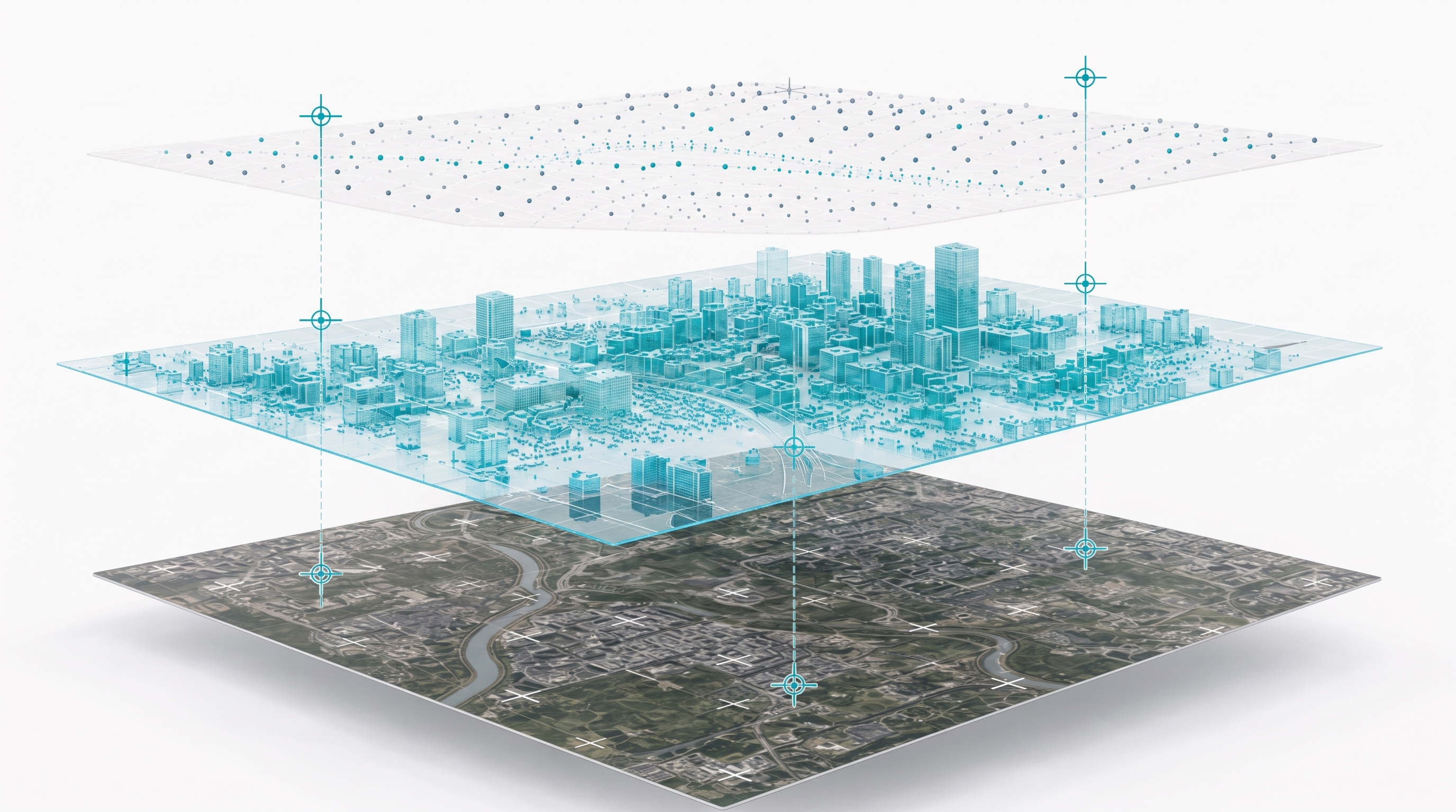
Spatial data from drones, satellites, CCTV, IoT, and drawings differs in format, coordinate reference system, and scale. A platform must ingest and standardize it reliably, integrate it onto a single spatial reference, and visualize it fast.
01
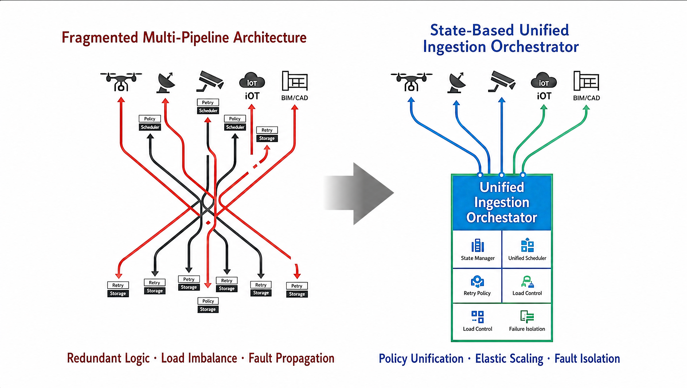
Ingesting and standardizing diverse data
Every data source has its own format and metadata structure. Ingestion must stay reliable as types and volumes grow, and normalize everything into a usable form.
02
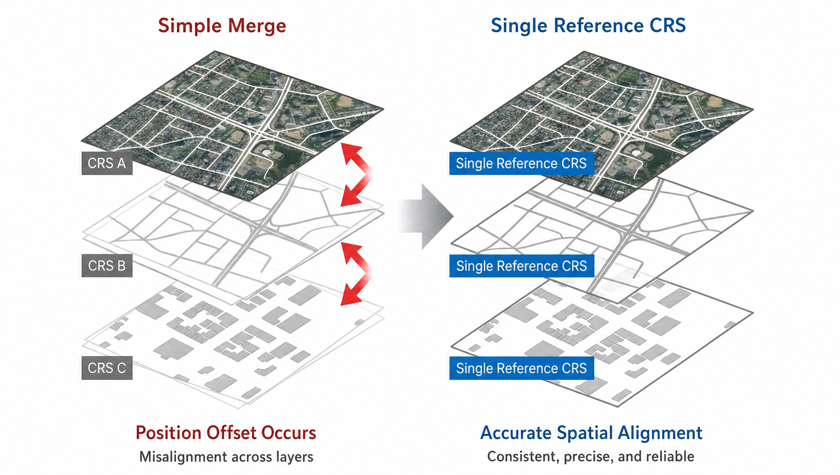
Precise integration of heterogeneous data
Simply merging data with different coordinate systems, resolutions, and time bases introduces error. 2D imagery, 3D models, and sensor data must be co-registered onto a single spatial reference.
03
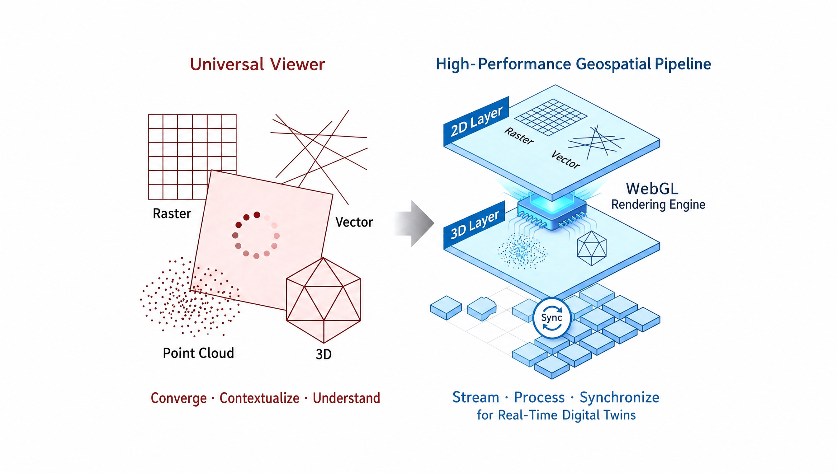
Fast visualization of massive datasets
Using large-scale spatial data on the web requires optimized streaming, rendering, and performance, so that many users can view it quickly and reliably.