

Recently, in the bidding guidelines for large public works and high-tech plant projects, more and more clients are demanding 3D spatial data from the construction phase.
This is closely tied to institutional trends such as the BIM policy of the Ministry of Land, Infrastructure and Transport (MOLIT), whose mandatory application expands to public works worth 50 billion KRW or more starting in 2026. What deserves attention is the essence of the 'BIM deliverables' that clients require from contractors. MOLIT's BIM implementation guidelines for the construction industry specify, in addition to 3D model data (Native and IFC formats), clash-detection results between trades and quantity take-off data based on the 3D model. Furthermore, private high-tech sites (semiconductor and secondary-battery plants, etc.) are increasingly adopting similar 3D data delivery standards.
From a field-operations perspective, this signals an important shift. Clients do not want a simple '3D drawing.' They are demanding objective spatial data to prove: "Was the actual site (As-Built) constructed without error, exactly as planned in the drawings (BIM)?" For contractors, securing spatial data has become both a requirement for winning contracts and starting construction, and at the same time an asset that protects the company throughout the construction process.

The fundamental reason clients demand three-dimensional data from the construction phase is the long-term lifecycle management of the asset. Construction is completed within a few years, but maintenance and repair continue for decades.
However, when this standard is applied to field operations, management blind spots arise. Once concrete pouring is complete, or once underground utilities are covered with soil during backfilling, it becomes very difficult to prove the construction integrity of that process after the fact. Situations arise in which you must clearly demonstrate whether underground piping was constructed exactly to the coordinates and levels of the design drawings, or whether foundation piles were installed in the correct positions so that the subsequent steel-frame work is free of interference.
Because the site changes daily with frequent design changes and simultaneous work by many subcontractors, objective proof is difficult with fragmentary photos or a manager's records alone. If questions are raised, there is a high risk of wasteful work and disputes, such as redeploying the survey team or re-excavating already-constructed areas.
When you have to prove a discrepancy, management efficiency depends on whether you leave it as mere paperwork or use it as evidence to defend the site's costs. Leading sites are already combining drones with spatial data platforms to preemptively block the risks of construction errors and rework.
Rather than reacting to post-inspection findings, it is more advantageous for cost and process management to correct construction errors before pouring by comparing the drawings against actual conditions with 3D data.
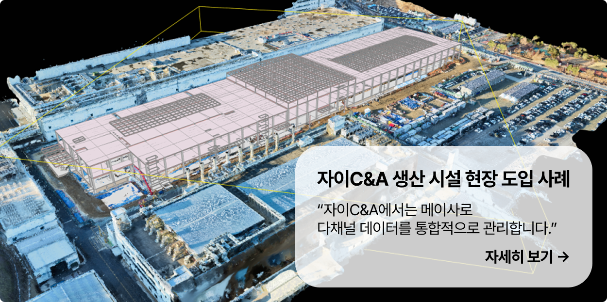
Past spatial data accumulated by process becomes a decisive clue for preventing unexpected accidents caused by underground utilities.
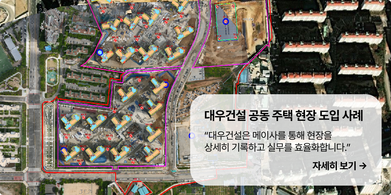
Ultimately, the key is how to routinely collect the vast amount of data clients demand without adding to the workload of construction-management and site staff. Collecting data with individual devices, manually comparing it against drawings, and creating reports increases staff fatigue and undermines the original purpose of adopting smart construction. Therefore, it is highly effective for sites to use an 'integrated spatial data platform' that runs everything from data collection to 3D model generation, drawing alignment, and object analysis in a single pipeline.
The stricter the client's delivery standards become, the more a system that can consolidate fragmented site records and prove construction integrity will establish itself as essential infrastructure for construction companies. What is noteworthy is that this data is double-sided. The very records that satisfy the client's demanding delivery standards conversely become a shield that protects the contractor itself in disputes and battles over liability. Time-series spatial data objectively accumulated before the concrete is covered will be the standard that increases site transparency while protecting the contractor's rights.

