Tight timelines, tight spaces, and dozens of subcontractors — from groundbreaking to completion, Meissa supports the most transparent, stable site management on building projects.
Verbal reports and floor plans can't untangle simultaneous workflows — and when visibility lags, the accountability lands on the person in charge.
Periodic drone capture of the entire site visualizes zone-by-zone progress on the orthophoto. Delayed zones are identified instantly, and as-built data becomes the basis for decisions.
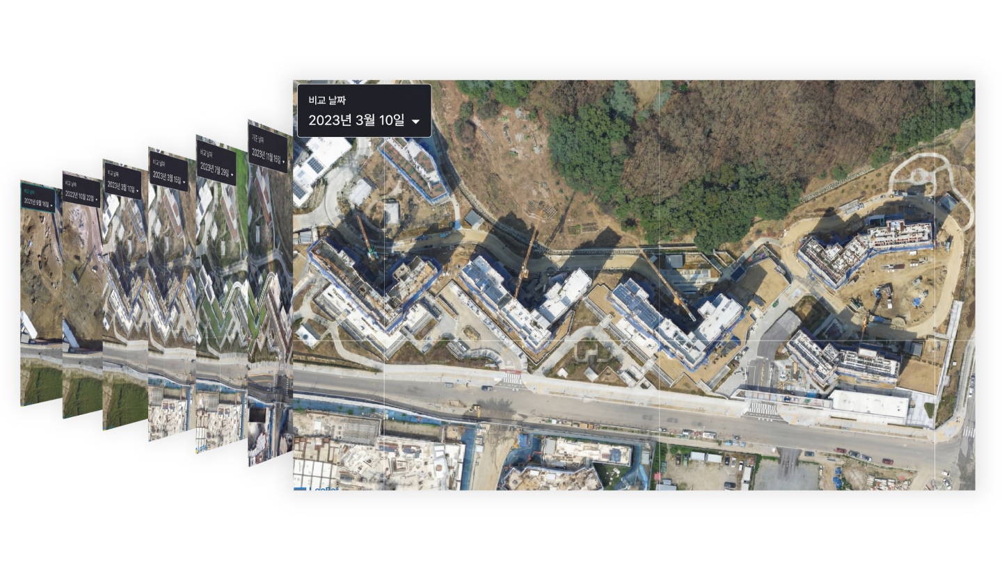
"The biggest advantage is knowing exactly where things stand. We move in real time, but drawings are static. With Meissa, the actual construction status we could never see from drawings alone is visible at a glance — planning and management have become far easier."
When settlements run on estimates, the same disputes repeat every month.
Coordinate-based area and volume calculations from drone data cut earthwork takeoffs from days to 10 minutes.
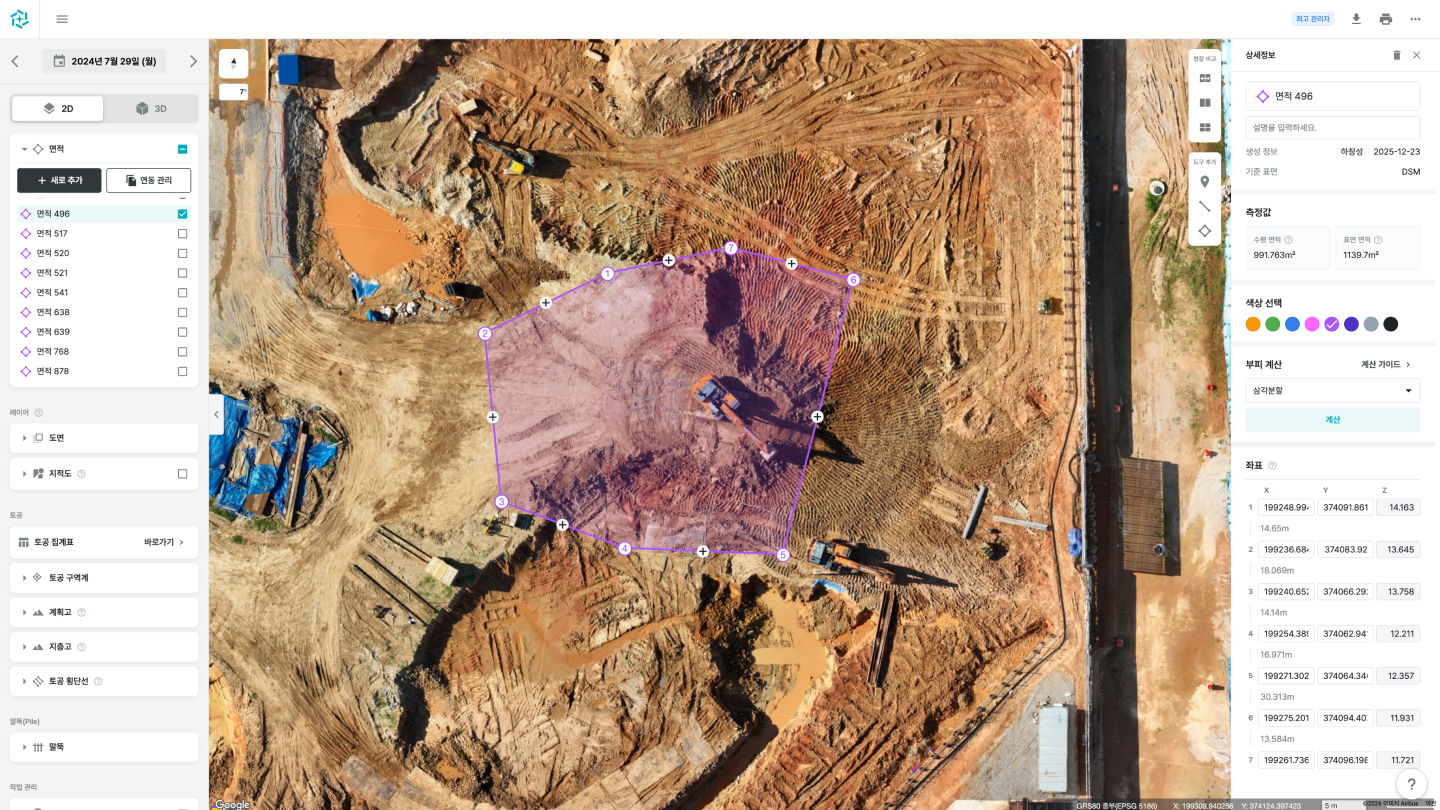
Earthwork calculations that took over 10 hours now take 10 minutes, and progress payment issues with our earthwork contractor simply disappeared.
"Meissa's area tools give us an objective measure of work completed, which has made our progress payment cycles much smoother."
After completion, retrieving records for the exact time and zone in question is difficult.
Periodic capture preserves the entire construction process as 3D data by date and location. Go back to any point in time and prove the integrity of your work.
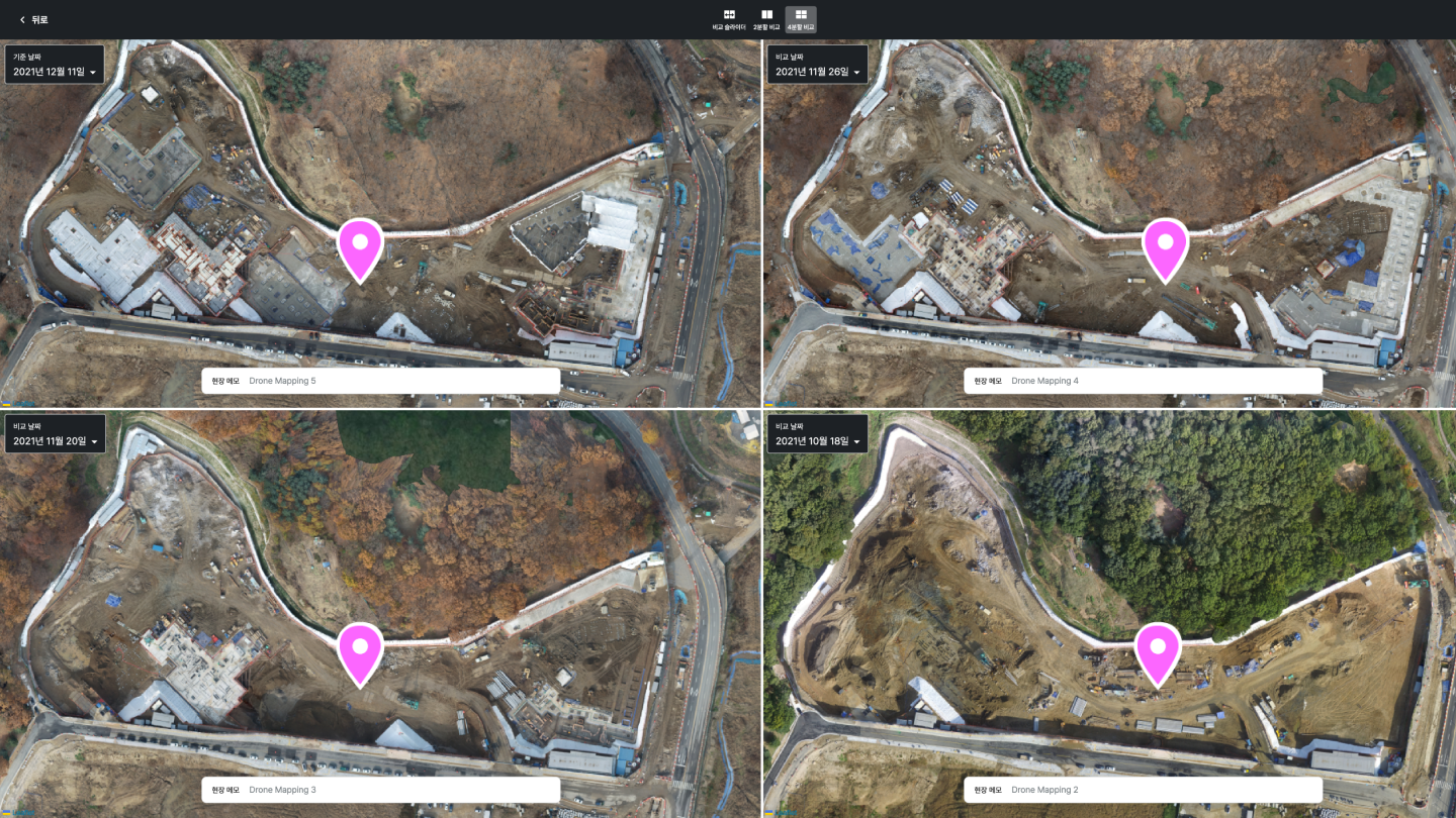
"When we had to dig again where tower crane cables had been buried, we checked Meissa to locate the buried lines and finished the work safely. A job site can't stop. In the end, records are all that remain."
We'll review your site's scale and schedule complexity together, and design the right adoption plan.
Vast footprints, massive earthwork quantities. Automate monitoring and settlement with drone data.
With standards varying by section, consistent monitoring is impossible — and every subcontractor conversation means another drive around the site.
The entire site fits on your monitor. Invite subcontractors onto the same orthophoto, point to exact locations, decide on the spot — and drive out only where an in-person check is truly needed.
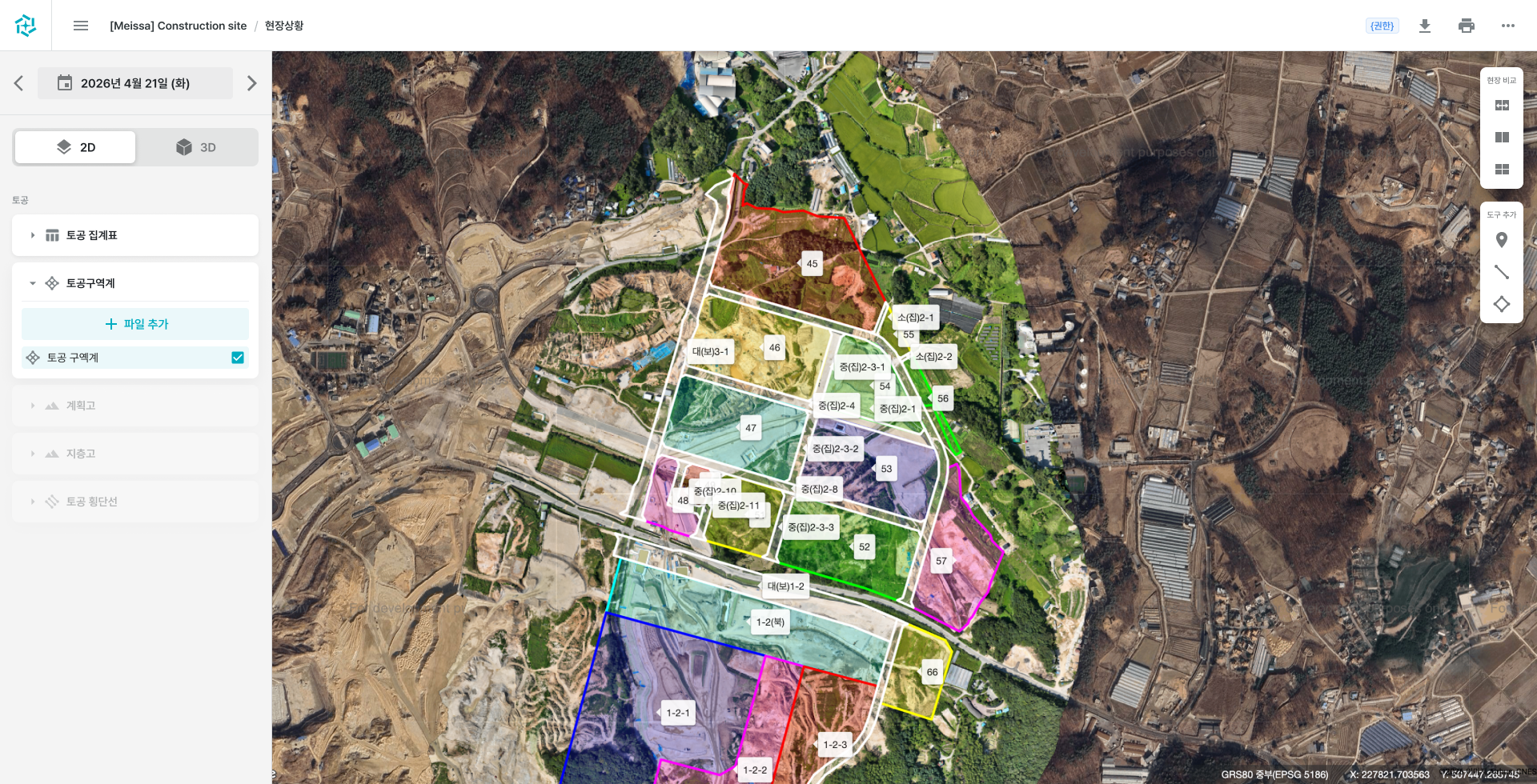
"Early in the project, if someone said 'there seems to be an issue at Ramp A around this station, please check,' we had to drive out. Now, even over the phone, it's 'open the Meissa file from that date' — 'Got it, confirmed.' The time and effort spent keeping the project organized has dropped dramatically."
The longer each survey cycle runs, the further progress payments and owner reports slip.
Calculate cut/fill volumes by zone directly on orthophotos and 3D models. Survey post-processing that took days now takes about 10 minutes.
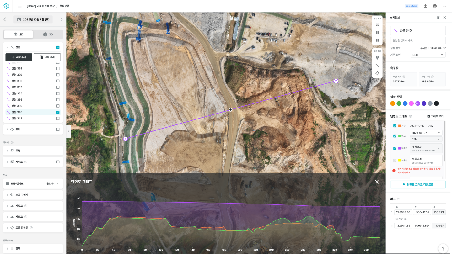
"We used to take it for granted: run surveys on the progress payment schedule, draw cross-sections at every station, and build the earthwork volume tables by hand. With Meissa, quantity takeoffs are more precise and take far less time. Upload an Excel file with the start and end stations, and the earthwork cross-section lines are set automatically — ready to download as a CAD file."
Recovering additional costs takes clear evidence — but conventional surveys and photos can't objectively prove before-and-after conditions or the scope of work.
Accumulated time-series data compares before and after at cm-level accuracy. The changed scope and nature of the work is proven by data — negotiations start from survey data, not assertions.
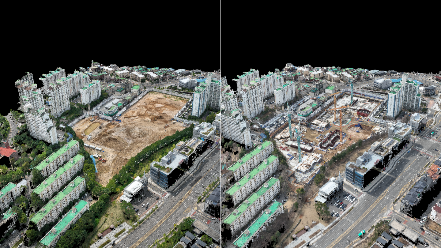
"We had a quantity issue at groundbreaking — the earthwork levels differed between when the geotechnical report was written and when construction actually started. We needed to re-baseline the budget, and fortunately we had time-stamped orthophotos in Meissa. We compared levels objectively across dates and quickly quantified the difference for the budget revision."
We'll review your site's scale and earthwork type together, and design the right quantity management plan.
High-value equipment, dense piping, tight schedules. Daily data and BIM alignment support error-free construction.
When everyone holds different site information, understanding diverges and decisions slip.
Daily drone capture lays out material locations, heavy-equipment movements, and each subcontractor's work zones on one screen. Progress and next decisions are handled on that same screen.
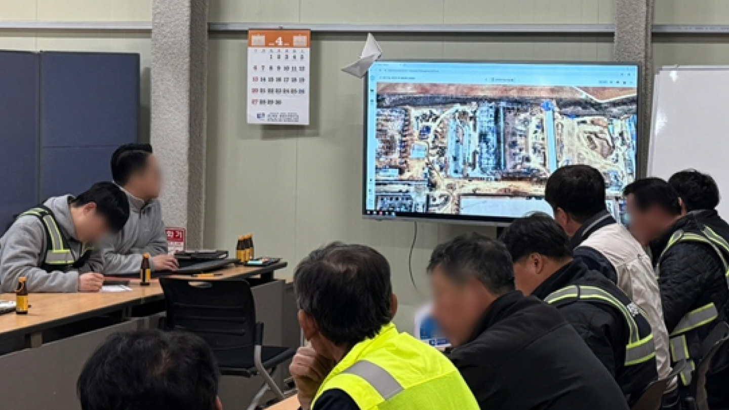
"Owner meetings, weekly meetings, daily progress meetings — we now run them all through Meissa. With all the data on one platform, the problems of mismatched site information and differing understanding disappeared at the root. Better collaboration made our meetings shorter, too."
Alignment verification always runs a beat behind — and the deviations in that gap turn into rework.
Open RVT and IFC files right on a field tablet with the web-based BIM viewer, and overlay them instantly on drone orthophotos and 3D models. Catch alignment deviations at build time and cut rework.
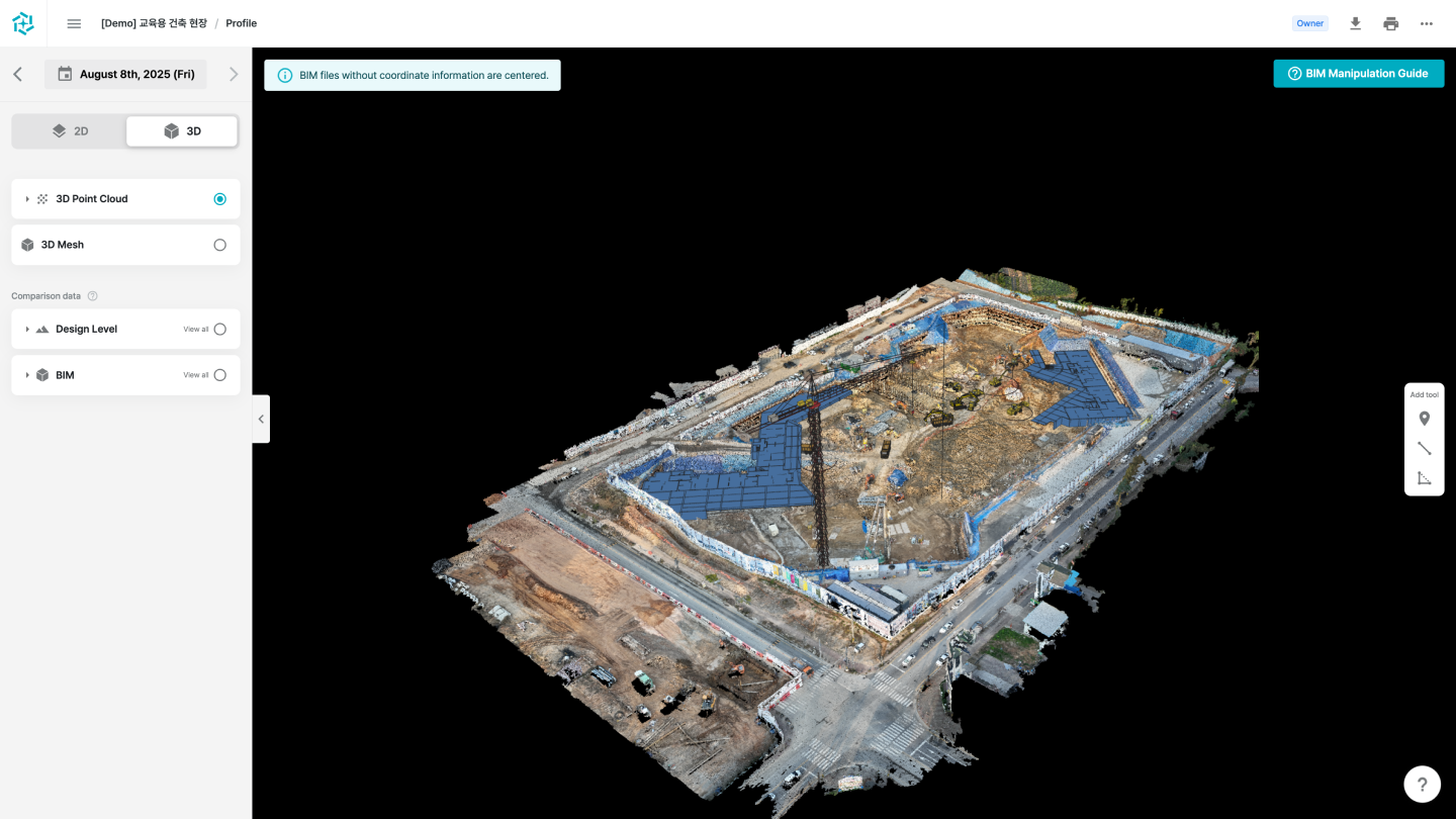
"Meissa is web-based and takes both RVT and IFC uploads. Because it has a built-in viewer, field crews can inspect the as-built state directly on a tablet and intuitively see how the piping is installed at each location."
Plant sites move high-value equipment and heavy machinery at the same time. Directing crew movements with drawings only goes so far — and when routes tangle, it means work interference and, worse, serious caught-in accidents.
Daily drone capture visualizes material locations, heavy-equipment routes, and other subcontractors' work zones. In safety briefings, direct movements on real site imagery instead of floor plans — removing interference and accident risk at once.
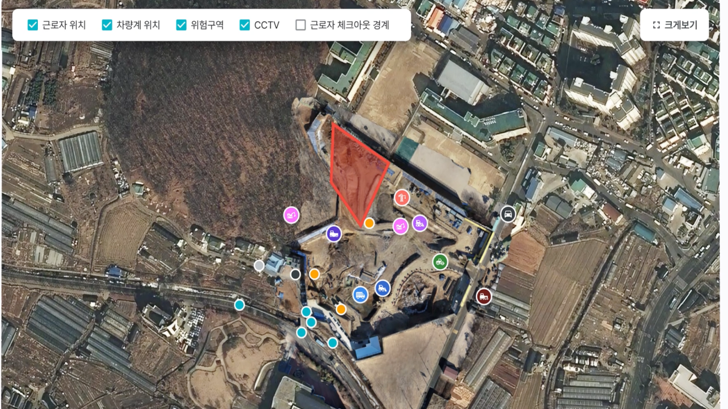
"Our site has narrow roads, with about 200 pieces of construction equipment moving through. At the morning toolbox talk we announce everything on a screen — and for workers who struggle with floor plans, explaining with visualized imagery makes it stick."
We'll review your design complexity and owner requirements together, and design the right management framework.
See how Meissa transforms construction sites through our customers' stories.