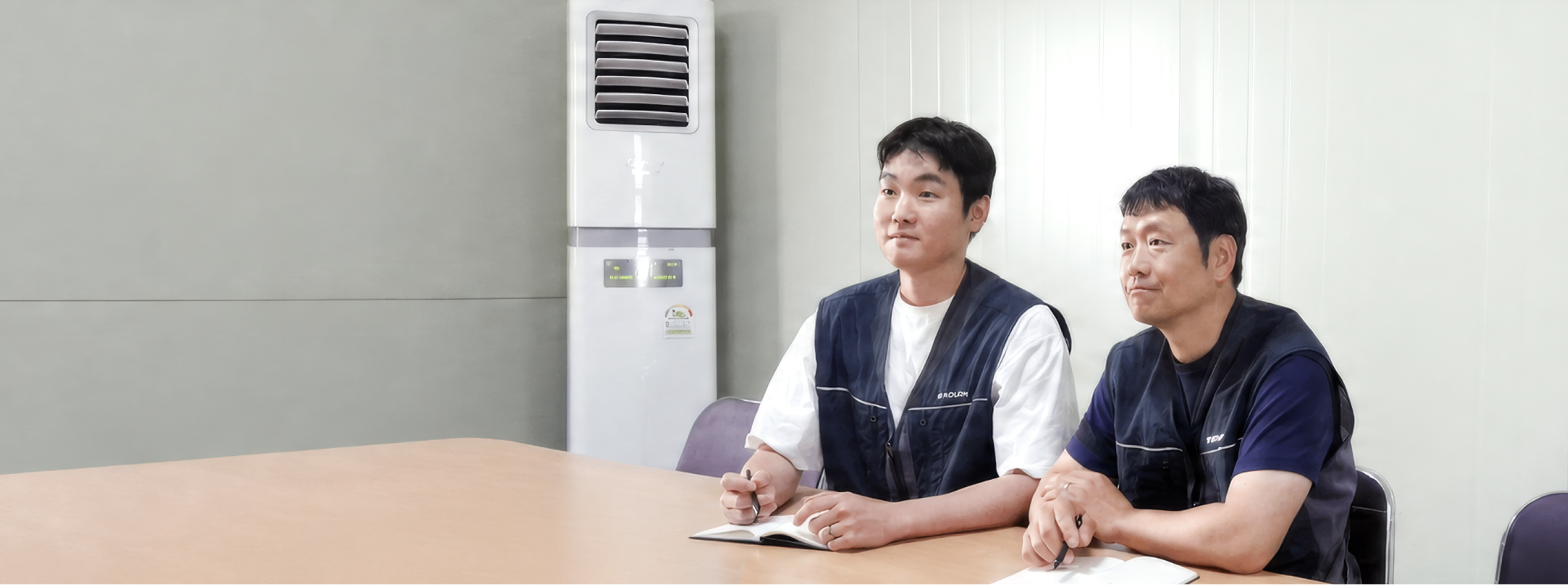
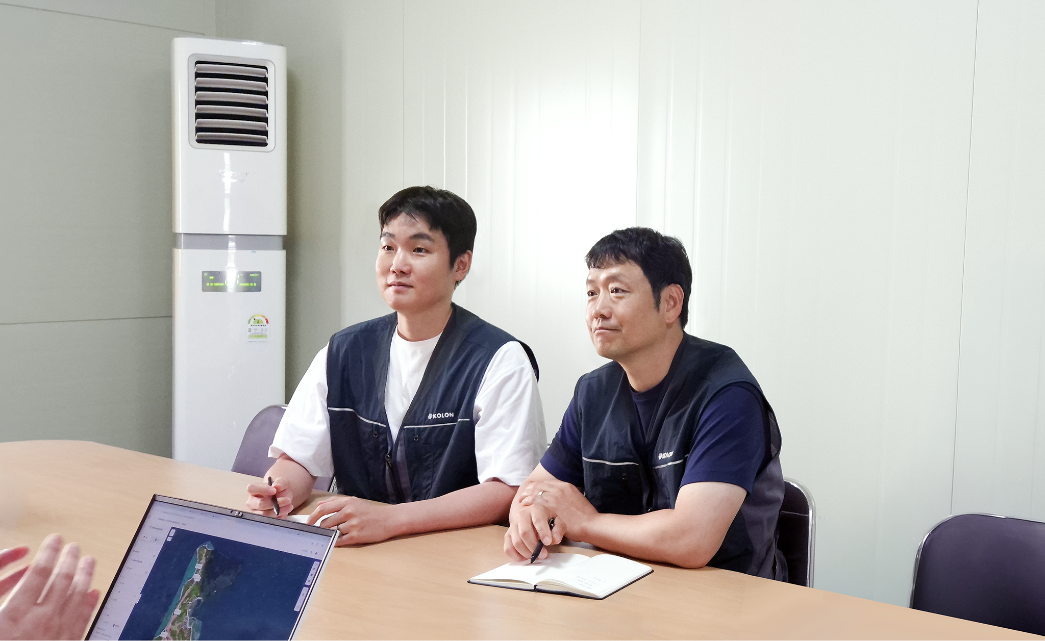
"With Meissa, Kolon Global looks in on a site it once reached by boat — right from the office."
Knowing "what state the site is in right now" is where all site management starts. But when one loop of a vast or unusual site takes half a day, that single check becomes pure time and labor cost.
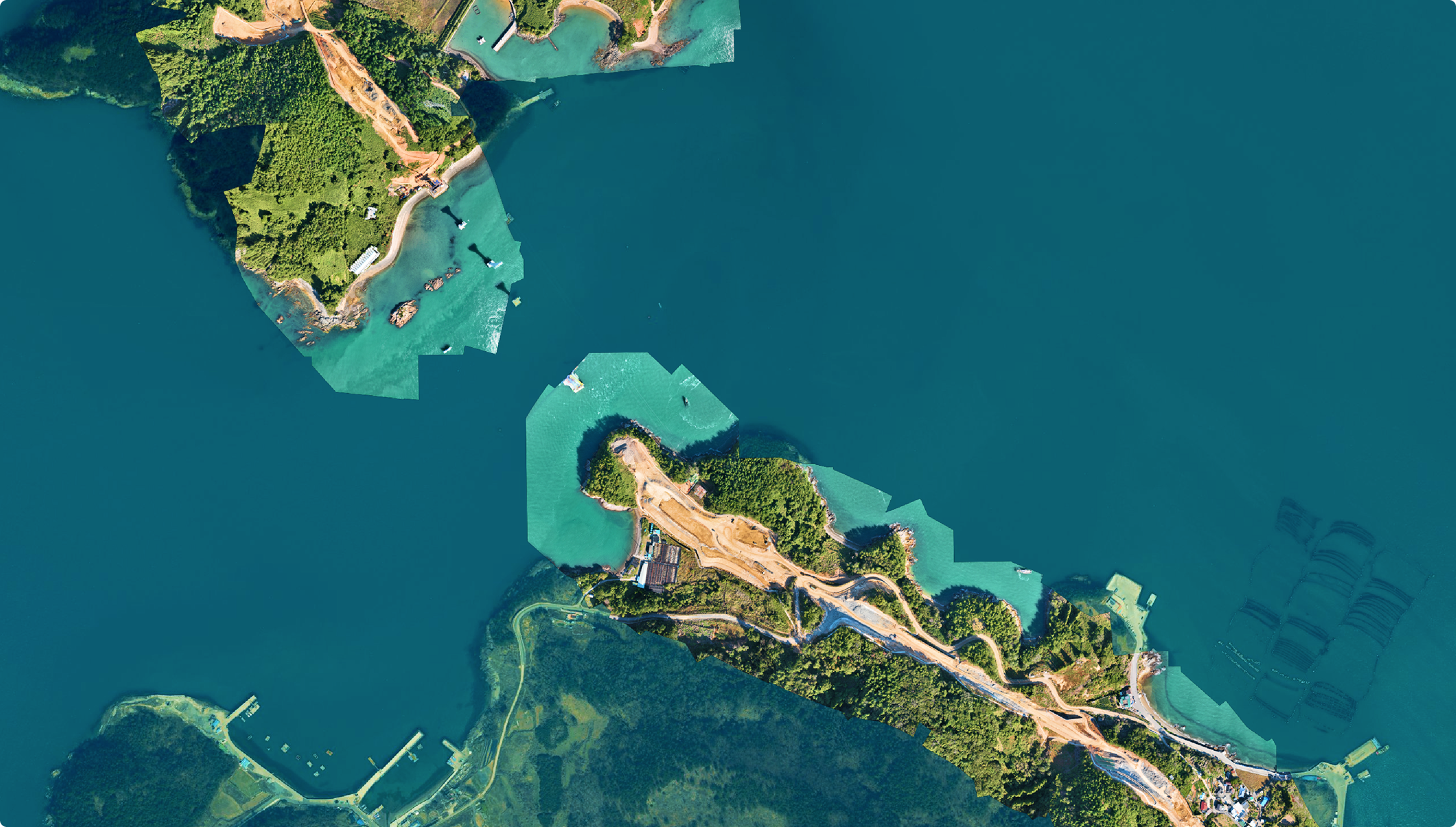
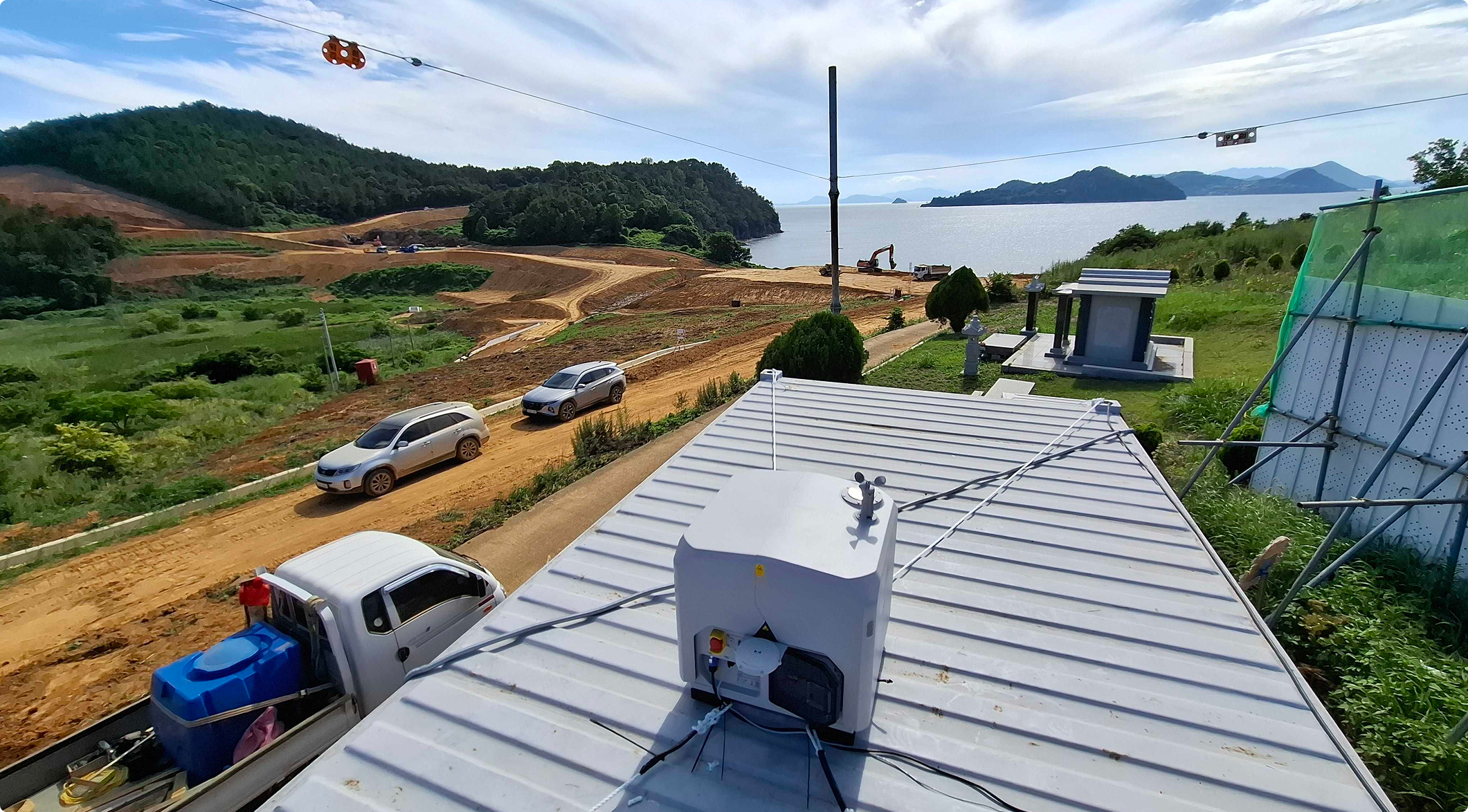
Kolon Global adopted the Meissa platform to solve this at the root. Now the team flies an autonomous drone from the office whenever needed, monitoring a hard-to-reach site and checking progress and worker safety. From the Yeosu Hwatae–Baekya site — three islands (Baekya-do, Je-do, Gae-do) and their connecting bridges — here's how Meissa changed the day.
Q. Briefly, your role and the site?
💬 Lee Jae-seok, Construction Manager
I'm the construction manager here. The site spans three islands and four bridges — two offshore, two on land — with Baekya-do connected by land, about 6.9 km in total. Labor-heavy work like deck installation and cable connection remains, but we're on track to finish on schedule.
Civil work is a daily cycle of pouring, inspection, and construction, and there are always conditions the design didn't capture. We used to revisit the site to check each one; now we review orthophotos from multiple angles in Meissa and spot what we missed instantly — then draw shop drawings, review with supervision, and report changes to the owner through the contract-admin team.
💬 Kwon Chan, Contract Administration Supervisor
I mainly handle authority liaison. When issues arise, I prepare and negotiate the documents for the owner and authorities. I also overlay drawings on current conditions to verify built quantities for billing, and rely on Meissa to produce owner reports and land-compensation and complaint materials.
From a site you traveled to, to one you check anytime
Q. The biggest change after adopting Meissa?
💬 Lee Jae-seok, Construction Manager
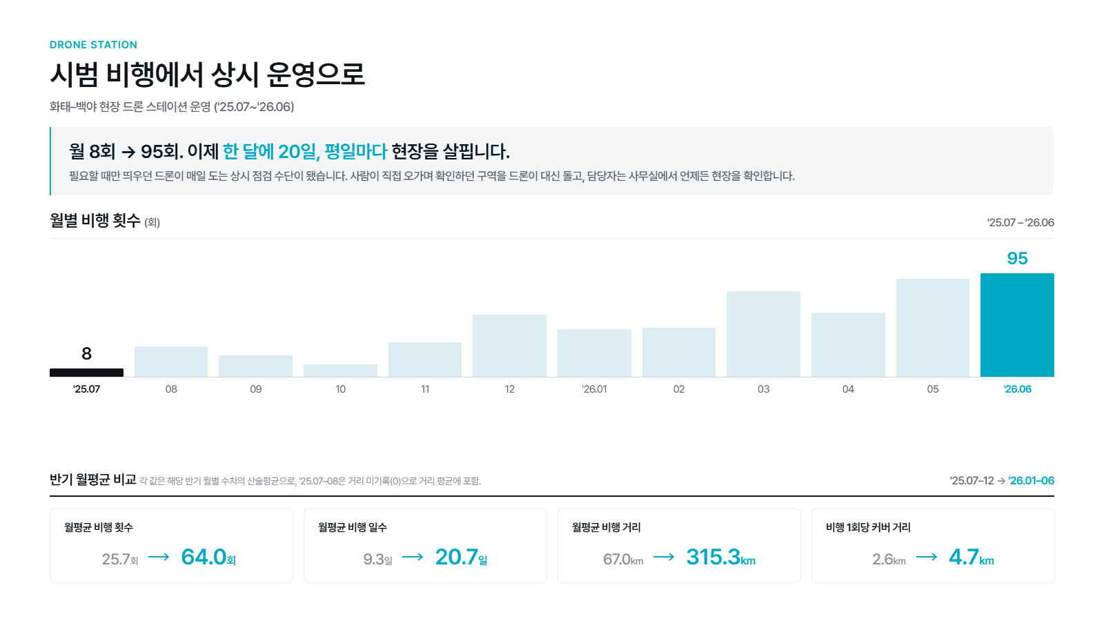
We can now check the site anytime without going in person. For island construction, one visit is a real undertaking — 20 minutes out, 20 back, plus looking around: easily 1.5–2 hours, half a day gone if you step out mid-work. For quick checks like "did the contractor finish and leave properly," we just fly the drone, scan from the office, and call right away. What once meant another boat ride now takes minutes. We fly three or four times a day, and every Monday we scan the whole site for weekend changes or incidents before starting — it's become a habit.
💬 Kwon Chan, Contract Administration Supervisor
For me, the time to prepare status materials dropped sharply. Once a month we film the full section for the owner. Before the drone station, we flew a piloted drone by hand — the connection dropped between islands and we needed three or four batteries. Now we set the flight path from the office; the drone films the whole route and recharges itself, with far better image quality and no one tied to it.
Q. Did flying often change how the team checks the site and communicates?
💬 Lee Jae-seok, Construction Manager
At first only the trained drone officer flew it, so every "film this" request piled onto one person. Now everyone in the office handles takeoff to return. We even made a group chat to announce flights — since only one can connect at a time, the rest wait their turn.
Hwatae-Baekya Stockholm Sky-Split Arrangement
That's how actively several teams view the site. We map orthophotos weekly and shoot other conditions as needed; each team looks for different things — construction status and hazards, workers, quality — from the same data. In meetings with the director, when views differ we pull Meissa up on the office TV and settle it on the spot. Far faster and clearer than words.
Overlaying plan and reality on one screen
Q. How does the construction team use the data?
💬 Lee Jae-seok, Construction Manager
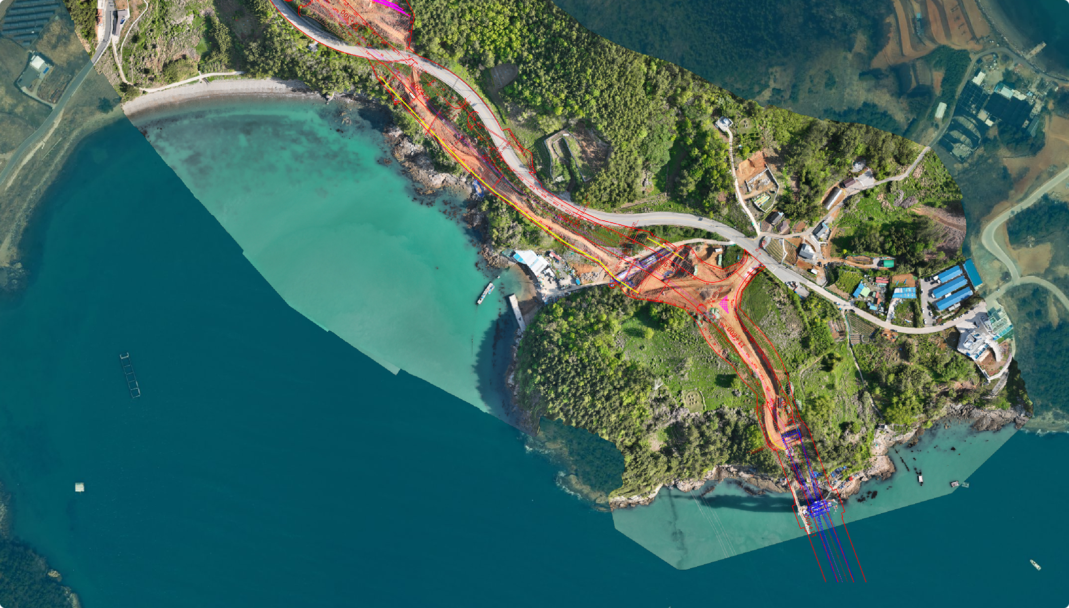
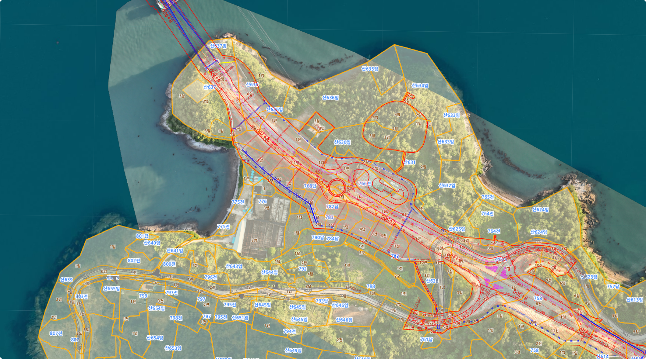
Our most labor-heavy task is drawing registration. A CAD drawing is the "plan"; the drone's orthophoto is the "actual site now." Meissa overlays both at true scale — with GCPs set properly, they align with almost no error. We used to stretch, shrink, and rotate photos by eye; now the Meissa engine handles GCP correction and registration automatically.
On that overlaid drawing we draw shops, add access roads or sequence, and it becomes a report — a job that took a full day now takes an hour. We also use the map tools: draw a line down a 25–30 m slope and its cross-section graphs instantly, so we check gradient and height against rock/rippable/soil criteria. Earthwork-volume settings are preloaded for instant use.
Q. And in contract-admin work?
💬 Kwon Chan, Contract Administration Supervisor
Contract admin constantly checks how the site matches the plan on paper. In Meissa we overlay the cadastral map and design drawing onto actual conditions, all aligned to the same location. This "overlay view" powers billing, land compensation, and complaints. For billing, whether structures like drainage, retaining walls, culverts, and ditches were built shows at a glance, so we confirm quantities fast. For land compensation and complaints, when residents ask how much construction crosses their land, we point it out on screen instead of explaining in words — smoother talks, far fewer misunderstandings. These maps go into almost every owner report and visitor briefing.
Eyes that reach the hard-to-see places
Q. How has the drone helped with safety in hard-to-access sections?
💬 Lee Jae-seok, Construction Manager
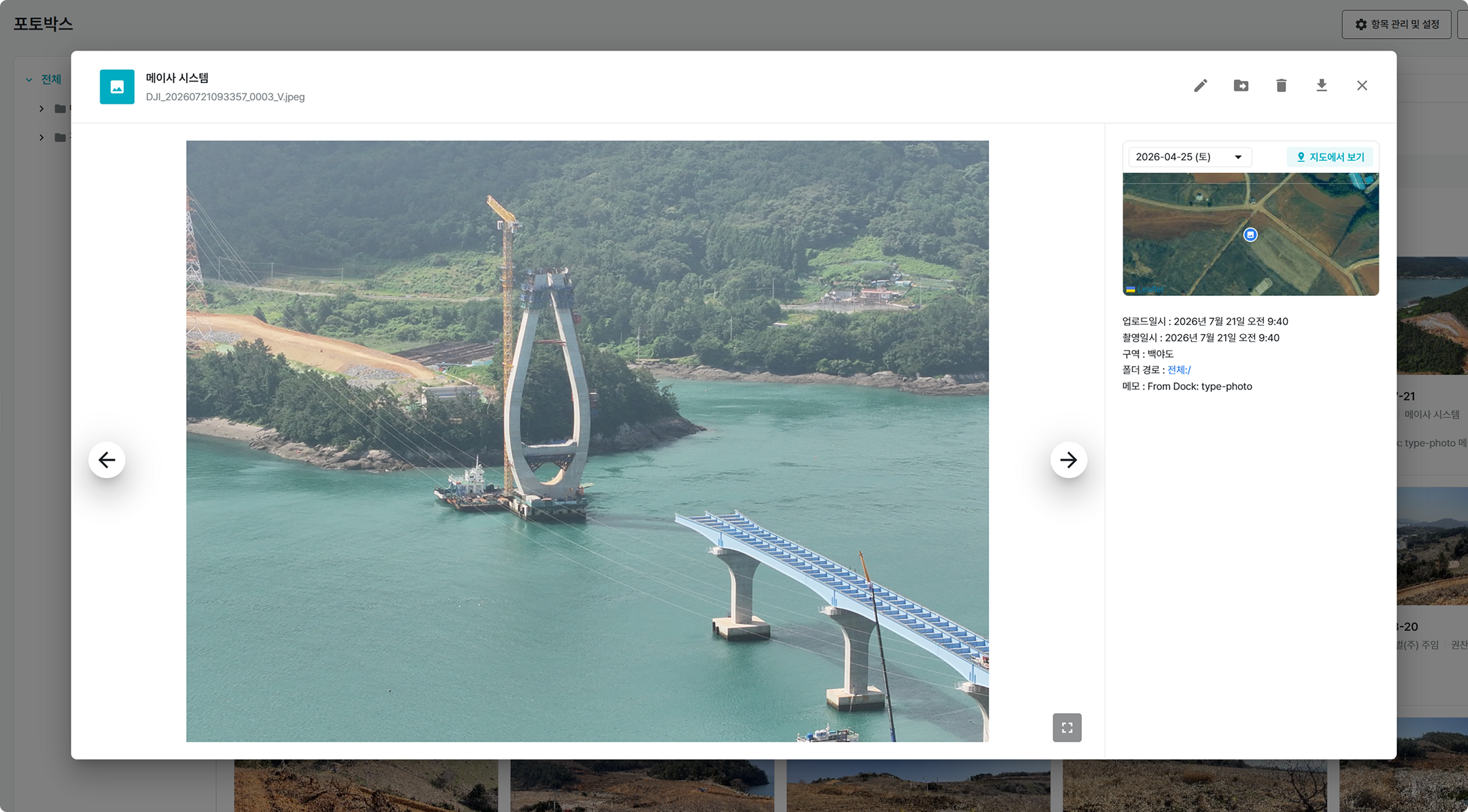
The drone checks places people can't easily reach. A bridge superstructure once meant a boat trip and climbing a vertical ladder to inspect piece by piece — dangerous and slow. Now we rotate the drone 360° and see the whole thing at once, including offshore zones and blind spots CCTV misses, then share the photos at the evening safety meeting. Daily views let us catch hazards preemptively — an uncovered ladder hatch is hard to spot by eye on a wide site, but drone records of each pylon surface it instantly, and we turn that into targeted safety training. Compliance is now near 100%. Precise checks — build-to-design, rebar — we still verify by direct measurement; the drone handles wide-area, continuous monitoring, complementing human inspection.
💬 Kwon Chan, Contract Administration Supervisor
During high-risk work like pouring or approach-bridge erection, we film to confirm safety hooks are fastened and check for hazards. For the recent No. 3 approach-bridge erection we recorded the process — great for checking from the office and keeping as evidence later.
Kolon Global and Meissa: building the future of smart construction together
Q. Reflections as an early drone-station adopter?
💬 Lee Jae-seok, Construction Manager
Our island-split, sprawling site made frequent checks genuinely hard — the drone airframe changed three times here alone. I even wondered if the drone station was going too far, but daily filming and instant platform use made it a natural pillar of site management. Cutting travel time alone is valuable, freeing time for other work. Through paving, lane marking, and the opening video, Meissa will be with us the rest of the way.
💬 Kwon Chan, Contract Administration Supervisor
This is my first site — and my first time with a drone and platform — but now I'd feel lost without it. The benefit grows the harder a site is to loop around. Even when we can't get out often, steady attention keeps the site in view; broadening my work's scope has been the biggest gain.