From Earthwork Volume Calculation to Safety Documentation: Introducing Meissa's Site-Tailored Add-on Services!
It's May, when sites grow busy before summer hits in full. From preparing for the monsoon that overlaps with earthwork schedules, to preventing heat-related illness ahead of the coming heat wave, to assessing site conditions for new orders. Both head offices and field sites must be run off their feet with matters big and small.
In this article, we introduce the 'Specialized Services & Custom Solutions' that Meissa has prepared to directly ease the burdens of on-site work. From volume-calculation outsourcing that ends subcontractor disputes to aerial photography for head-office order reviews, check right now which custom service your site and situation need.
Progress-payment disputes and overtime? Meissa will solve them for you!
💡Earthwork Volume Calculation Service (Earthwork Package Full)
What we provide
We handle the entire earthwork surveying process on your behalf — from on-site drone photography to precise DTM generation, quantity calculation, and earthwork volume table preparation — and deliver the final output.
Recommended for
Site managers and engineering team leads who need objective, precise data to clearly align standards with partner companies during progress-payment settlement
What is the Earthwork Volume Calculation Service?
Meissa's Earthwork Volume Calculation Service builds a Digital Terrain Model (DTM) through a precise, drone-data-based review process, and delivers everything through area and volume calculation to the final earthwork volume table. Rather than simple task outsourcing, it is a responsibility-based service that guarantees the quality of the output, providing decision-making baseline data and a basis for risk management at key milestones such as before groundbreaking, mid-construction, and completion.
💡 Cross- and Longitudinal-Section Drawing Service
What we provide
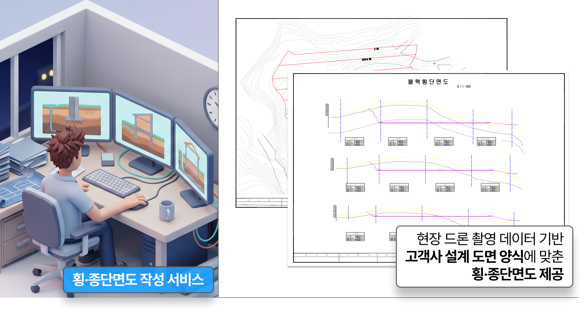
We provide the site's latest drone photography data as a CAD file, formatted to match the cross-section and longitudinal-section design template your company already uses.
Recommended for
Engineering/construction practitioners who spend a great deal of time preparing cross-section drawings for monthly progress-payment claims
What is the Cross- and Longitudinal-Section Drawing Service?
Meissa's 'Cross- and Longitudinal-Section Drawing Service' leaves the parts that require the site's own review — such as obstacle removal (DTM refinement) and final quantity calculation — for your practitioners to perform directly, and handles the earliest stage on your behalf: 'fitting current-status data to the design drawing template'. By efficiently sharing out the manual-work portions, you can lower cost burden and improve the site's cross-section work efficiency.
Before officially adopting the platform, start with no burden — 'one-off custom services’
💡 HQ Package for Head-Office Order & Status Review
What we provide
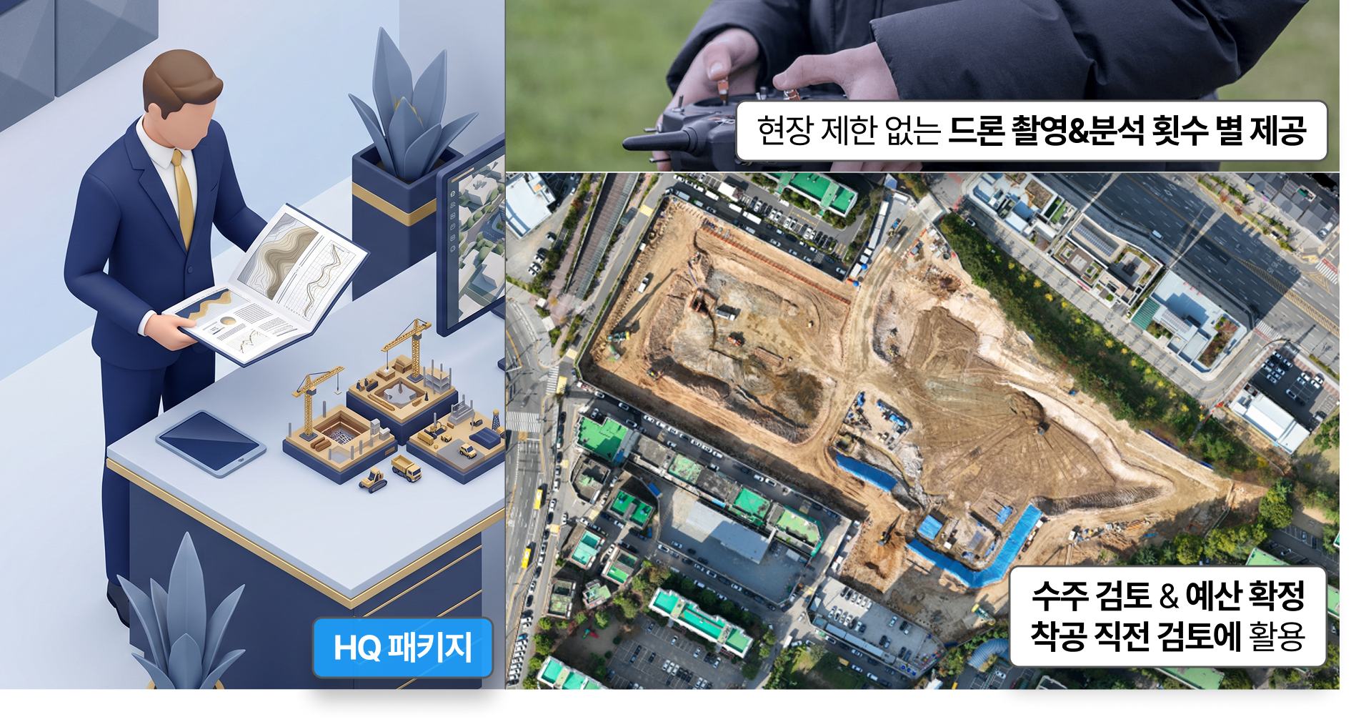
Without a site-level platform contract, the head office secures a bundle of 10 drone-photography and analysis credits and distributes them across the sites that need them.
Recommended for
Head-office sales and estimating staff who need precise terrain assessment to set an appropriate bid price before bidding on a project site
Project management staff who must check discrepancies between design drawings and actual terrain before groundbreaking in order to review budgets and manage risk
What is the HQ Package?
The HQ Package lets you contract and operate platform usage rights in units of 10, on a team basis. Because the head office can flexibly allocate credits across multiple project sites nationwide or to sites needing one-off checks, management efficiency is high.
💡 Custom Photography Service (Regular / One-off)
What we provide
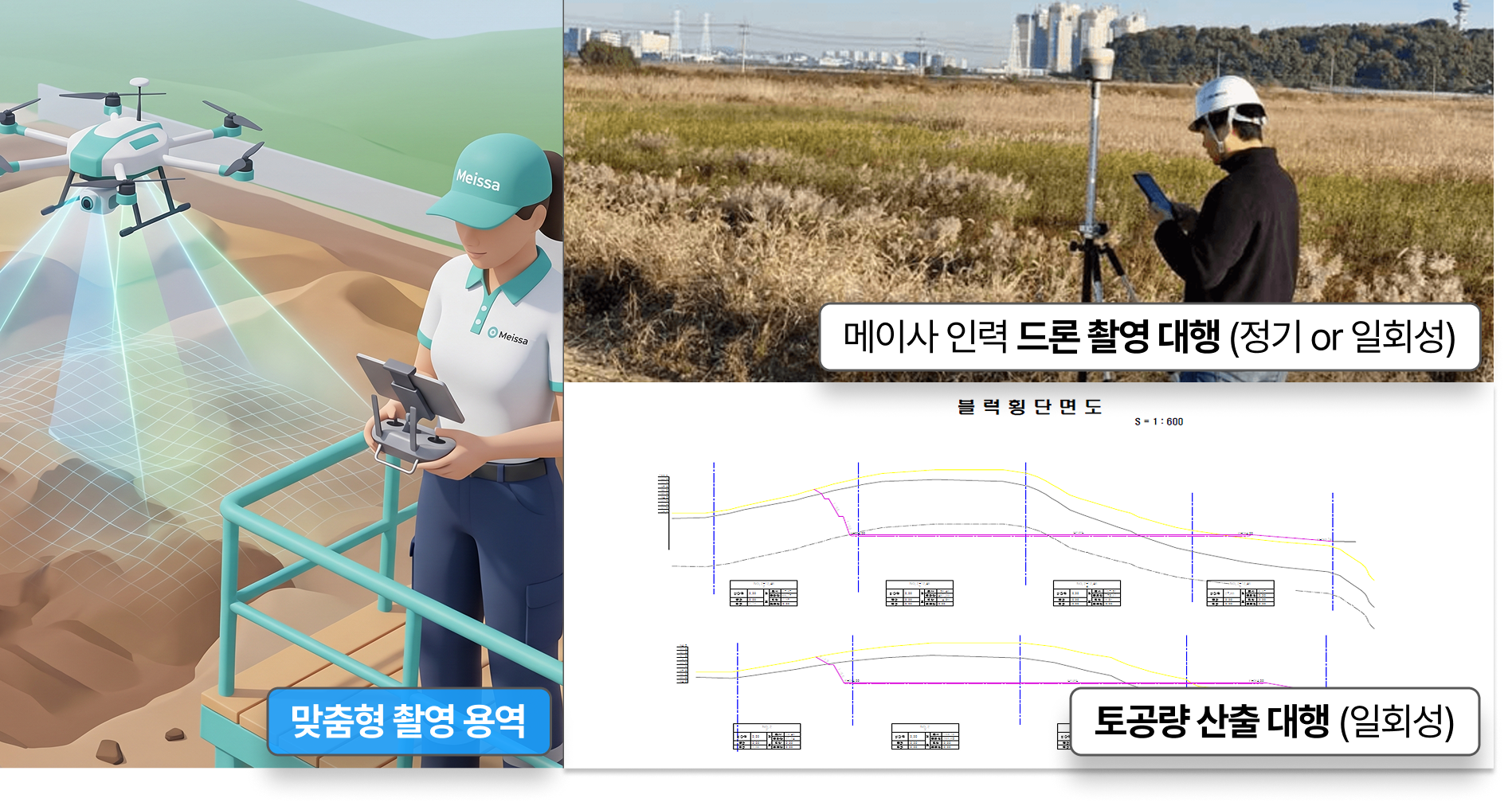
When a site has no drone pilot on staff or needs urgent status assessment, Meissa personnel are deployed directly to handle photography and data collection.
Recommended for
Sites that have data-utilization needs but currently have no staff assigned to operate a drone on a regular basis
Practitioners who need immediate on-site status checks and damage-quantity assessment due to bad weather (heavy rain, etc.)
What is the Custom Photography Service?
During periods when on-site work is concentrated, practitioners may find it hard to secure the time to fly a drone and process the data themselves. In such cases, if you use the 'Regular Photography Service', Meissa visits the site on a coordinated schedule and handles drone photography and earthwork volume calculation for you.
In addition, when urgent status assessment is needed due to unexpected natural disasters such as sudden heavy rain, you can use the 'One-off Photography Service' to quickly scan the site and receive the calculated data for fast decision-making.
Documentation you can't compromise on — 'Smart Safety Specialized Package’
💡 Meissa Safety Package
What we provide
Through worker and vehicle location tracking, danger-zone alerts, and AI video monitoring, safety-management records are logged and preserved in real time.
Recommended for
Site safety & health teams and head-office staff who need an objective, systematic data-archiving system for their safety-management action records
What is the Meissa Safety Package?
As safety-management standards have recently tightened, it has become more important for sites to thoroughly carry out the relevant measures while also preserving records that clearly prove them. The Smart Safety Package monitors the movement of workers and equipment, provides alerts when someone approaches a danger zone, and automatically detects unsafe situations through AI. This entire management process is automatically recorded as time-series data within the platform, so it can be used as objective evidence of your actions if an incident occurs.
What solution does your site need most right now?
Beyond a simple 3D viewer, Meissa's custom services genuinely reduce your site's resource load. So what is the most urgent solution for your site right now? If you're hesitating to adopt them, use the test below to first diagnose your site's current state. On the results page, check the service and usage that fit your site's situation exactly, and lighten the load of site management together with Meissa!
⚡ 30-second diagnosis
The right Meissa service for your site?
Answer a few questions and we'll instantly recommend the service that fits your site's situation.
Question 1 / 425%
Step 1
Are you currently using the Meissa platform?
The recommended service changes depending on whether you already use it.
Step 2
Which side do you handle work on?
The right service differs for field practitioners and head-office staff.
Step 3
Do you have staff on site who can operate a drone?
The support you need differs depending on whether drone photography is possible.
Step 4
Do you need photography support?
We'll find the support approach that fits your site's situation.
Step 4
What is the most burdensome task on your site?
Please select the concern that applies.
Step 5
Within progress/earthwork tasks, which part is especially hard?
We'll recommend the service that fits your concern exactly.
Step 3
What is the head office's most important concern?
Please select the situation that applies.
Step 4
Which stage are you currently at?
The most effective service differs by stage.
Step 4
How are you currently managing safety?
The adoption impact differs by your current approach.
🚁
Recommended service
Regular Photography Service
Even without drone operators, you can secure site data on a regular basis. Meissa's specialists visit the site themselves to photograph it and even calculate the earthwork volume for you.
When you need urgent or irregular status assessment, Meissa personnel quickly visit the site to handle photography and data collection. They can respond fast even in bad weather or unexpected situations.
If you have no drone operators or still find it hard to use, Meissa can help you directly. We can photograph on your behalf as a service, or you can build in-house capability through our training program. Training runs quarterly, and we'll notify you when the next session opens.
✅ Sign-up complete! We'll let you know when the next session opens.
🚁
Recommended service
Custom Photography Service
It's fine if you have no drone operators. Meissa's specialists visit the site themselves to carry out drone photography and data collection for you. Both regular contracts and urgent one-off services are available.
We handle the entire earthwork surveying process on your behalf, from drone photography to precise DTM generation, quantity calculation, and earthwork volume table preparation. You can end standard disputes with partners using objective data.
Escape the monthly repetitive manual cross-section work. We deliver CAD files based on the latest drone data, exactly in your company's design template. We provide them quickly and at a reasonable cost whenever you request.
Worker and vehicle location tracking, danger-zone alerts, and AI video monitoring. Every safety-management record is automatically logged on the platform, becoming objective evidence you can pull up instantly if an incident occurs.
From order review to pre-groundbreaking status assessment, the head office can flexibly allocate 10 platform analysis credits without a site-level contract. We'll suggest up to 3 usage points per site.
Precise earthwork-volume data is key to managing the budget risk of an active site. We compare actual construction progress after groundbreaking against the design baseline to provide accurate quantity data.
It looks like you're already using the Meissa platform effectively. Keep actively using site data for even smarter site management. If you're curious about new features or services, reach out to your contact anytime.
Even if you have no urgent concerns right now, adopting the Meissa platform lets you easily use drone-based site data. It changes the standard of site management.