


Hello, this is Meissa, the spatial information platform.
If this is your first time encountering a drone-based spatial information platform, you may wonder, "How can this platform help on a construction site?"
To answer that question, we have gathered practical tips for using Meissa that are already being applied in the field. Take a quick look at the platform's various features and real-world use cases!

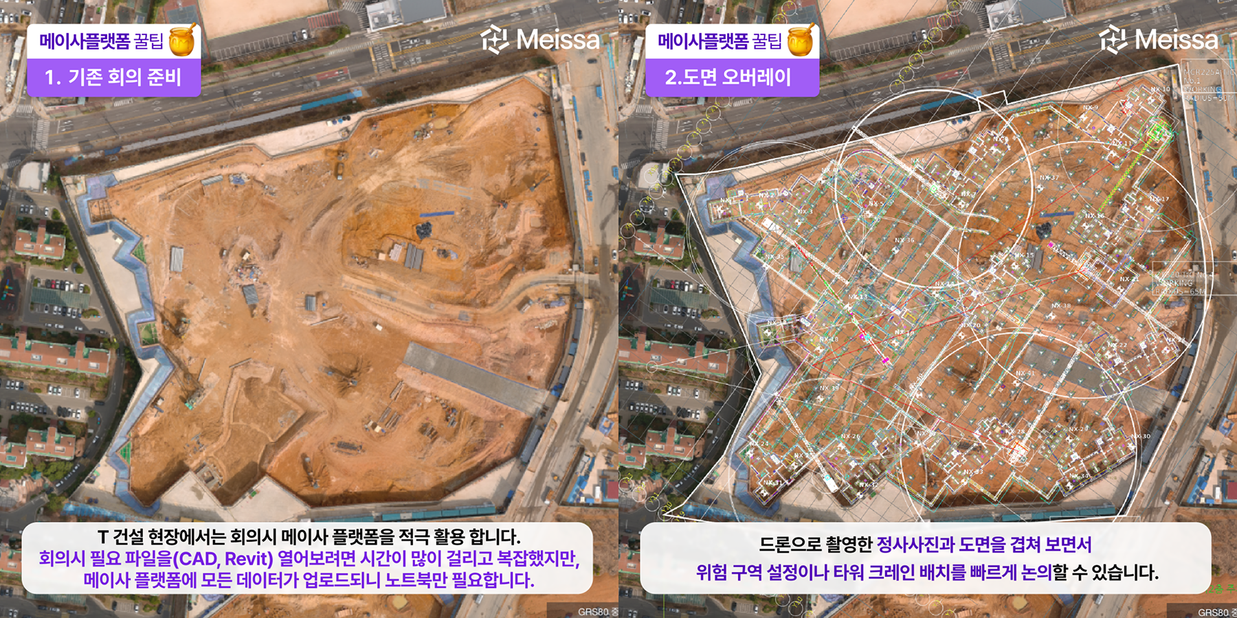
At the T Construction site, the Meissa platform is actively used for meetings.
With the Meissa platform, you can upload the files you need for a meeting and easily review CAD or BIM data alongside the current site conditions.
By overlaying drawings onto orthophotos captured by drone, you can quickly discuss whether construction is being carried out in the correct location, where to designate hazard zones, where to position the tower crane, and more. You can also display 3D point cloud and BIM data together to visually confirm whether construction is progressing as planned.
.png)
At the F Construction site, internal review materials are easily produced using the Meissa platform.
If you want to quickly check and share land boundary information during the site handover process, try the [Location] tool. By entering boundary positions based on coordinate data obtained in the field, you can view the boundaries together with the current site conditions, and export that material as a PDF or Excel file.
.png)
At the G Construction site, Meissa is used to handle public complaints.
As you use Meissa for site management, past data naturally accumulates on the platform. By leveraging this data, you can respond flexibly to unexpected complaints as well, including those concerning road damage.
.png)
The safety team at the G site monitors worker locations through the Meissa platform and the Meissa Guard app to build a safer worksite.
Through the platform, they get a bird's-eye view of the entire site to check the placement of signalers, flaggers, and others, and through Meissa Guard they monitor how on-site personnel are moving.

