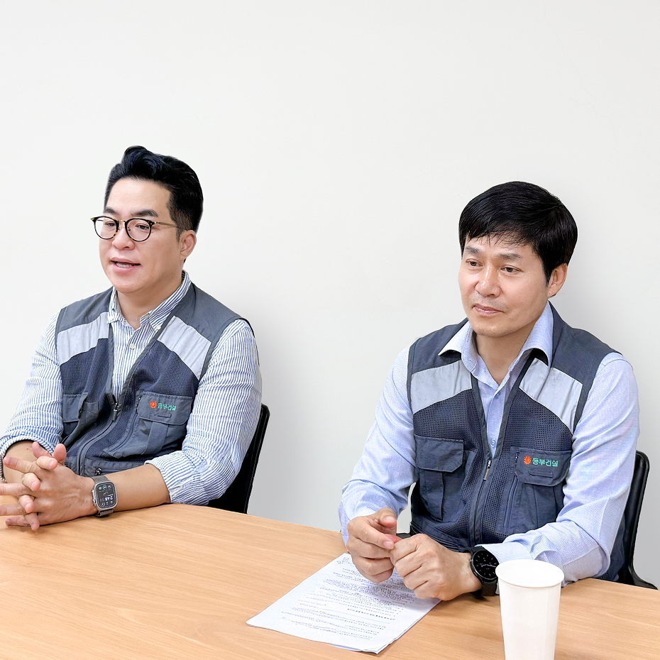
“Dongbu Construction has achieved real-time site management with Meissa.”
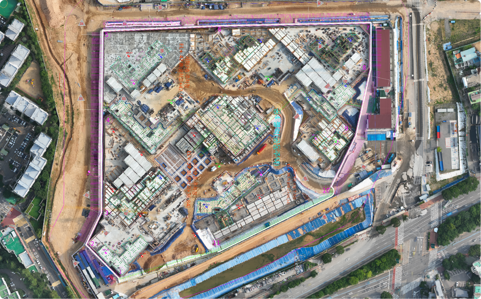
At a large-scale site spanning over 30,000 pyeong, where buildings are spread out and high-altitude work is frequent, a visual tool and systematic record-keeping system are essential to manage both safety and quality.
To address these site conditions, Dongbu Construction adopted Meissa. Through drone patrols, the team swiftly monitors the vast area, identifies potential risks in real time, and tracks progress precisely using time-series data accumulated on the platform.
Discover how Meissa enabled real-time site management at Dongbu Construction’s Cheonan Football Center project.
Technology that compresses time and space
Q. Please introduce your role and the project you are leading.
💬Mr. Lee Chul
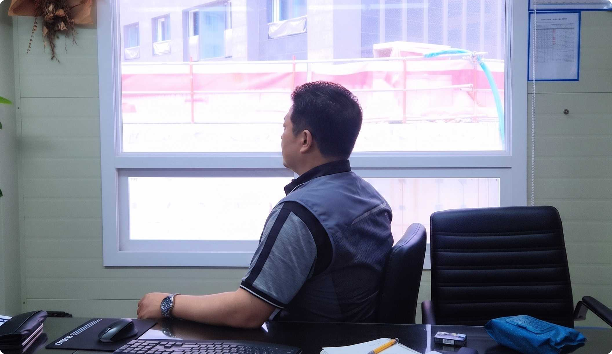
Hello, I’m Lee Chul, the General Manager of Safety and Health at the Cheonan Football Center project. My role in this project is to prioritize safety above all else while ensuring the completion and quality of the facility.
This project goes beyond creating a stable training environment for national athletes—it aims to provide a space where people of all ages, from children to adults, can enjoy football at their own level.
Although I’ve overseen many different sites at Dongbu Construction, building a football stadium has been a rare and personally meaningful experience. I hope this place becomes a special space where many people can gather, enjoy, and create lasting memories together.
Q. What led you to adopt Meissa?
💬 Mr. Lee Chul
In one of my previous projects, the site was vast and located in a special environment where drone flights were completely restricted. The frustration I felt back then was largely resolved here at the Cheonan Football Center site.
There were two main reasons we needed Meissa. First, the sheer scale of the site—it spans nearly 30,000 pyeong. Efficiently managing such a large area requires a tool that can fully leverage drones and drone data.
Second, it was essential to ensure both quality and safety in high-altitude work zones as the structures rose. We needed a solution that could visually confirm worker safety while also verifying construction quality at elevated sections. Meissa fit these two core needs perfectly and proved to be a highly valuable tool for our site operations.

💬 Mr. Kyung-sung Yoon
We felt the need for a better system to manage a large site where workers were dispersed across multiple areas. With three separate buildings located apart from one another, integrated management was challenging. Because so many workers were spread out over a vast area, we needed a platform that could store and utilize drone data for quick, efficient supervision. Using drones, we could instantly identify hazardous activities and, with the speaker-equipped drone, issue immediate on-site instructions. The platform then allowed us to check whether improvements were maintained and how work had progressed over time.
From a quality perspective, Meissa was equally necessary. The Cheonan Football Center buildings are tall and irregularly shaped, with complex high-altitude work zones that require specialized equipment for access. Beyond ensuring safety, verifying construction quality at such heights demanded a safe, elevated vantage point like that provided by drones. We spent considerable time exploring how to make the most of both the drones and the platform to achieve this.
Before using Meissa, we had to send people out to check progress manually—measuring with tapes, taking photos, and cross-referencing with printed drawings. These were extremely time- and labor-intensive tasks. Now, we can simply upload drone-captured imagery to the Meissa Platform, compare it directly with design drawings, perform measurements, and monitor workers’ activities all in one place. It’s a tremendous compression of time and space—what once took an entire day can now be done in just five to ten minutes.
💬 김태훈 대리님 (공사팀)
지금 저희 현장은 전 직원이 메이사를 다룰 줄 알아요. 현황은 보통 2주에 한 번씩 업데이트하고 있고요. 현장이 어떻게 돌아가고 있는지 다 같이 확인하는 소통 창구 같은 느낌이에요.
Safety Management with the Meissa Platform
Q. After adopting Meissa, which features did you use most often?
💬 Mr. Kyung-sung Yoon
We made full use of nearly every feature on the platform, but safety management was our top priority. We monitored worker locations, marked vulnerable groups for closer supervision, and conducted intensive inspections of high-risk zones.
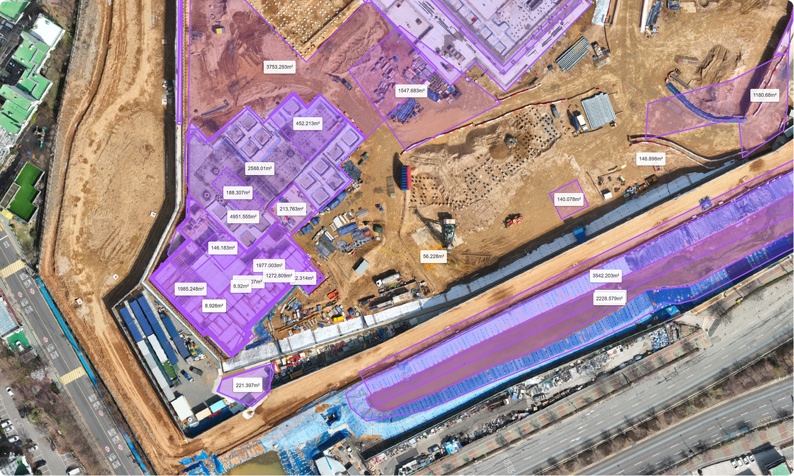
For monitoring, the platform proved highly effective in training partner companies. We used visual data to educate workers on proper material handling and storage. Tools like line and area measurement were also used to calculate quantities—for example, determining the required length of safety railings—and to verify claims for overestimated work quantities.
We also utilized the surface model feature to predict potential flood zones before the rainy season, helping us decide where to relocate equipment and how to adjust the height of electrical panels. The drawing overlay function was another frequently used feature—it allowed us to compare CAD drawings with current site conditions, verify the placement of openings, and identify areas that required additional safety railings.
💬 Mr. Lee Chul
In addition to what Mr. Yoon mentioned, we also used Meissa to verify construction accuracy. Once a building is positioned on the site, it’s crucial to confirm that it aligns precisely with the design coordinates—and Meissa made this process much faster. It was especially useful for cross-checking the exact placement of piles and foundations. Since this project is not only a national training center but also a facility where structural and aesthetic integrity are both vital, ensuring that the heavy roof was perfectly supported was of utmost importance.
We also used the platform to calculate the volume of reinforced concrete (RC). By marking various points to define an area and multiplying by height, we could easily determine the total volume. This proved valuable when reviewing work progress and payment claims. For instance, by comparing the volume completed this month with previous data, we could instantly see the remaining workload at a glance.
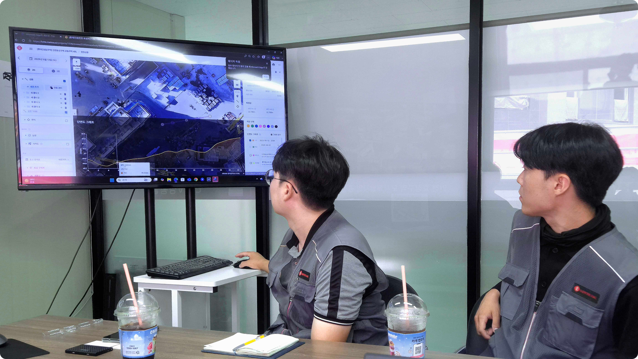
Q. 여러 도면을 메이사에 올려두고 보신 것 같습니다. 이런 도면들은 실무에서 구체적으로 어떻게 활용하셨나요?
💬 Mr. Kyung-sung Yoon
We actively utilized both drones and the MeissaGuard feature for external and internal patrols.
For external patrols, drones and MeissaGuard proved especially effective. With a drone, we could inspect the entire 30,000-pyeong site in less than 15 minutes. During these flights, we monitored for unsafe behaviors such as working during rest hours or not wearing safety belts, and issued immediate correction orders. When heat-related illnesses became a concern, we attached a speaker module to the drone to broadcast messages—announcing work suspensions, enforcing rest breaks, or providing multilingual safety alerts—to prevent potential incidents. For high-altitude operations, drones allowed us to monitor workers in real time, ensuring they were working safely. Over time, workers even became accustomed to these patrols—some would instinctively show their safety gear to the drone when they noticed it flying nearby.
Using MeissaGuard, we also tracked worker movement. Because workers were scattered across a large site, it was difficult to monitor each individual’s location and activities. Through MeissaGuard, we could easily check whether anyone entered restricted zones or failed to vacate the site during break times. Interestingly, this system even helped us detect an issue where a signalman was repeatedly leaving his station during work hours in a heavy-equipment zone—allowing us to take immediate corrective action to maintain site safety.
💬 김태훈 대리님 (공사팀)
소장님 말씀처럼, 실제로 파일 도면을 맵에 올려두고 드론 현황과 비교해 보니 위치를 이상하게 벗어난 부분들이 한눈에 띄더라고요. 현장에 직접 나가서 측기로 다시 재봤더니 실제로 기준치 이상 위치가 벗어난 것들이 있어서 서둘러 바로잡았었죠.
💬 박정훈 사원님 (기계팀)
저 같은 경우는 도면 자체를 활용했다기보다는 참고해서 도면 바깥으로 빠지는 배수 펌프나 가설 배관의 길이 잴 때 잘 활용했습니다. 설계 도면에는 딱 현장 부지 내부만 표현되어 있거든요. 그런데 현장 경계 바깥으로 빼내야 하는 배관이나 펌프는 도면에 없으니 길이를 알기 어렵습니다. 그래서 정사사진 위에 우수배관도를 올려놓고, 자재를 청구하기 전에 현장 상황을 보며 실제 배관이 나갈 경로를 화면에 그어봤습니다. 그렇게 대략적인 길이를 미리 뽑아보고 여유 있게 자재를 주문해서 설치하는 식으로 사용한 경험이 있네요.
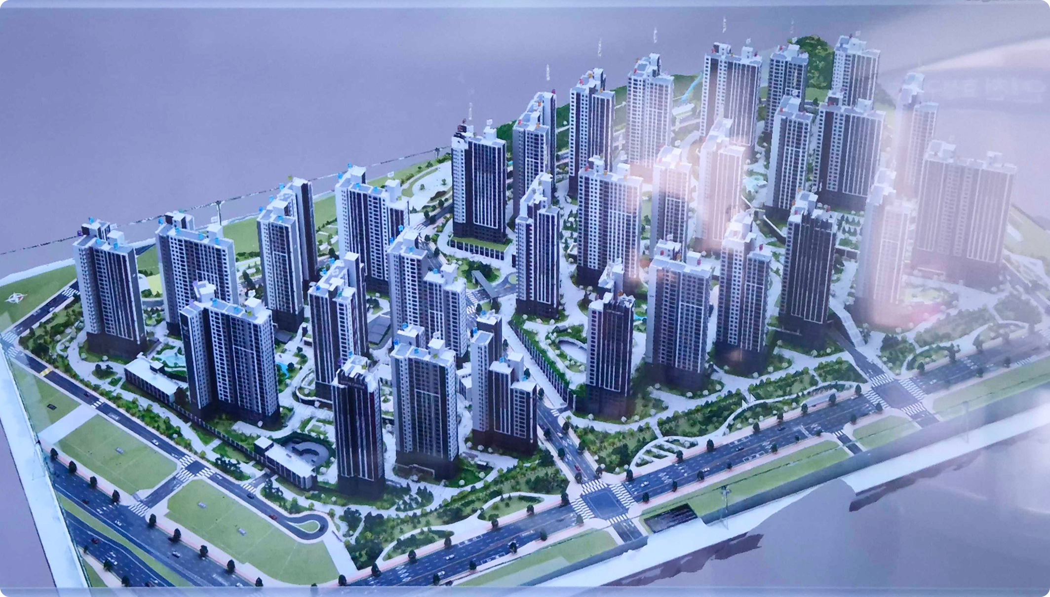
Q. ‘현황’ 뿐만이 아닌, 완공 후의 '단지 조감 모형'도 3D로 올려보시는게 흥미롭습니다. 어떤 이유에서인가요?
💬 박규영 현장소장님
보통 실물 단지 모형은 덩치가 커서 현장 사무실에 마땅히 둘 데가 없습니다. 자리 차지도 많고요. 그런데 이걸 3D로 촬영해서 플랫폼에 올려두니까, 주간 회의할 때 참 편하더라고요.
진행 중인 '현재'의 현황은 메이사 전경으로 파악하고, 계획된 '미래'의 모습은 이 3D 모델로 보고 있습니다. "이쪽 도로는 형상이 어떻게 빠지기로 했지?", "도로 쪽 조경석 마운딩이나 단지 안의 고저차가 설계상 어떻게 계획됐더라?" 하고 2D 평면 도면만으로는 감이 잘 안 오는 단지 모습을 실시간으로 돌려보며 사전 회의를 정말 많이 합니다.
나중에 준공하고 나서 모델하우스랑 다르다는 민원이 들어올 때를 대비해 기록으로 남겨두려는 목적도 있었지만, 실무적으로는 한 플랫폼 안에서 현장의 처음과 끝을 다 확인할 수 있다는 게 큽니다. 솔직히 처음엔 이렇게 다방면으로 쓸 수 있을 줄 몰랐는데, 아주 요긴하게 잘 쓰고 있습니다.
Sharing Information, Aligning Perspectives
Q. You mentioned that Meissa was particularly helpful during progress meetings. Could you elaborate on that?
💬 Mr. Kyung-sung Yoon
What stood out most was how smoothly our progress meetings went. Subcontractors joined the site in sequence—from structural to finishing works—and new supervisors often had little knowledge of the site conditions. Normally, we would need to escort them around and explain, “This part is like this, that area is like that.” But in reality, everyone is busy, and workers are actively operating on site, so such thorough walkthroughs are rarely possible. As a result, some supervisors occasionally misunderstood the site situation or made assumptions that weren’t accurate.
In those moments, we opened Meissa to show the actual site conditions in real time. We could explain, “Given the current state, it’s difficult to proceed as planned, so we need to find another approach,” or display precise measurements to say, “This section doesn’t have enough space for the materials you mentioned—your proposed method may not work.” This visual clarity made discussions much more productive.
For example, some supervisors insisted on bringing in equipment to move materials through a basement window opening, assuming it would fit. But Meissa’s measurements clearly showed that the space was too narrow. These are things you can’t confirm just by looking at drawings—you need to see the actual conditions. If equipment had already been ordered and used forcefully just to avoid waste, it could have caused an accident. Having that visual proof allowed us to reach agreements safely and rationally.
When you argue verbally, it often leads to conflict—but when you show the numbers, everyone agrees. That’s why using Meissa during meetings helped us avoid unnecessary work and keep discussions calm and solution-oriented.
💬 김태훈 대리님 (공사팀)
토공 정산뿐만 아니라, 골조 쪽 기초 타설을 할 때도 활용도가 높습니다. 도면대로만 예쁘게 파지는 게 아니라 필연적으로 과굴착이 생기기 마련이거든요. 예전 같으면 과굴착을 감안해서 다시 도면화를 하거나 할증을 더 얹어서 물량을 산출해야 했습니다. 하지만 메이사를 쓴 뒤로는, 누름타설이나 버림타설처럼 정형화되지 않은 면적이라도 현장에서 급할 때 면적 도구로 쓱 찍어보면 대략적인 수량이 바로 나오니까 실질적 물량 파악에 도움이 많이 돼요. 실제로 나중에 실타설 물량과 비교해 보니 산출 오차가 꽤 정확하게 들어오더라구요.
💬 Mr. Kyung-sung Yoon
I believe productive meetings only happen when everyone shares the same understanding of the facts. In that sense, Meissa played a significant role in aligning perspectives across the entire team.
Dongbu Construction and Meissa: Building the Future of Smart Construction Together
Q. What future developments do you hope to see from Meissa?
💬 Mr. Lee Chul
We mainly use the 3D view during progress meetings and risk assessments. When relying only on 2D images, it’s often difficult to tell whether a covered area is a roof or a floor. That’s why I hope to see improvements in the 3D rendering speed and image clarity. It would also be great if measurement tools could function as smoothly in 3D as they do in 2D. For example, when reviewing the site in 3D, if I notice a missing guardrail, I’d like to measure its height or width right away within that same view.
I believe this need extends beyond us to inspectors from the Ministry of Labor as well. They have countless sites to inspect but can’t visit each one in person. If they could deploy drones to check whether safety installations meet regulations—and verify those details directly in 3D without setting foot on-site—it would provide tremendous value and efficiency.
💬 Mr. Kyung-sung Yoon
Site management may have started with drones, but I believe the real competition will ultimately center on platforms. Drones were just the first step; in the future, I expect platforms will integrate various technologies—from wearable devices to tower crane CCTVs and more.
It’s similar to how food delivery evolved: we once searched through local flyers, but now we simply open a platform and browse from a list of nearby restaurants. Platforms have boundless potential. Likewise, I envision Meissa evolving into a comprehensive ecosystem—one that not only connects multiple on-site devices but also incorporates functions such as verifying completion of safety training or tracking specific certifications. The possibilities are endless, and I look forward to seeing how Meissa continues to grow.