
Managing sites with drone platforms – does it really work? If you've ever considered implementing one, you've probably wondered, "Do we really need this for a site that's already running smoothly?"
To put it simply, yes, it's effective. But it's not just about a single drone flight; rather, the greater the data accumulation, the greater the impact.The key to understanding this is simple: construction site management is ultimately about 'operations driven by spatial data.' Design, construction, and earthwork calculations all occur within a spatial context, so site management is most accurate when based on spatial data. Drones are the fastest and most precise tools for acquiring that data.
In this article, we'll explore the real-world impact of drone solutions like Meisa, focusing on three key aspects: cost, time, and reliability.

%201.png)
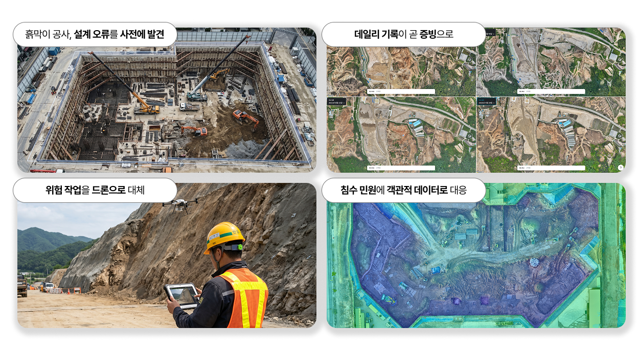
On civil engineering sites, the prime contractor conducts surveys, and then subcontractors perform them again. This results in duplicated time and costs for the same task. By utilizing drones, instead of multiple surveys for the prime contractor, subcontractors, supervisors, and client submissions, a single, standardized dataset can be used. With drone data, Calculate earthwork volumeManaging changes in earthwork volume as 3D spatial data clarifies communication between companies, as everyone operates on the same standard.
This value is evident in day-to-day operations, but it becomes even more significant during unexpected situations. When managing multiple sites, unforeseen issues are bound to occur at one or two locations. For a contractor, a single issue can be the decisive factor that determines a project's profitability. The crucial point is, the data needed at that moment cannot be created on the spot. Only data consistently accumulated beforehand can serve as a reliable standard. Therefore, cost-effectiveness is not only evident for each individual site but also significantly apparent from the perspective of overall risk management for the entire company.
%201.png)
Even for the same issue, people often have different perspectives. When someone says, "there's a problem in section A," some might focus on the details while others look at the bigger picture. This often leads to a repetitive cycle of site visits for verification, meetings, and reporting.
Using drone data shortens this process. Since everyone plans and makes decisions based on the same visual information, accurate and swift decisions can be made for any designated section. The larger the site and the further the civil engineering project is from the office, the more significantly you will appreciate the value of reducing travel time.
%201.png)
Construction projects can span one, two, or even three years. Relying solely on photos and memory means undocumented sections will be lost first, and memories will naturally fade over time. Recording with drone spatial data, however, the site's appearance at a specific point in time remains intact, enabling objective explanations and verification. A site, once passed, cannot be revisited, so records themselves become an asset just by being accumulated. Furthermore, if all data is stored in the cloud, its utilization becomes even easier. There's no need to go to an office computer to find data; you can immediately check and verify it on the spot, whether on a mobile phone or a field tablet.
While it might sound vague when only described, its effectiveness becomes much clearer in real-world applications.
The commonality among these four cases is clear. That the consistently accumulated spatial data served as an operational standard in normal times and as the most reliable evidence in critical moments.
Recent industry trends further emphasize this perspective. The Construction & Economy Research Institute of Korea (CERIK) noted that as the focus of AI competition shifts from 'algorithms' to 'data', the data generated daily at construction sites should be viewed not merely as a byproduct, but as a core asset that will determine future competitiveness,they emphasized. They pointed out that much of the field data is only used for verification when accidents or disputes occur, failing to accumulate into greater value. The institute suggested that an efficient way to secure high-quality data is to "create a structure where data naturally accumulates during the course of work, rather than incurring separate collection costs."
And the conclusion is clear: "In the age of AI, the competitiveness of the construction industry depends less on how much equipment it possesses, and more on how much high-quality field data it acquires and utilizes."Spatial data created by drones is precisely that asset. Beyond preventing a single issue, accumulating every moment of a site as objective data quickly becomes a company's competitive edge.
The value of drone solutions is realized not in a single capture, but in consistent accumulation. Ultimately, The more effectively data is accumulated on-site, the clearer the benefits will be.
That's why Maysa doesn't just stop at providing drone data. We automate data collection with unmanned drone stationsand make ground control point (GCP) work easy with RTK,thereby creating a system where data naturally accumulates during the work process without additional burden. Furthermore, we establish an environment where communication and decisions are made based on spatial data, helping to ensure the solution is truly 'operational' on-site. Even after implementation, a dedicated account manager continues to provide regular training and on-site inspections, working alongside you.
The experience of those who have overseen sites for 20-30 years is invaluable. When that experience is combined with daily accumulated spatial data and AI, and organized into objective evidence, on-site decision-making will become even more robust.
If you're curious about how to accumulate your site's data as an asset, please contact us anytime via the inquiry button. Maysa will help manage the variables on your site.
📺 This article has been restructured based on 'The Utility Value of Drone Solutions in Construction Sites'. If you'd like to know more details, the presentation videohere.

