


Hello, this is Meissa, the spatial information platform.
If this is your first time encountering a drone-based spatial information platform, you may wonder, "How can this platform actually help on a construction site?"
To answer that question, we have gathered practical Meissa tips that are already being applied in the field. Take a quick look at the platform's diverse features and real-world use cases!

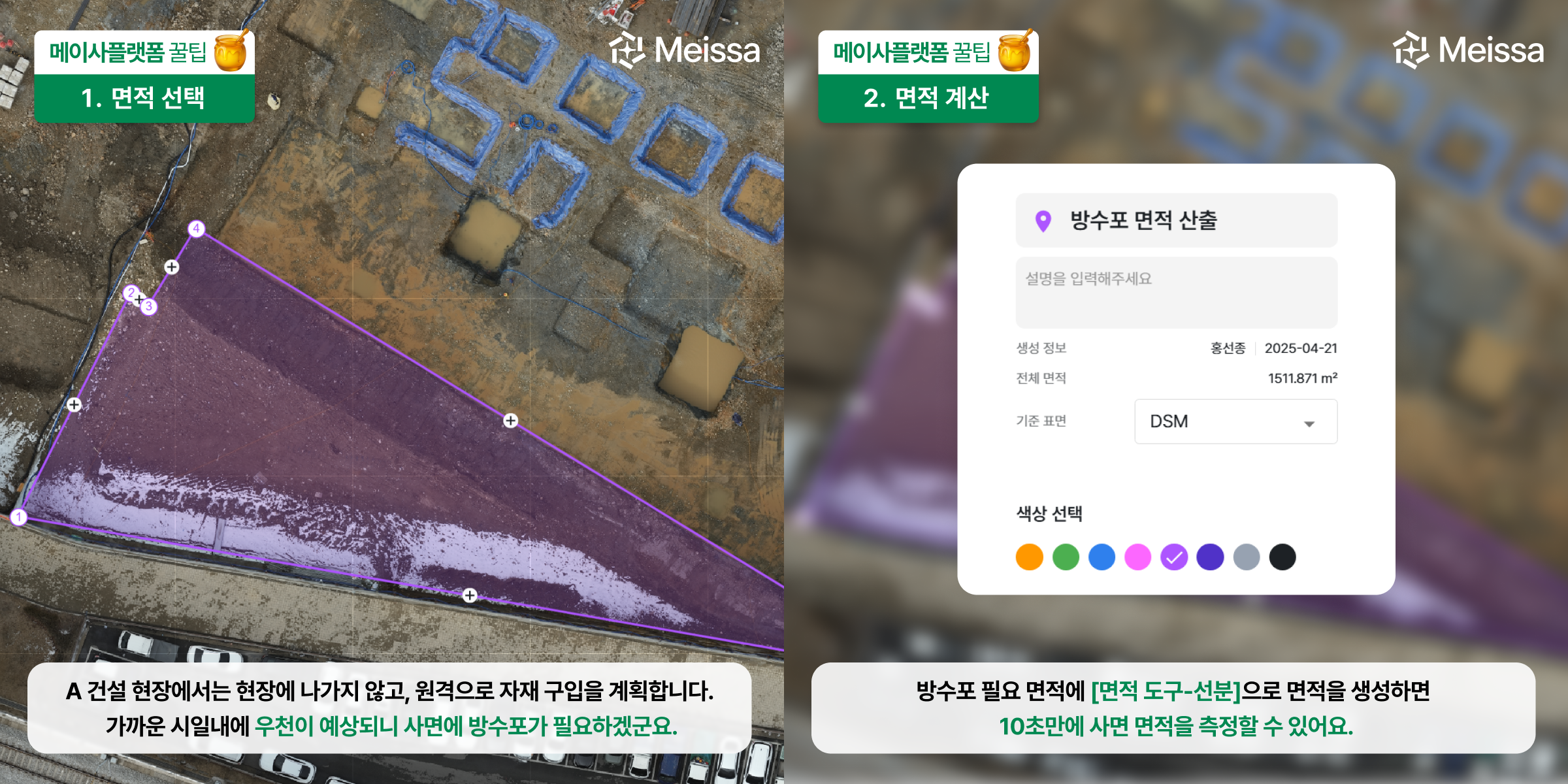
At Construction Site A, they plan material purchases remotely, without going out to the site.
[Area Tool – Line] Using this feature to draw the area where a waterproof sheet is needed automatically calculates the area based on the DSM. Even uneven slopes can be measured precisely, enabling smooth material procurement planning.
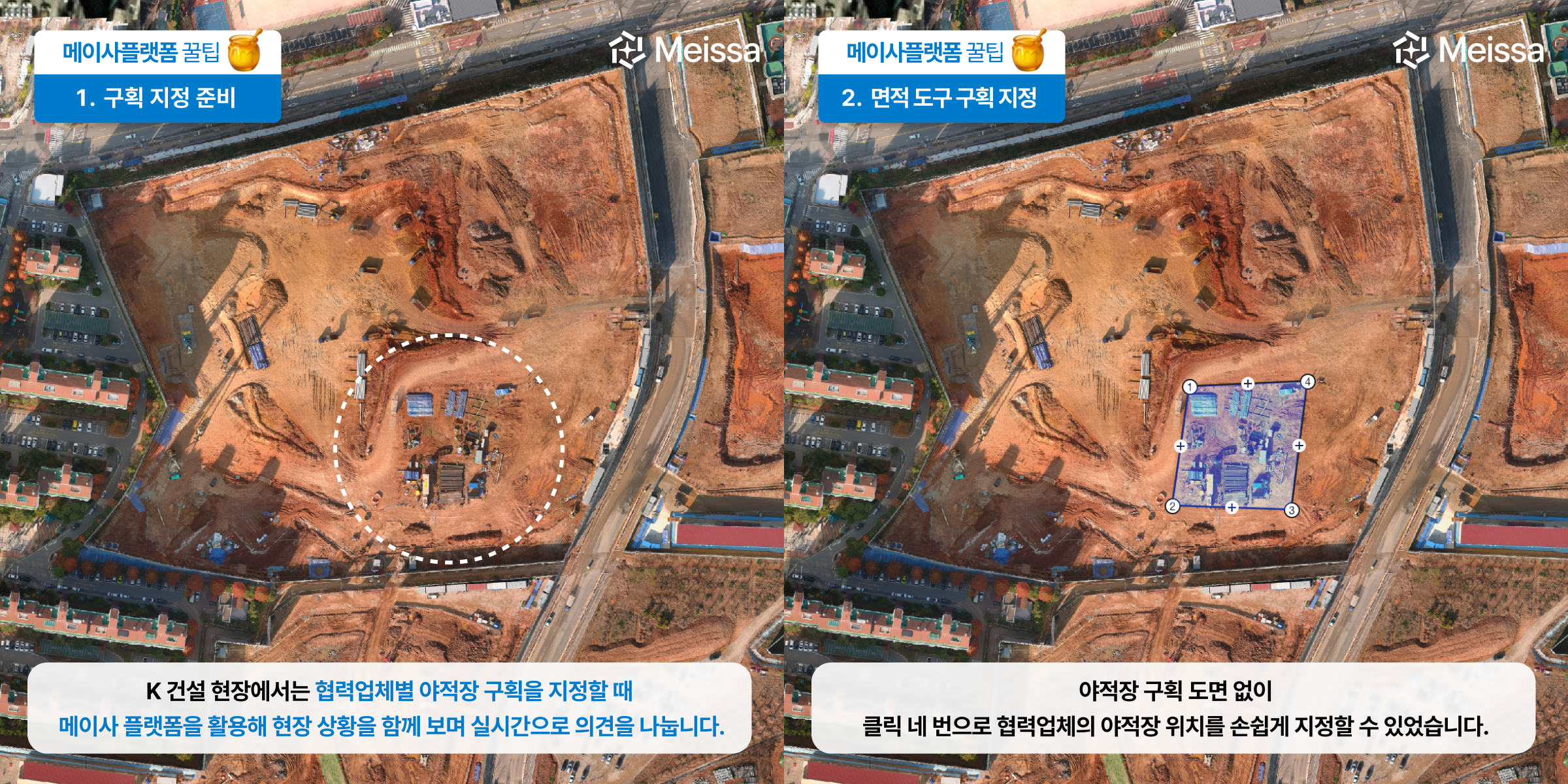
At Construction Site K, when assigning storage yard sections to each subcontractor, they use the Meissa platform to view the site situation together and exchange opinions in real time.
The at-a-glance view of the site enables intuitive discussion among subcontractors. When a request comes in for the area each company needs, you can use the [Area Tool] to calculate it instantly and check whether the assigned storage yard is adequate.
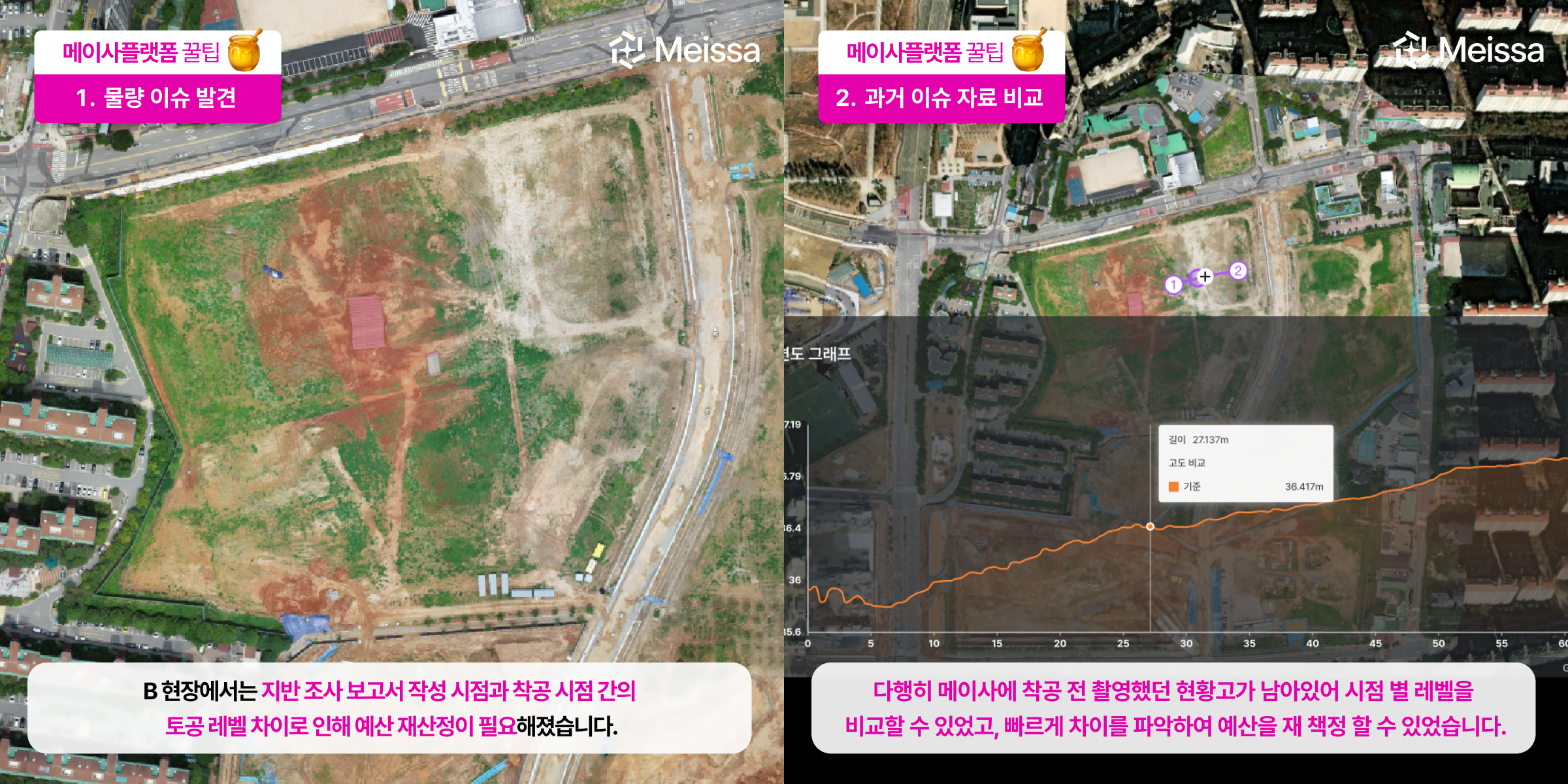
On the Meissa platform, capture data remains for each point in time, so you can respond with data even to issues you did not anticipate in the past.
At Site B, a difference in earthwork levels between when the ground survey report was written and the time of groundbreaking required a budget recalculation. Because the pre-groundbreaking existing elevation remained on the Meissa platform, levels were compared across each point in time. The comparison results were used as supporting evidence for the necessary budget recalculation.
[Note] To accurately assess volumes before groundbreaking, the GCPs inside and outside the site must be properly installed according to Meissa's guide before capturing.
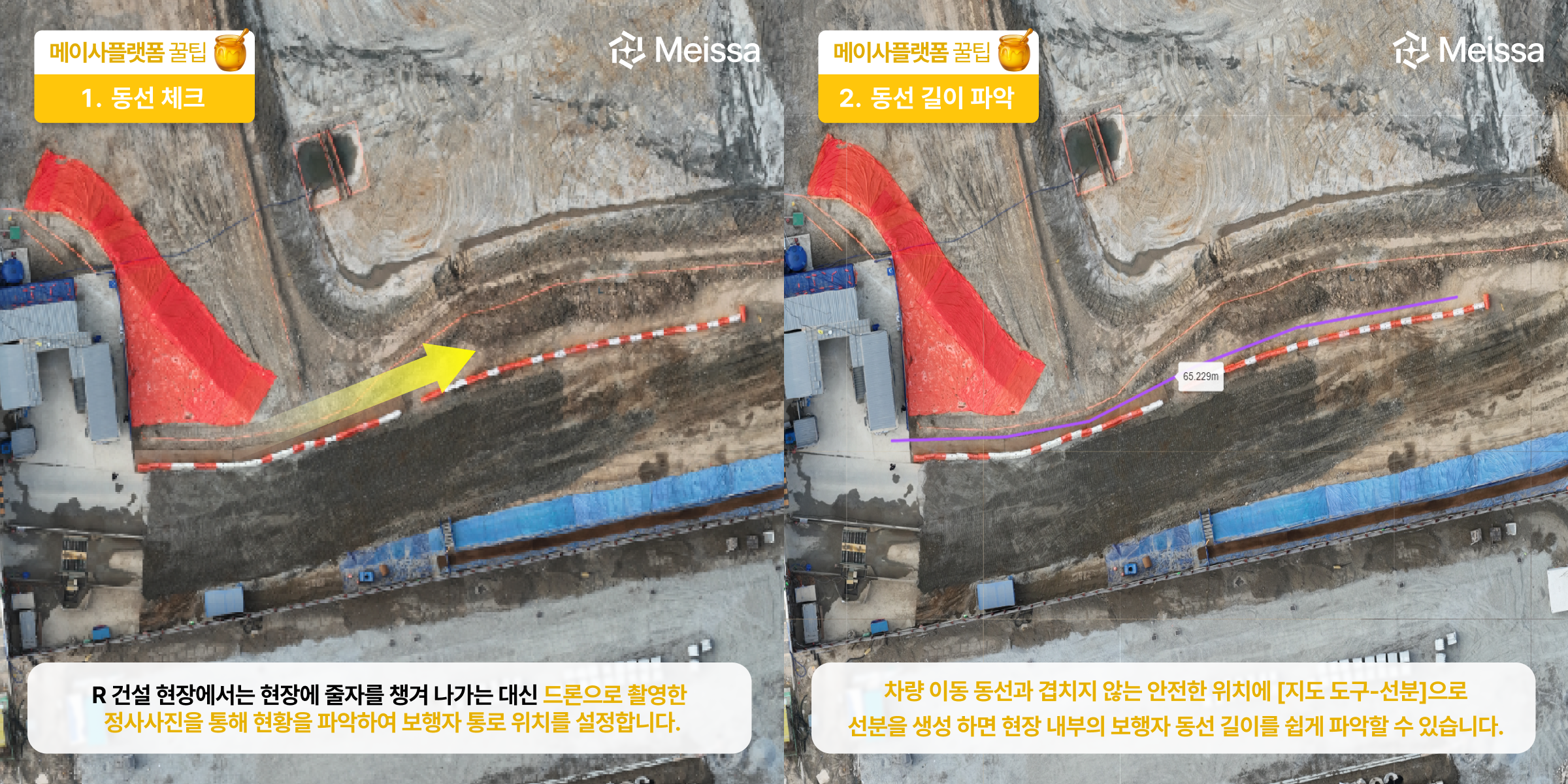
At Construction Site R, they use the Meissa platform to check current conditions and plan pedestrian routes without going out to the site.
By using the [Area Tool – Line] feature to create a line at a safe location that does not overlap with vehicle routes, you can check whether a sufficient safety distance between people and vehicles is secured, including the length of the pedestrian route inside the site. In addition, through surface distance measurement, the administration team can more accurately estimate the order quantity of super cones.

