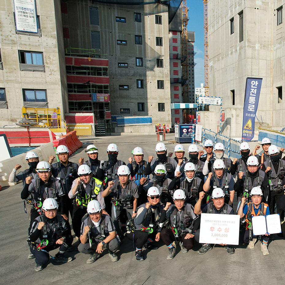
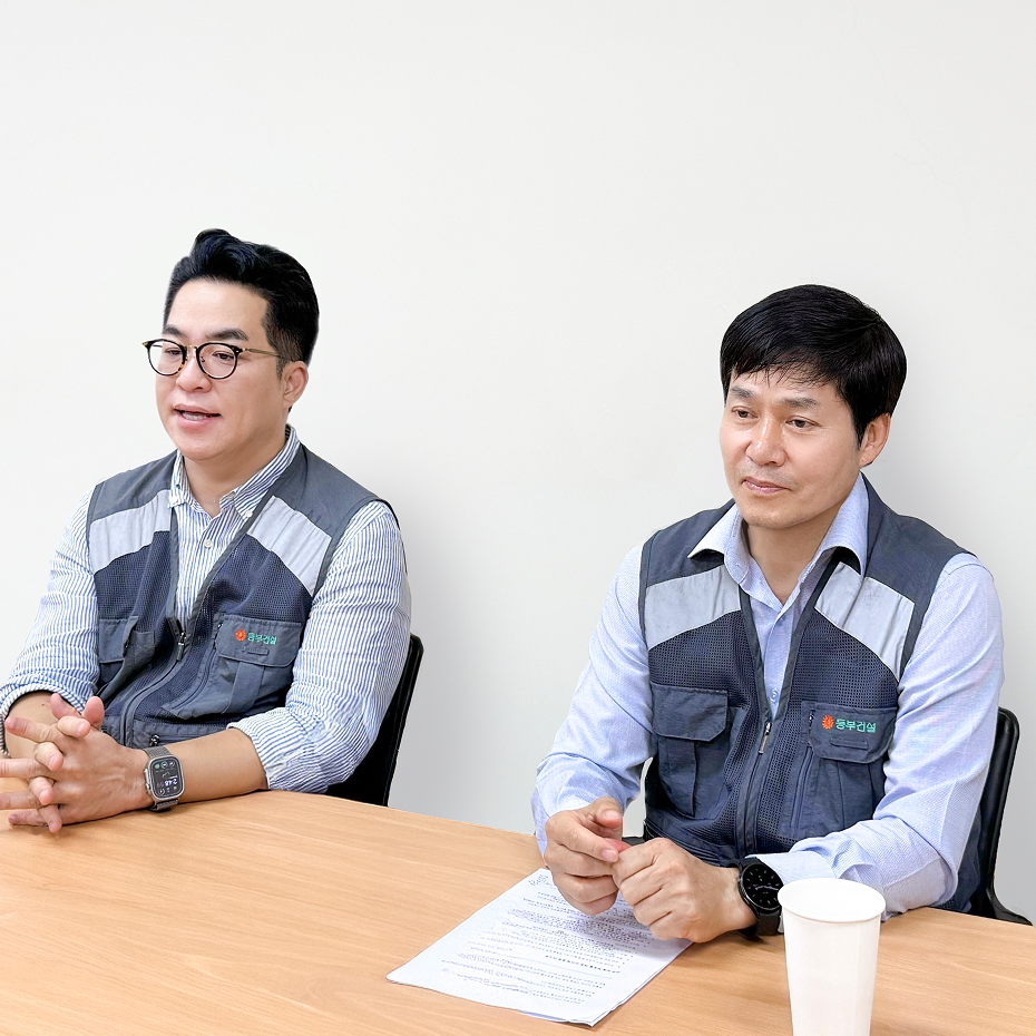
“With Meissa, Lotte E&C coordinates today's complex workflows and previews tomorrow's completed complexes.”
On large-scale, complex residential sites with significant elevation differences, accurate tracking and workflow coordination determine project success. Lotte E&C adopted Meissa to overcome the limitations of 2D drawings, streamline subcontractor cost settlements, and efficiently manage everything from safety to site control.
Check out our interview from Lotte E&C's Incheon Hyoseong District Residential 4BL site to see how Meissa became a vital tool for team communication and site management.
Q. Could you briefly introduce your site?
💬 Park Gyu-young, Site Manager
"Hello, I am Park Gyu-young, the Site Manager for the Incheon Hyoseong District Residential 4BL project. We began in September 2024 and are now entering the final stages of construction.
When I took over this site in 2024, my biggest challenge was finding a smart way to monitor a complex project at a glance. After hearing about the success of using Meissa at our Cheonan site, I worked with our R&D institute to implement it here.
We started using the platform during the initial excavation phase. It was incredibly useful for pinpointing earth retention and earth anchor locations by interacting with the 3D models. Experiencing that practical value early on is why we still rely heavily on Meissa today for site monitoring and subcontractor coordination as we wrap up construction."
💬 Mr. Kim Tae-hoon (Construction Team)
Every employee on our site knows how to use Meissa. We typically update the site data every two weeks. It truly serves as a unified communication hub where everyone can easily check how the site is progressing.
오가야 하는 현장에서, 수시로 들여다보는 현장으로
Q. 메이사를 도입하고 가장 크게 달라진 점이 궁금합니다.
💬 이재석 공사과장님
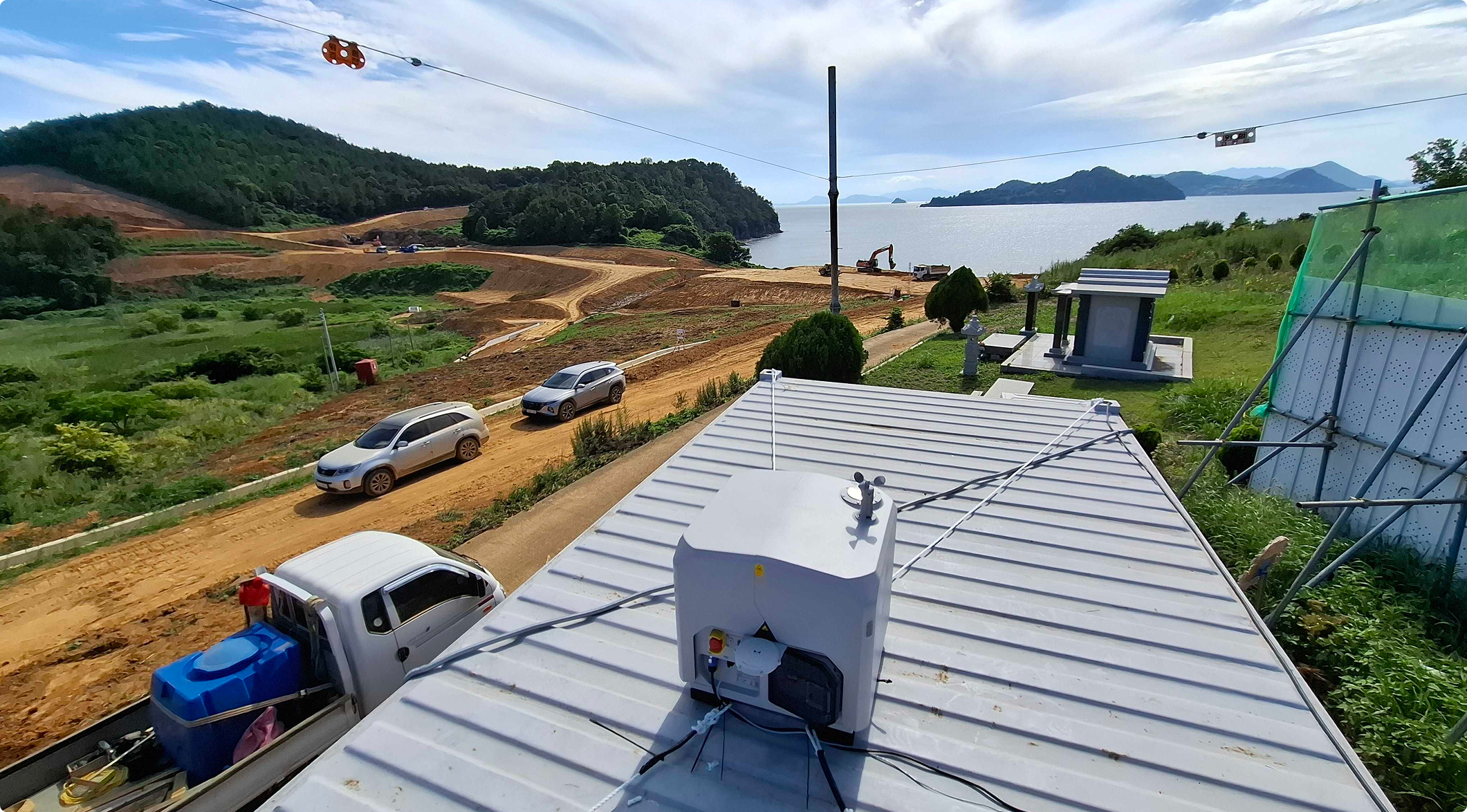
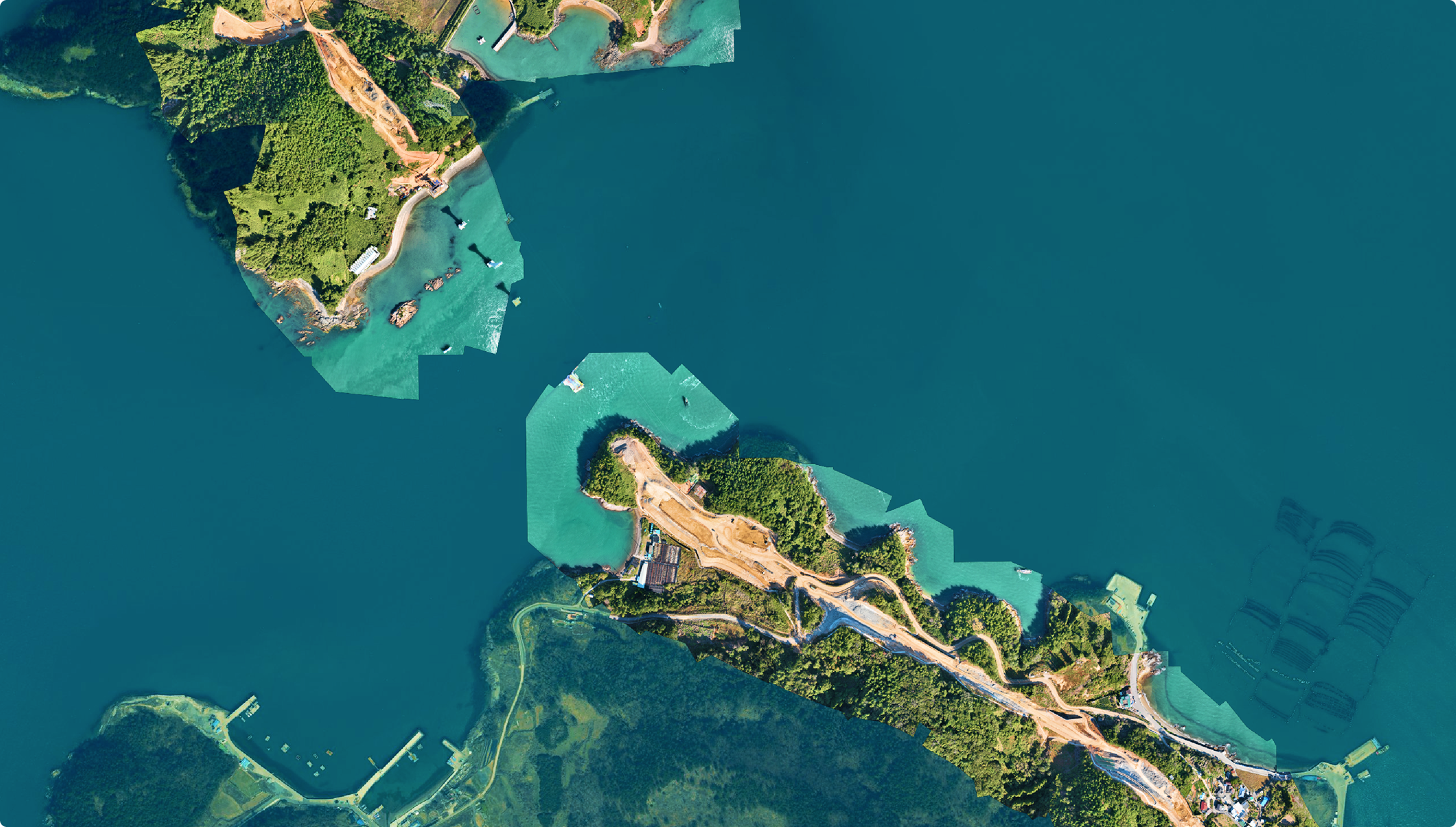
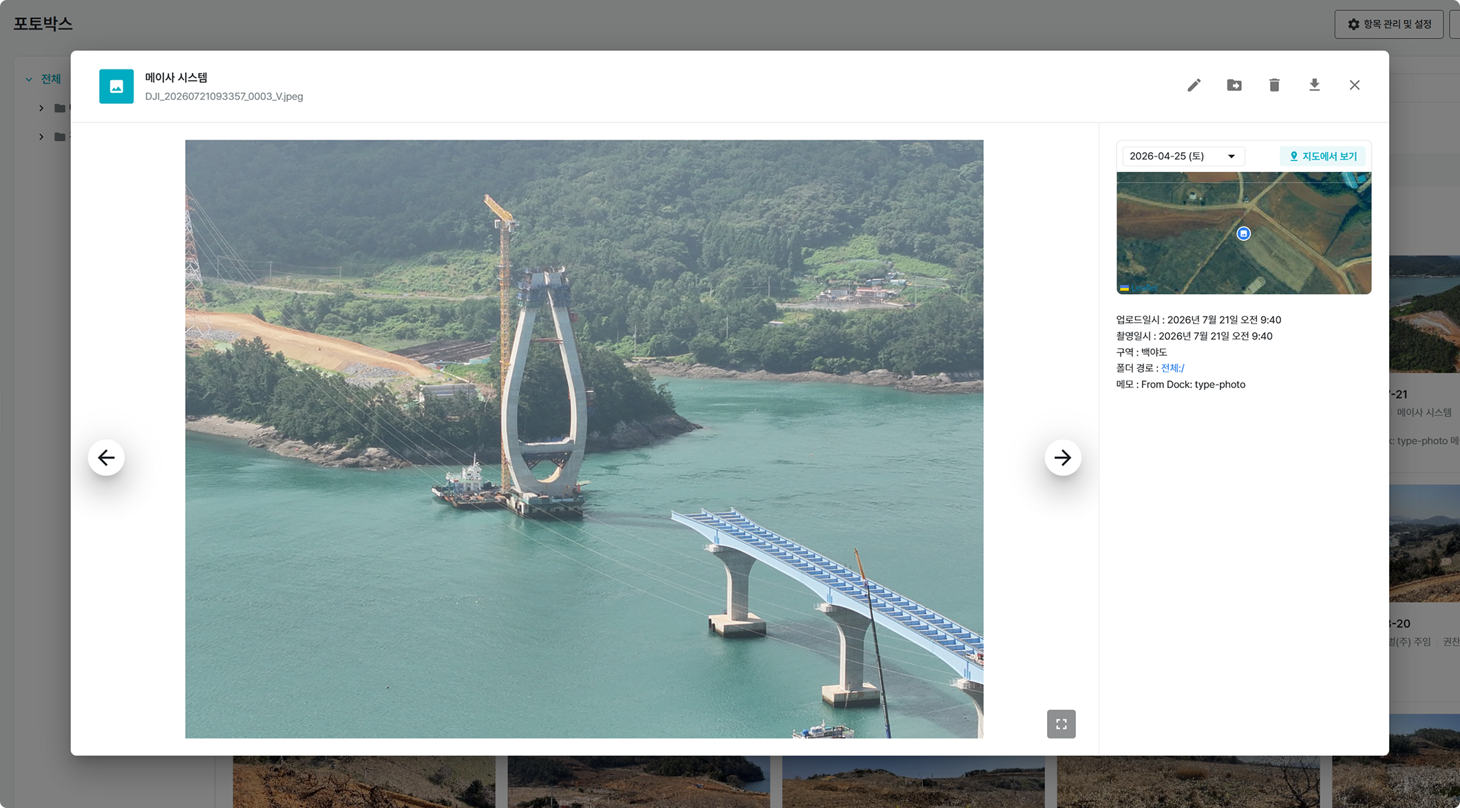
가장 크게 달라진 건, 이제 현장에 직접 나가지 않고도 수시로 현장을 들여다볼 수 있다는 점입니다. 저희가 해상 섬 공사라, 원래는 현장 한 번 보러 나가는 게 여간 일이 아니거든요. 통통배를 서너 대 운영하는데, 나가는 데 20분, 들어오는 데 20분, 현장 둘러보는 시간까지 하면 한 번 다녀오는 데 기본 한 시간 반에서 두 시간은 그냥 빠져요. 한창 작업하는 중에 한 번 나갔다 오면 반나절이 훅 가는 거죠.
그러니 깊이 봐야 하는 일이야 직접 나가지만, '업체가 마무리 잘 하고 나갔나' 정도 확인하자고 매번 배를 타긴 어렵거든요. 지금은 그럴 때 드론을 바로 띄웁니다. 사무실에서 쭉 훑어보고 "여기 아직 안 됐네, 다시 정리하고 나오시라"고 바로 전화하죠. 예전 같으면 그거 하나 보겠다고 또 배를 탔을 텐데, 이제는 몇 분이면 끝나니까요.
그렇게 오가던 시간이 줄어드니 그 시간에 다른 일을 챙길 수 있고, 확인하는 횟수도 부쩍 늘어서 하루에 서너 번은 드론을 띄웁니다. 특히 월요일 아침이면 주말 사이 무너지거나 변한 곳은 없는지, 사건·사고는 없었는지 드론으로 현장 전체를 쭉 훑어보고 나서 그날 업무를 시작하는데, 이게 어느새 하나의 습관처럼 자리 잡았습니다.
💬 권찬 공무주임님
저한테 가장 크게 와닿는 건 현황과 관련한 자료를 만드는 시간이 확 줄었다는 점이에요. 공무팀은 발주처에 낼 자료를 만들 일이 참 많은데, 보고서에 활용할 자료를 얻기가 빠르고 쉬워졌거든요.
한 달에 한 번씩 시점부터 종점까지 전 구간을 영상으로 찍어 발주처에 진행 상황을 공유드리는데요. 드론 스테이션을 들이기 전엔 조종형 드론으로 사람이 직접 날려야 해서 손이 많이 갔어요. 비행 거리가 짧다 보니 섬과 섬을 넘는 사이 연결이 끊기기도 하고, 배터리도 서너 개씩 챙겨야 했고요. 그런데 지금은 사무실에서 항로만 걸어두면 드론이 알아서 전 구간을 찍고 스스로 충전까지 하니, 사람이 계속 붙어 있을 필요가 없어졌습니다. 화질도 훨씬 좋아졌고요.
Q. 수시로 드론을 띄우게 되면서, 팀이 현장을 확인하고 소통하는 방식에도 변화가 있었을 것 같습니다.
💬 이재석 공사과장님
처음에는 교육받은 드론 담당 주임만 드론을 다뤘어요. 그러다 보니 "이것 좀 찍어봐라" 하는 요청이 그 친구한테만 몰려 부담이 컸죠. 지금은 사무실 각 팀 담당자가 모두 이륙부터 촬영, 복귀까지 다룰 줄 압니다. 현장을 각 팀에서 워낙 자주 들여다보다 보니, 저희끼리 드론 비행 시작을 알리는 단체 채팅방까지 생겼어요. 비행 중에는 여러 명이 동시에 접속할 수 없다 보니, 누군가 "지금 비행 시작합니다" 하고 올리면 나머지는 순서를 기다리는 식입니다. 그만큼 여러 팀이 활발하게 현장을 본다는 얘기죠.
정기 정사사진은 주 1회 매핑하도록 스케줄을 걸어두고, 그 밖의 현황은 필요할 때마다 수시로 촬영합니다. 팀마다 보는 관점도 달라서, 공사팀은 시공 상태와 위험 요소를, 안전팀은 근로자를, 품질팀은 품질을 봅니다. 같은 데이터를 두고 각자 필요한 걸 챙겨 보는 거죠.
소장님과의 회의에서도, 논의하다 서로 파악한 내용이 다를 때면 소장실 TV로 메이사 플랫폼을 바로 띄워 현황을 확인합니다. 예컨대 물이 모이는 지점과 배수 구조물 위치가 어긋나 있으면 화면을 함께 보며 "여기는 조정하자"고 그 자리에서 정리가 되고요. 말로 오갈 때보다 훨씬 빠르고 오해 없이 명확합니다.
Resolving Current Workflows, Shaping the Future
Q. How are you using Meissa for workflow coordination and task delegation on such a complex, multi-level site?
💬 Mr. Kim Tae-hoon (Construction Team)
Because our site has significant elevation differences, work sequences can easily get tangled. It used to be a struggle to explain this verbally, but now we pull up Meissa on a tablet during subcontractor meetings.
We coordinate intuitively by looking at the screen: 'This is the pump car area, and that’s the crane radius, so let’s split the work into AM and PM to avoid clashes,' or 'Waterproofing starts here, so please clear the materials.' We even measure pouring distances directly on the platform to check equipment reach before finalizing our plans.
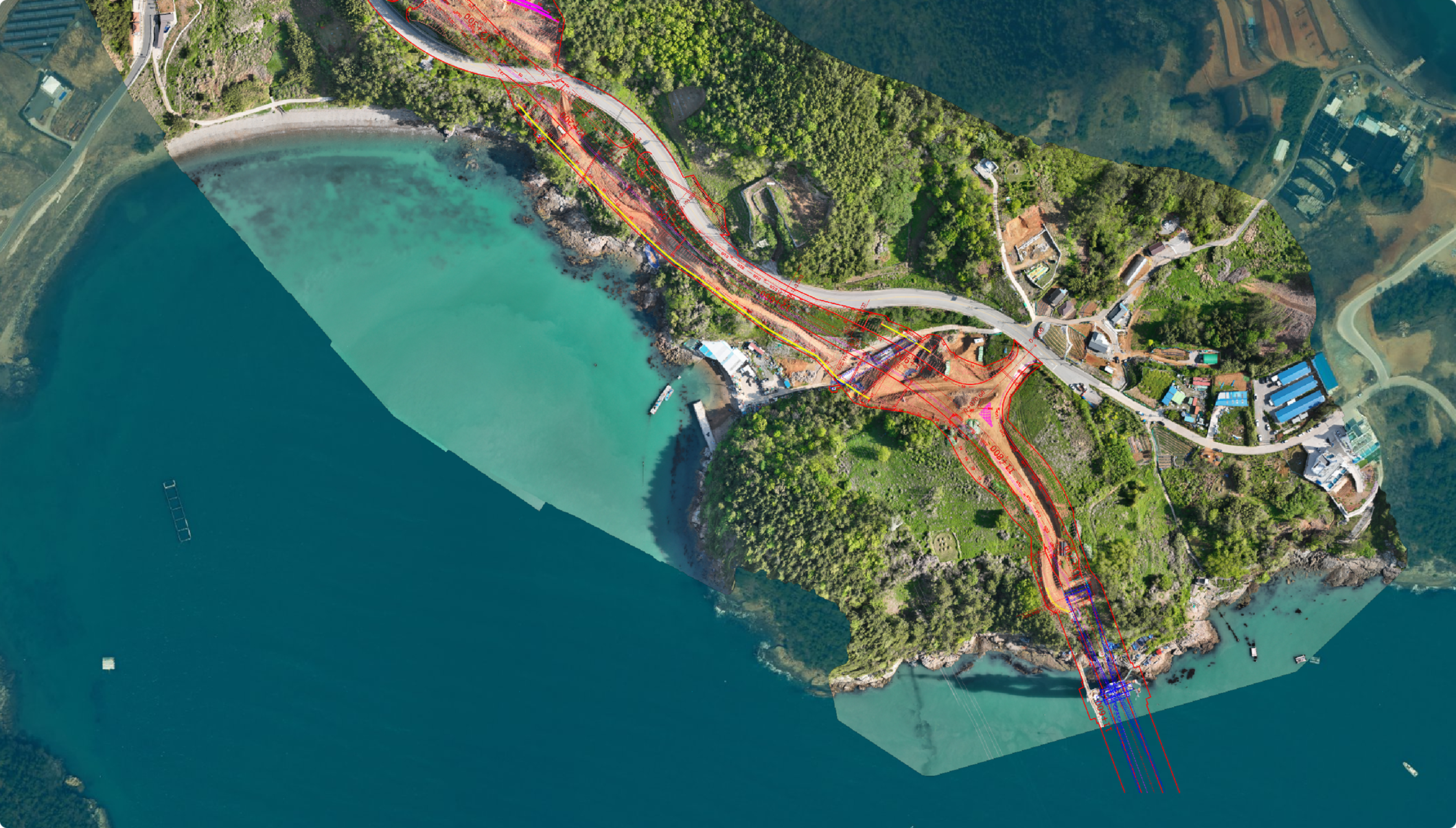
Similarly, I use it for task delegation. I can't memorize every location for safety fences or zoning nets, so I quickly check Meissa from the office.
For example, if a safety fence needs to be dismantled to move materials, I just take a screenshot from Meissa and point out the exact section. I could walk out to the site and take a photo myself, but this method drastically cuts down on physical travel time and ensures immediate understanding.
Q. It seems you have overlaid various drawings on Meissa. How exactly were these blueprints utilized in practice?
💬 Mr. Park Gyu-young (Site Manager)
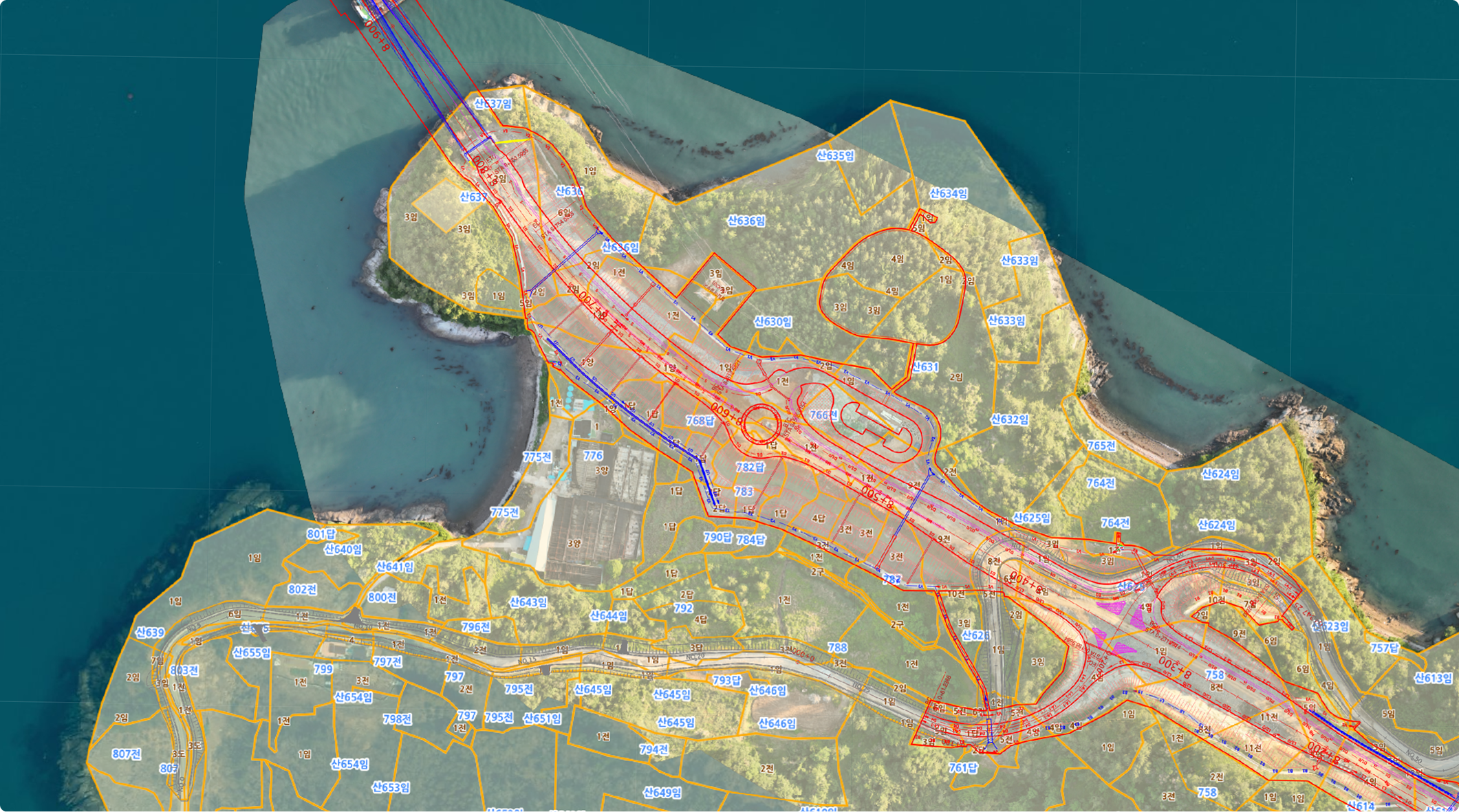
The design overlay feature is exceptionally useful. We relied on it heavily to verify the positioning of temporary structures, underground facilities, precast concrete (PC), and basement columns.
It was particularly valuable during PHC piling work, as it displays exact pile locations. If we notice any deviation on the screen, we can immediately call the subcontractor to address the issue. Doing this manually on-site is incredibly labor-intensive, but being able to check it instantly from the office has been a massive help for construction management.
Proving Site Data with Numbers: Beyond the Blueprints
Q. Did you also use Meissa to calculate material quantities during earthworks or structural framework construction?
💬 Mr. Park Gyu-young (Site Manager)
Yes, we utilized it for interim cost settlements with our subcontractors. Knowing the total volume isn't enough; we need to analyze the data by specific soil properties.
By capturing drone data every time the soil strata changed, we obtained highly accurate values and finalized our settlements based on those figures. Having this clear, objective evidence pleased the headquarters team as well. It made me realize that this platform could significantly reduce chronic settlement disputes.
💬 Mr. Kim Tae-hoon (Construction Team)
Its usability goes beyond earthworks; it’s highly effective for foundation concrete pouring as well. Excavations never turn out as perfectly as the drawings suggest; over-excavation is inevitable. In the past, we had to either redraw the plans to account for this or add a premium to calculate the correct quantities.
With Meissa, even for irregular surface areas like leveling concrete or weight concrete, we can simply use the area measurement tool to get an immediate estimate when we are in a rush. It is a massive help for grasping the actual required materials. When we later compared our estimates to the actual poured volume, the calculated margin of error was remarkably precise.
Lotte E&C and Meissa: Shaping the Future of Smart Construction
Q. Do you plan to continue using Meissa on future projects?
💬 Mr. Oh Min-kyun (Safety Team)
From a safety manager’s perspective, one of Meissa’s biggest advantages is the ability to overlay blueprints directly onto panoramic site photos. It allows us to verify if actual construction matches the drawings on a single screen. In the past, we had to roughly estimate working radiuses on outdated drone photos for our reports, which compromised reliability. But Meissa’s distance values are based on actual measurements, meaning we can accurately mark working radiuses and directly embed them into our safety plans.
There are still some hurdles to fully integrating tech-based safety on site. With a daily workforce of 500, securing GPS consent and training each worker in their 40s and 50s isn't easy, and we must also consider the costs associated with such a large workforce. However, I know Meissa is continuously updating its features. Once functions like location-based hazard alerts are fully adopted, I expect it will deliver substantial value for worker safety management
💬 권찬 공무주임님
저는 이번이 첫 현장이라 드론도 플랫폼도 처음 다뤄봤는데, 지금은 없으면 불편할 정도로 익숙해졌습니다. 도서 지역이든 아니든, 현장을 한 바퀴 살피는 데 오래 걸리거나 품이 많이 드는 현장일수록 그 이점이 크다고 느꼈고요. 공무 업무를 하는 동료라면, 저는 주저 없이 권하고 싶습니다.