Disaster Management
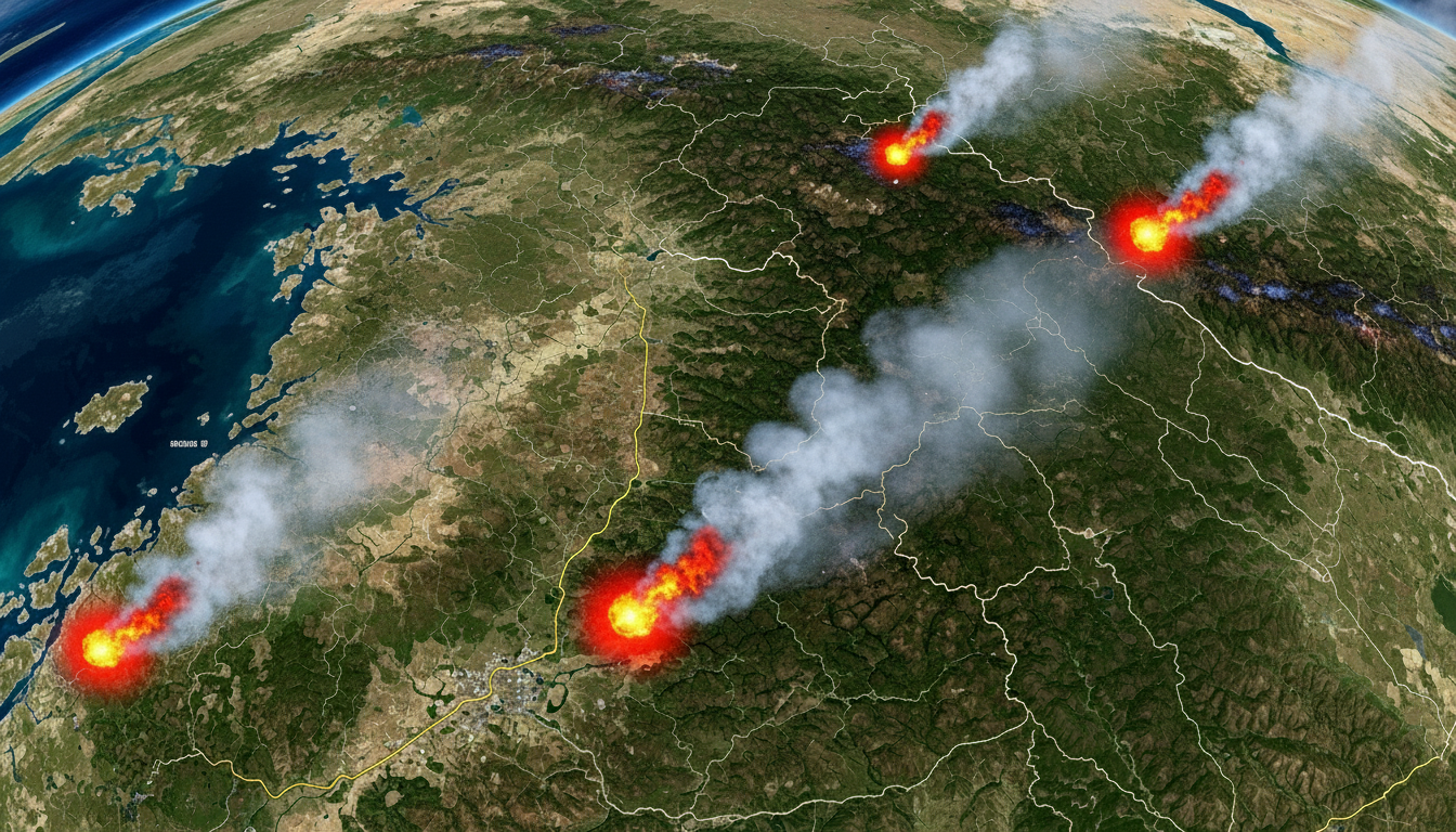
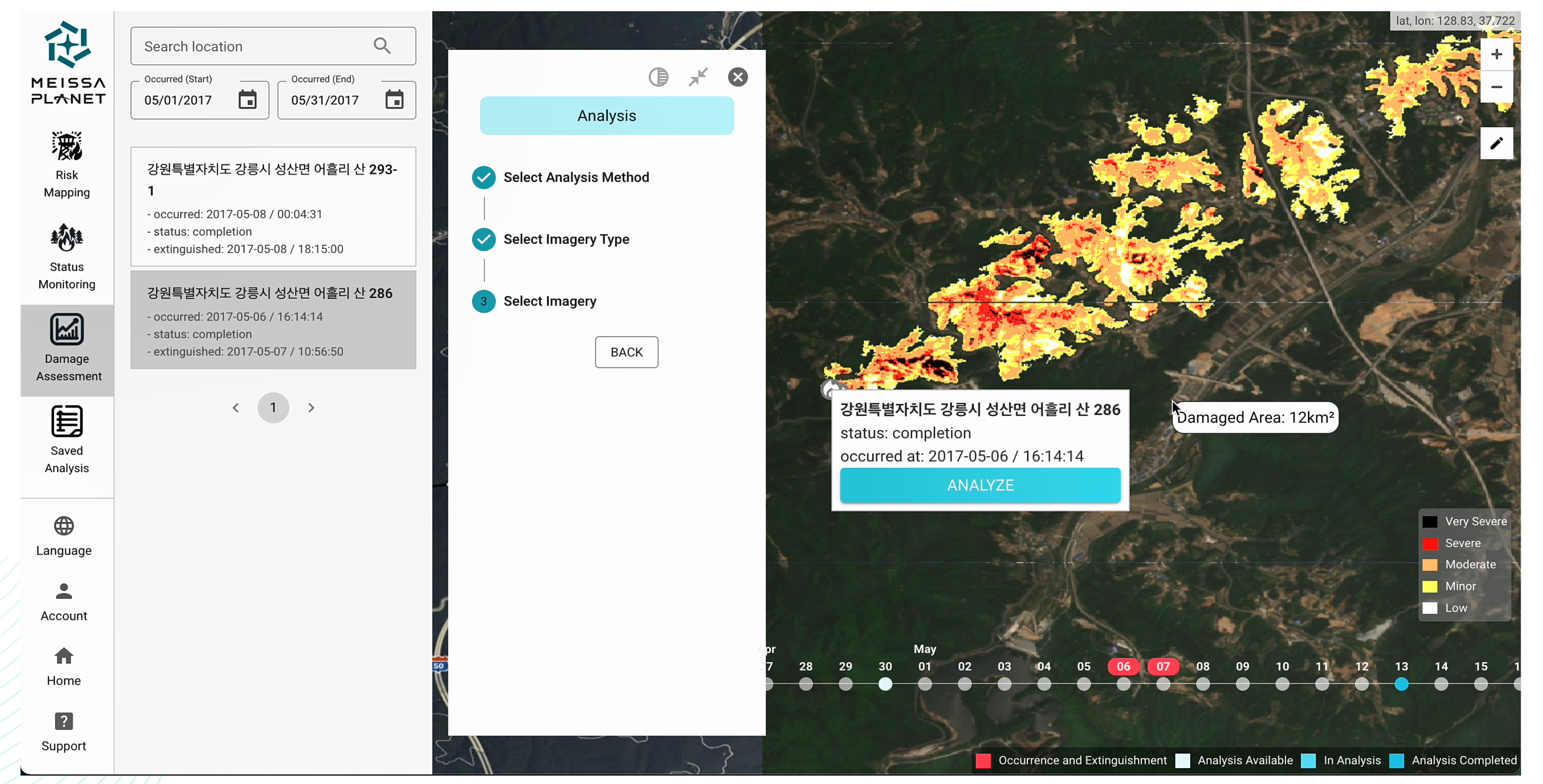
By fusing satellite data from various sensors, we provide integrated monitoring across all stages of a wildfire: from predicting fire risk and detecting suspicious heat signatures to analyzing damage extent and tracking recovery progress.
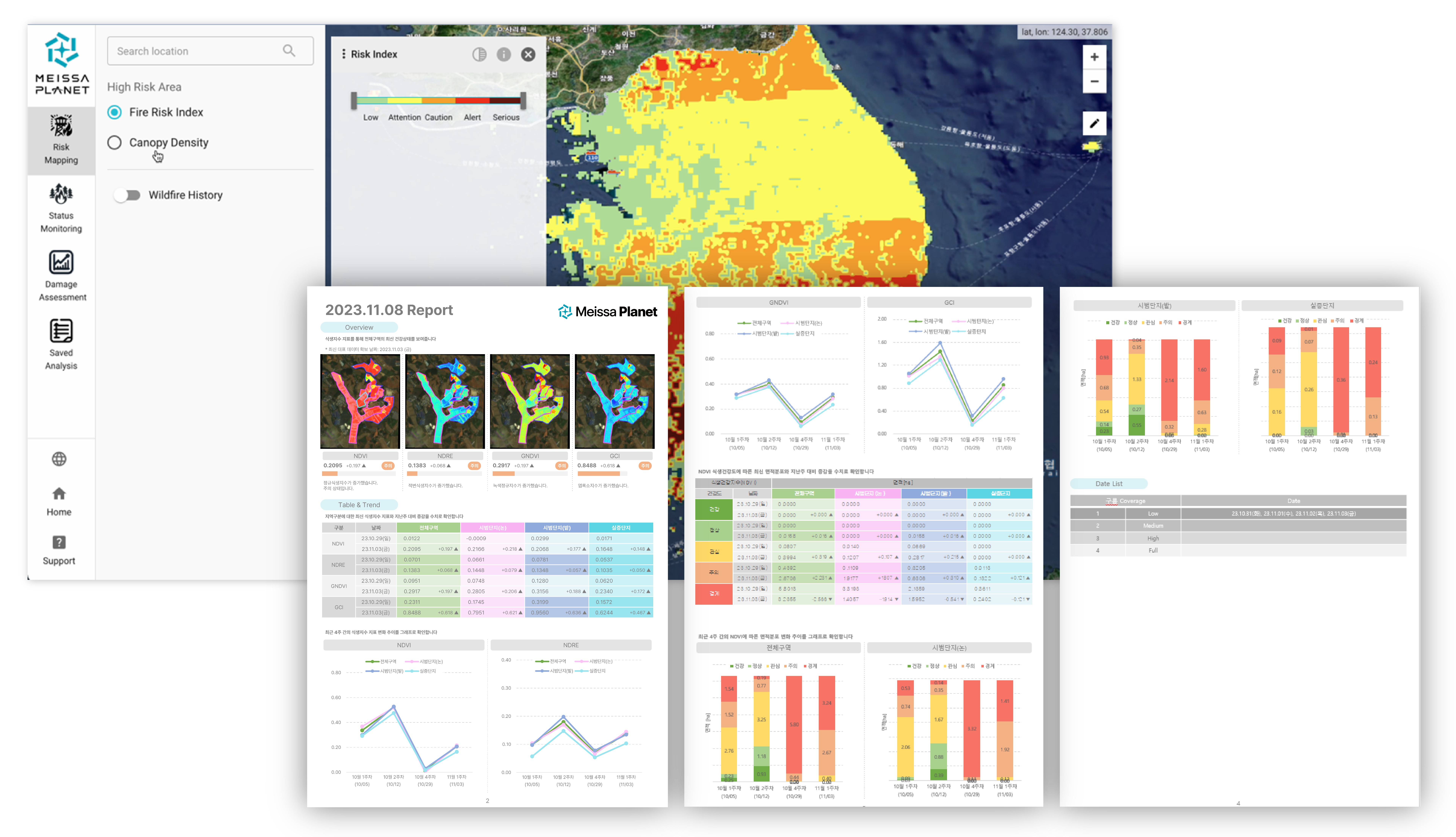
Utilizing multi-sensor satellite imagery, we can detect early signs of vegetation vitality decline, water stress, and potential pest or disease patterns.
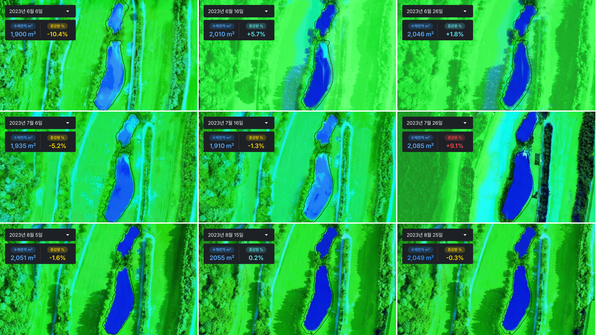
Continuously monitor changes in reservoir water levels using satellite imagery to proactively assess drought risks.